 |
|
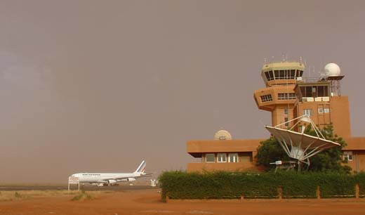
| Diori Hamani International Airport |
 |
| IATA: NIM – ICAO: DRRN |
| Summary |
| Airport type |
Military/Public |
| Owner |
Government |
| Location |
Niamey, Niger |
| Elevation AMSL |
732 ft / 223 m |
| Coordinates |
13°28′54″N 002°10′13″E / 13.48167°N 2.17028°E / 13.48167; 2.17028Coordinates: 13°28′54″N 002°10′13″E / 13.48167°N 2.17028°E / 13.48167; 2.17028 |
| Runways |
| Direction |
Length |
Surface |
| m |
ft |
| 09R/27L |
3,000 |
9,843 |
Bitumen |
| 09L/27R |
1,620 |
5,315 |
Laterite |
| Sources: Agence pour la Sécurité de la Navigation aérienne en Afrique et à Madagascar |
Diori Hamani International Airport (IATA: NIM, ICAO: DRRN) is an airport in Niamey, the capital of Niger. It is located in the south eastern suburbs of the city, along the Route Nationale 1, the major highway linking Niamey with the east of the nation. The airport complex also includes the major base for the Armed Forces of Niger's "Armee d'Air".
In 2004, the airport served 97,814 passengers. The Air traffic control for NIM is operated by the ASECNA, which bases one of its five air traffic zones for the continent at Niamey. The airport is named after Hamani Diori, the first President of Niger. Airlines and destinations
| Airlines |
Destinations |
| Afriqiyah Airways |
Bamako, Cotonou, Tripoli |
| Air Algérie |
Algiers |
| Air Burkina |
Abidjan, Ouagadougou |
| Air France |
Paris-Charles de Gaulle |
| Air Mali |
Bamako |
| Ethiopian Airlines operated by ASKY Airlines |
Bamako, Lomé |
| Mauritania Airways |
Abidjan, Nouakchott |
| Royal Air Maroc |
Casablanca |
EAMAC
ASECNA operates the "African School for Meteorology and Civil Aviation/Ecole Africaine de la Météorologie et de l'Aviation Civile" at the Niamey airport complex, as well as in the Plateau quarter of Niamey city centre. Founded in 1963, EAMAC trains civil aviation professionals and aviation meteorologists from across Africa.
The above content comes from Wikipedia and is published under free licenses – click here to read more.
| General Info
|
| Country |
Niger
|
| ICAO ID |
DRRN
|
| Time |
UTC+1
|
| Latitude |
13.481547
13° 28' 53.57" N
|
| Longitude |
2.183614
002° 11' 01.01" E
|
| Elevation |
732 feet
223 meters
|
| Type |
Joint (Civil and Military)
|
| Magnetic Variation |
002° W (01/06)
|
| Operating Agency |
MILITARY - CIVIL JOINT USE AIRPORT
|
| Alternate Name |
NIAMEY
|
| Near City |
Niamey
|
| Operating Hours |
24 HOUR OPERATIONS
|
| International Clearance Status |
Airport of Entry
|
| Communications
|
| NIAMEY TWR |
119.7
118.1
|
| NIAMEY INFO |
5652
6586
8894
8903
13294
|
| NIAMEY CON |
131.3
126.1
|
| Communications Remarks |
|
| TWR |
Provides APP.
|
| Runways
|
| ID |
Dimensions |
Surface |
PCN |
ILS
|
| 09R/27L |
9843 x 148 feet
3000 x 45 meters |
ASPHALT |
059FBXT |
YES
|
| 09L/27R |
5315 x 131 feet
1620 x 40 meters |
LATERITE. |
- |
NO
|
| Navaids
|
| Type |
ID |
Name |
Channel |
Freq |
Distance From Field |
Bearing From Navaid
|
| VOR-DME |
NY |
NIAMEY |
088X |
114.1 |
1.3 NM |
265.4
|
| Supplies/Equipment
|
| Fuel |
Jet A1, without icing nhibitor.
100/130 MIL Spec, low lead, aviation gasoline (BLUE)
|
| Remarks
|
| CAUTION |
Laterite rwy unsvc for 24 hr flw rain.
|
| FUEL |
(NC-100LL, A1)
|
| RSTD |
Ovft of city proh.
|
The content above was published at Airports-Worldwide.com in 2010.
We don't guarantee the information is fresh and accurate. The data may be wrong or outdated.
For more up-to-date information please refer to other sources.
|
|


