 |
|
| Baruun-Urt Airport |
 |
| Baruun-Urt Airport in 1972 |
| IATA: UUN – ICAO: ZMBU |
| Summary |
| Airport type |
Joint (Civil and Military) |
| Operator |
Civil Aviation Authority of Mongolia |
| Location |
Baruun-Urt |
| Elevation AMSL |
3,205 ft / 977 m |
| Coordinates |
46°39′37″N 113°17′07″E / 46.66028°N 113.28528°E / 46.66028; 113.28528Coordinates: 46°39′37″N 113°17′07″E / 46.66028°N 113.28528°E / 46.66028; 113.28528 |
| Runways |
| Direction |
Length |
Surface |
| ft |
m |
| 18/36 |
7,217 |
2,200 |
Grass |
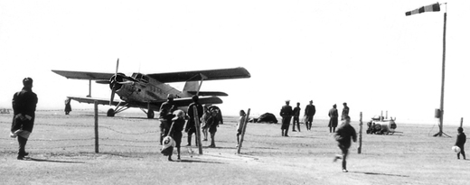
The airport building in 1972 Baruun-Urt Airport (IATA: UUN, ICAO: ZMBU) is a public airport located in Baruun-Urt, the capital of Sükhbaatar Province in Mongolia.
The above content comes from Wikipedia and is published under free licenses – click here to read more.
| General Info
|
| Country |
Mongolia
|
| ICAO ID |
ZMBU
|
| Time |
UTC+8
|
| Latitude |
46.660347
46° 39' 37.25" N
|
| Longitude |
113.285328
113° 17' 07.18" E
|
| Elevation |
3205 feet
977 meters
|
| Magnetic Variation |
006° W (01/06)
|
| Operating Agency |
CIVIL GOVERNMENT, (LANDING FEES AND DIPLOMATIC CLEARANCE MAY BE REQUIRED)
|
| Near City |
Sukhbaatar
|
| Operating Hours |
SUNRISE TO SUNSET (SR-SS)
|
| Communications
|
SHARGA
SR-SS
|
5505
|
SHARGA
SR-SS
|
130.0
|
| Runways
|
| ID |
Dimensions |
Surface |
PCN |
ILS
|
| 18/36 |
7217 x 164 feet
2200 x 50 meters |
BITUMINOUS, TAR OR ASPHALT MIXED IN PLACE, OILED. |
- |
NO
|
| Navaids
|
| Type |
ID |
Name |
Channel |
Freq |
Distance From Field |
Bearing From Navaid
|
| NDB |
SB |
BARUUN-URT |
- |
330 |
At Field |
-
|
| Remarks
|
| RSTD |
Tkof rwy 18, ldg rwy 36 only.
|
The content above was published at Airports-Worldwide.com in 2010.
We don't guarantee the information is fresh and accurate. The data may be wrong or outdated.
For more up-to-date information please refer to other sources.
|
|


