Mikonos Island National Airport |
Mikonos Island National Airport
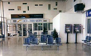
Passenger Facilities
Regulatory Authority & Air Navigation : Hellenic Civil Aviation Authority
Location Indicator: LGMK [JMK (ICAO)]
CI IN : MKA , CI OUT ?MK
Regulatory Authority and Air Navigation Service
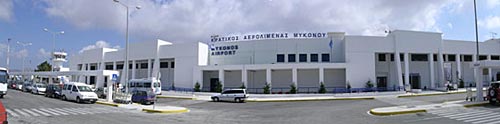
Mikonos National Airport, Mikonos Island, GREECE
Main activities Management of air passenger terminals
and aircraft parking.
Number of employees: 23
Number of employees with agencies and concessionaries based at the air
terminal :
Ground Handling : Olympic Airways S.A
Airfield Data
Latitude :370 26' 11" North
Longitude ; 250 20' 31" East
Airfield elevation : 405' (123m)
Runway direction : 16/34
Runway Length : 1900 m
Major town serviced : Hora (4 km away) -(Mykonos Town)
Airfield restrictions: Local flying restrictions
Load classified and type: -
 Lighting
aids Lighting
aids
Approach : YES
Threshold : YES
Runway ; YES
Taxiway : NO
Emergency Equipment : Fire vehicles, arrangements for crash recover
Fire category : Cat. 6
No. of passenger terminals; 2
No. of freight terminals: 1
No. of aircraft stands
Operational hours : 24
Airlines : Olympic Airways S.A & AEGEAN AIRLINES
Rent a Car Offices : YES
Baby-changing rooms : YES
Parking : YES
Left-luggage : NO
Lost & Found : YES
Coordinates:
Mikonos Island National Airport
Postal: Mikonos Island,GREECE
Tel: +30 22890 79000,
FAX : +3022890 27489
TELEX : 0293118 LGMK GR
E-mail: kamktl at otenet gr
WEB: http://www.hcaa-eleng.gr/mikon.htm
Images and information placed above are from
http://www.hcaa-eleng.gr/mikon.htm
http://mykonos-accommodation.com/jmk-mykonos-airport.htm
We thank them for the data!
| General Info
|
| Country |
Greece
|
| ICAO ID |
LGMK
|
| Time |
UTC+2(+3DT)
|
| Latitude |
37.435128
37° 26' 06.46" N
|
| Longitude |
25.348103
025° 20' 53.17" E
|
| Elevation |
405 feet
123 meters
|
| Magnetic Variation |
003° E (01/05)
|
| Beacon |
Yes
|
| Daylight Savings Time |
Last Sunday in March to last Sunday in October
|
| Communications
|
| TWR |
118.75
122.1
257.8
(257.8 O/S UFN.)
|
| APP |
118.75
122.1
|
| RDO |
5637
2989
(5637 0400-1700Z++) (2989 1700-0400Z++)
|
| Runways
|
| ID |
Dimensions |
Surface |
PCN |
ILS
|
| 16/34 |
6244 x 98 feet
1903 x 30 meters |
ASPHALT |
034FBXU |
NO
|
| Navaids
|
| Type |
ID |
Name |
Channel |
Freq |
Distance From Field |
Bearing From Navaid
|
| VOR-DME |
MKN |
MIKONOS |
037X |
110 |
At Field |
-
|
| NDB |
MKO |
MIKONOS |
- |
401 |
At Field |
-
|
| Supplies/Equipment
|
| Fuel |
Jet A1, without icing nhibitor.
100/130 MIL Spec, low lead, aviation gasoline (BLUE)
|
| Remarks
|
| CAUTION |
Windshear due to hi winds. Bird haz.
|
| FUEL |
(NC-100LL, A1) avbl only Apr-Oct.
|
| LGT |
PAPI Rwy 16 O/S UFN. Thld lgt Rwy 34 displ 98' N. ABn, green coded, MKN.
|
| MISC |
Ldg acft backtrack to end of Rwy for turnaround. Avoid turning eng exhaust twd trml in apn area. Use low pwr when taxiing to/fr apn.
|
| OPR HOURS |
Opr by NOTAM.
|
Runway 16/34
6244 x 98 feet
1903 x 30 meters
| Runway 16
|
| Surface |
ASPHALT
|
| True Heading |
160.0
|
| Latitude |
37.443253
37° 26' 35.71" N
|
| Longitude |
25.344658
025° 20' 40.77" E
|
| Elevation |
394.9 feet
120 meters
|
| Slope |
-0.1°
|
| Landing Distance |
6244 feet
1903 meters
|
| Takeoff Distance |
6444 feet
1964 meters
|
| Overrun Length |
200 feet
61 meters
|
| Overrun Surface |
ASPHALT
|
| Lighting System |
LIRL
REIL |
| Runway 34
|
| Surface |
ASPHALT
|
| True Heading |
340.0
|
| Latitude |
37.427083
37° 25' 37.50" N
|
| Longitude |
25.351814
025° 21' 06.53" E
|
| Elevation |
388.9 feet
119 meters
|
| Slope |
0.1°
|
| Landing Distance |
6244 feet
1903 meters
|
| Takeoff Distance |
6444 feet
1964 meters
|
| Overrun Length |
200 feet
61 meters
|
| Overrun Surface |
ASPHALT
|
| Lighting System |
LIRL
REIL
PAPI |
Navaids
| MIKONOS
|
| Type |
ID |
Channel |
Freq |
Country |
State
|
| VOR-DME |
MKN |
037X |
110 |
Greece |
-
|
| Latitude |
Longitude |
Airport
|
37.440389
37° 26' 25.40" N |
25.344419
025° 20' 39.91" E |
LGMK |
Navaids
| MIKONOS
|
| Type |
ID |
Channel |
Freq |
Country |
State
|
| NDB |
MKO |
- |
401 |
Greece |
-
|
| Latitude |
Longitude |
Airport
|
37.436944
37° 26' 13.00" N |
25.346389
025° 20' 47.00" E |
LGMK |
The content above was published at Airports-Worldwide.com in 2005.
We don't guarantee the information is fresh and accurate. The data may be wrong or outdated.
For more up-to-date information please refer to other sources.
|


