Kerkira Airport (Ioannis Kapodistrias) |
 Kerkira
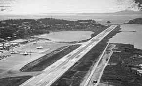
Airport Kerkira
Airport
The airport was opened in 1962
Distance and Direction from city: 1NM SW from harbour.
Refernce point: 393627N 195440E
Elevation: 1,67m
Runway: Designation 169°/349° Dimensions 2373x45
POSTAL ADDRESS: I. Kapodistrias Airport
69100 KERKYRA
GREECE
TELEPHONE: +302661089600
TELEX: 0332319 LGKR GR
FAX: +302661045829
e-mail: kakktl at otenet gr
IATA CODE: CFU
Telephone Directory
Airport Call Center:+302661089600
Airport Manager: +302661089801
Airport Operation Section: +302661089823
Air Traffic Services Section: +302661089824
Telecommunications Section: +302661089805 Fax:+302661045829
Airlines
Olympic Airways : +3026610 33576, 49064, 22963
AEGEAN AIRLINES : +3026610 27100
Car rental
HERTZ tel. : +3026610 33547
EUROPE CAR tel. : +3026610 46440
AVIS tel. : +3026610 42007
Fuel Company
BP tel. : +3026610 22289
SHELL : +3026610 32930, 32370
Tel : +3026610 45930
Air traffic statistics 2000
Flights: 16.705
Passengers: 2.236.878
WEB: http://www.alxd.gr/AirportQuide/Kerkyra/KerkyraE.htm
Images and information placed
above are from
http://www.alxd.gr/AirportQuide/Kerkyra/KerkyraE.htm
We thank them for the data!
| General Info
|
| Country |
Greece
|
| ICAO ID |
LGKR
|
| Time |
UTC+2(+3DT)
|
| Latitude |
39.601944
39° 36' 07.00" N
|
| Longitude |
19.911667
019° 54' 42.00" E
|
| Elevation |
6 feet
2 meters
|
| Type |
Civil
|
| Magnetic Variation |
002° E (01/05)
|
| Beacon |
Yes
|
| Near City |
Kerkira
|
| Operating Hours |
24 HOUR OPERATIONS
|
| International Clearance Status |
Airport of Entry
|
| Daylight Savings Time |
Last Sunday in March to last Sunday in October
|
| Communications
|
| TWR |
120.85
122.1
257.8
|
| ATIS |
126.35
|
| APP |
118.075
122.1
122.35
381.0
|
| RDO |
5637
2989
(5637 Opr 0400-1700Z++) (2989 Opr 1700-0400Z++)
|
| Runways
|
| ID |
Dimensions |
Surface |
PCN |
ILS
|
| 17/35 |
7792 x 148 feet
2375 x 45 meters |
ASPHALT |
033FBXU |
NO
|
| Navaids
|
| Type |
ID |
Name |
Channel |
Freq |
Distance From Field |
Bearing From Navaid
|
| VOR-DME |
KRK |
KERKIRA |
094X |
114.7 |
12.1 NM |
321.8
|
| NDB |
KEK |
KERKIRA |
- |
403 |
At Field |
-
|
| Supplies/Equipment
|
| Fuel |
Jet A1, without icing nhibitor.
100/130 MIL Spec, low lead, aviation gasoline (BLUE)
|
| Remarks
|
| CAUTION |
Bird haz. Due to WIP on TWY A and B, the fst 820' of RWY 17 unsvc, pers and eqpt in vcnty.
|
| FUEL |
A1 (EKO Alda Abee, fone C30-66-10-45930) Caution: Quality Hold on A1. (NC-100LL)
|
| LGT |
ABn, white coded K. PAPI Rwy 17-35 rcpt ltd to 8 either side of cntrline. PAPI Rwy 35 GS 3.08 .
|
Runway 17/35
7792 x 148 feet
2375 x 45 meters
| Runway 17
|
| Surface |
ASPHALT
|
| True Heading |
169.0
|
| Latitude |
39.612283
39° 36' 44.22" N
|
| Longitude |
19.909211
019° 54' 33.16" E
|
| Elevation |
6.0 feet
2 meters
|
| Slope |
0.0°
|
| Landing Distance |
6444 feet
1964 meters
|
| Takeoff Distance |
7792 feet
2375 meters
|
| Displaced Threshold Length |
1348 feet
411 meters
|
| Lighting System |
MIRL
PAPI |
| Runway 35
|
| Surface |
ASPHALT
|
| True Heading |
349.0
|
| Latitude |
39.591275
39° 35' 28.59" N
|
| Longitude |
19.914606
019° 54' 52.58" E
|
| Elevation |
6.0 feet
2 meters
|
| Slope |
0.0°
|
| Landing Distance |
7579 feet
2310 meters
|
| Takeoff Distance |
7792 feet
2375 meters
|
| Displaced Threshold Length |
213 feet
65 meters
|
| Lighting System |
MIRL
REIL
A2
PAPI |
Navaids
| KERKIRA
|
| Type |
ID |
Channel |
Freq |
Country |
State
|
| VOR-DME |
KRK |
094X |
114.7 |
Greece |
-
|
| Latitude |
Longitude |
Airport
|
39.443889
39° 26' 38.00" N |
20.072778
020° 04' 22.00" E |
LGKR |
Navaids
| KERKIRA
|
| Type |
ID |
Channel |
Freq |
Country |
State
|
| NDB |
KEK |
- |
403 |
Greece |
-
|
| Latitude |
Longitude |
Airport
|
39.587778
39° 35' 16.00" N |
19.911667
019° 54' 42.00" E |
LGKR |
The content above was published at Airports-Worldwide.com in 2005.
We don't guarantee the information is fresh and accurate. The data may be wrong or outdated.
For more up-to-date information please refer to other sources.
|


