 |
 |
|
||||
|
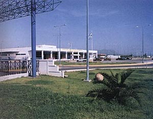
Kalamata International Airport is one from the 15 International modern Greek Airports. It operated from to1959. For 20 years roughly it has been operated in the Airport of Triode. Because the need of use of a bigger runway by the modern planes were transported in the 19-7-1970 in southern utmost the airport of the 120 P.E.A. where it operated up to the 19-1-1991. From the 16/1/91 up to today operates in Hellenic Civil Aviation privately spaces which cover 2450 m2 of area , in the South East side of the 120 P.E.A. In 1986 with the start of flights charter from the abroad, was presented the need manufacture of new installations. The work was completed shortly and in the 16-1-1991 was placed in operation the new Terminal as it is today. The distance from the city of Kalamata is 7 km. Mission of Kalamata airport is the service of air transportation needs and at extension its contribution in the growth and the progress of Messinia, but also wider region. Kalamata International Airport Kalamata International Airport Tel: +30 27210 63805 E-mail : kakltl at otenet gr
WEB: http://www.hcaa-eleng.gr/kalam.htm Images and information placed above are from
Runway 17R/35L8868 x 148 feet
|
||||||||||||||||||||||||||||||||||||||||||||||||||||||||||||||||||||||||||||||||||||||||||||||||||||||||||||||||||||||||||||||||||||||||||||||||||||||||||||||||||||||||||||||||||||||||||||||||||||||||||||||||||||||||||||||||||||||||||||||||||||||||||||||||||||
| Runway 17R | |
|---|---|
| Surface | ASPHALT |
| True Heading | 169.0 |
| Latitude | 37.080394 37° 04' 49.42" N |
| Longitude | 22.022597 022° 01' 21.35" E |
| Elevation | 26.0 feet 8 meters |
| Slope | -0.1° |
| Landing Distance | 8868 feet 2703 meters |
| Takeoff Distance | 9818 feet 2993 meters |
| Overrun Length | 950 feet 290 meters |
| Overrun Surface | ASPHALT |
| Lighting System | MIRL
REIL PAPI |
| Runway 35L | |
|---|---|
| Surface | ASPHALT |
| True Heading | 349.0 |
| Latitude | 37.056453 37° 03' 23.23" N |
| Longitude | 22.028181 022° 01' 41.45" E |
| Elevation | 16.0 feet 5 meters |
| Slope | 0.1° |
| Landing Distance | 8868 feet 2703 meters |
| Takeoff Distance | 9818 feet 2993 meters |
| Overrun Length | 950 feet 290 meters |
| Overrun Surface | ASPHALT |
| Lighting System | MIRL
REIL J PAPI |
| KALAMATA | |||||
|---|---|---|---|---|---|
| Type | ID | Channel | Freq | Country | State |
| TACAN | KLM | 099X | - | Greece | - |
| Latitude | Longitude | Airport |
| 37.076667 37° 04' 36.00" N |
22.018889 022° 01' 08.00" E |
LGKL |
| KALAMATA | |||||
|---|---|---|---|---|---|
| Type | ID | Channel | Freq | Country | State |
| VOR-DME | KAM | 073X | 112.6 | Greece | - |
| Latitude | Longitude | Airport |
| 37.066433 37° 03' 59.16" N |
22.023906 022° 01' 26.06" E |
LGKL |
| KALAMATA | |||||
|---|---|---|---|---|---|
| Type | ID | Channel | Freq | Country | State |
| NDB | KTA | - | 348 | Greece | - |
| Latitude | Longitude | Airport |
| 37.056464 37° 03' 23.27" N |
22.024550 022° 01' 28.38" E |
LGKL |
The content above was published at Airports-Worldwide.com in 2005.
We don't guarantee the information is fresh and accurate. The data may be wrong or outdated.
For more up-to-date information please refer to other sources.

 |
|
Copyright 2004-2026 © by Airports-Worldwide.com, Vyshenskoho st. 36, Lviv 79010, Ukraine Legal Disclaimer |
 Airport
History
Airport
History 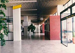 Coordinates: