 |
|
Hohenfels Military Airfield (AAF) |
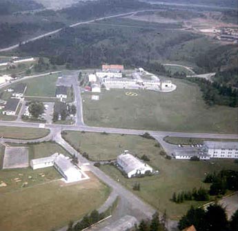
Images and information placed above are from
http://www.dustoff.org/photo/photos7.htm
We thank them for the data!
| General Info
|
| Country |
Germany
|
| ICAO ID |
ETIH
|
| Time |
UTC+1(+2DT)
|
| Latitude |
49.218056
49° 13' 05.00" N
|
| Longitude |
11.836111
011° 50' 10.00" E
|
| Elevation |
1455 feet
443 meters
|
| Type |
Military
|
| Magnetic Variation |
001° E (01/05)
|
| Beacon |
Yes
|
| Operating Agency |
U.S.ARMY
|
| Operating Hours |
SEE REMARKS FOR OPERATING HOURS OR COMMUNICATIONS FOR POSSIBLE HOURS
|
| Daylight Savings Time |
Last Sunday in March to last Sunday in October
|
| Communications
|
| TWR |
31.8
41.75
122.1
141.95
341.7
|
PMSV METRO
FM 60.0.
|
SEE REMARKS
|
| LANGEN INFO |
127.975
|
| Communications Remarks |
|
| TWR |
Opr 0600-1600Z++ Mon-Fri; clsd Sat, Sun and US hol; OT advsy svc only. All freq advsy svc when twr not in operation. For flt flw svc inside EDR137 ctc twr.
|
| Runways
|
ID
|
Dimensions |
Surface |
PCN |
ILS
|
| 09/27 |
2187 x 72 feet
667 x 22 meters |
ASPHALT |
- |
NO
|
| Navaids
|
| Type |
ID |
Name |
Channel |
Freq |
Distance From Field |
Bearing From Navaid
|
| NDB |
HFX |
HOHENFELS |
- |
286 |
At Field |
-
|
| Supplies/Equipment
|
| Fuel |
JP-8, SemiKeroscene MIL Spec T-83133, without icing inhibitor
|
| Remarks
|
| CAUTION |
Extv day/ngt remote operated unmanned acft ops wi EDR-137. TV twr 1800' 1.3 NM S of afld. TV twr 1860' 1.2 NM NNE of afld. Smokestack 1626' 0.4 NM NE apch end Rwy 27. Two lgtd rdo ant 1685'/1650', 0.6 NM NE apch end Rwy 27.
|
| CSTMS/IMG |
CSTMS avbl for emerg.
|
| FUEL |
Avbl 0530-2030Z++ Mon-Fri; 48 hr PPR for wkend, GM hol and req over 1000 gal. J8
|
| MISC |
Rot Bcn lctd 0.6 NM NE of afld. Wx fcst: as msn rqr. Fone DSN 466-2891/2691. OT Sembach Wx obsn DSN 496-6145/6146. OPS H24. Fone DSN 466-2614/2814, C09472-832614.
|
| NS ABTMT |
No ovft any built up area blw 3000'. See VFR ARR/DEP RTE EUR.
|
| RSTD |
24 hr PPR for ACFT with Code 7 and abv, (incl EDR137)-PPR for all F/W. Afld and tfc pat are in EDR137, ctc with advsy is mand outside twr opr hr. Current (prev 120 days) EDR137 Redline briefing and review of dly rng bulletin mand prior to opr wi the EDR with the exc of the afld.
|
Runway 09/27
2187 x 72 feet
667 x 22 meters
| Runway 09
|
| Surface |
ASPHALT
|
| True Heading |
090.0
|
| Latitude |
49.218056
49° 13' 05.00" N
|
| Longitude |
11.831667
011° 49' 54.00" E
|
| Landing Distance |
2187 feet
667 meters
|
| Takeoff Distance |
2187 feet
667 meters
|
| Lighting System |
HIRL
REIL |
| Runway 27
|
| Surface |
ASPHALT
|
| True Heading |
270.0
|
| Latitude |
49.218056
49° 13' 05.00" N
|
| Longitude |
11.840556
011° 50' 26.00" E
|
| Landing Distance |
2187 feet
667 meters
|
| Takeoff Distance |
2187 feet
667 meters
|
| Lighting System |
HIRL
REIL |
Navaids
| HOHENFELS
|
| Type |
ID |
Channel |
Freq |
Country |
State
|
| NDB |
HFX |
- |
286 |
Germany |
-
|
| Latitude |
Longitude |
Airport
|
49.218333
49° 13' 06.00" N |
11.859444
011° 51' 34.00" E |
ETIH |
The content above was published at Airports-Worldwide.com in 2005.
We don't guarantee the information is fresh and accurate. The data may be wrong or outdated.
For more up-to-date information please refer to other sources.
|
|


