|
Ouanda Djallé Airport (IATA: ODJ, ICAO: FEGO) is an airstrip serving Ouanda Djallé,
a village in the Vakaga prefecture of the Central African Republic. The airstrip lies alongside the RN5 road that runs northwest out of the village.
There is a large hill 3 kilometres (1.9 mi) southeast of the airstrip.
|
Ouanda Djallé Airport |
|
|
| Summary |
| Airport type |
Public |
| Serves |
Ouanda Djallé |
| Elevation AMSL |
1,985 ft / 605 m |
| Coordinates |
08°54′25″N
22°47′50″E |
| Map |
|
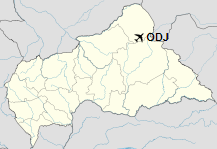
Location of Ouanda Djallé Airport in the Central African Republic
|
| Runways |
| Direction |
Length |
Surface |
| m |
ft |
14/32 |
1,300 |
4,265 |
Grass |
|
|
Source: Landings.com Google Maps GCM |
The above content comes from Wikipedia and is published under free licenses – click here to read more.
The content above was published at Airports-Worldwide.com in 2019.
We don't guarantee the information is fresh and accurate. The data may be wrong or outdated.
For more up-to-date information please refer to other sources.
|


