|
Mobaye Mbanga Airport (ICAO: FEFE) is an airport serving Mobaye, a town on the Ubangi River in the Basse-Kotto prefecture of the Central African Republic.
The airport is 7 kilometres (4.3 mi) downstream from the town, and south approach and departure
might cross the river, which is locally the border with the Democratic Republic of the Congo.
The Gbadolite non-directional beacon (Ident: BLT) is located 6.8 nautical miles (12.6 km) southwest of the airport.
The Gbadolite VOR-DME (Ident: BLT) is located 12.5 nautical miles (23.2 km) southwest of the airport.
|
Mobaye Mbanga Airport |
|
|
| Summary |
| Airport type |
Public |
| Serves |
Mobaye, Central African Republic |
| Elevation AMSL |
1,332 ft / 406 m |
| Coordinates |
4°22′30″N
21°08′00″E |
| Map |
|
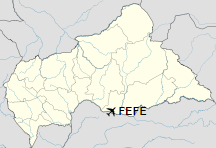
Location of Mobaye Mbanga Airport in the Central African Republic
|
| Runways |
| Direction |
Length |
Surface |
| m |
ft |
03/21 |
1,960 |
6,430 |
Laterite |
|
|
Source: Landings.com Google Maps GCM |
The above content comes from Wikipedia and is published under free licenses – click here to read more.
The content above was published at Airports-Worldwide.com in 2019.
We don't guarantee the information is fresh and accurate. The data may be wrong or outdated.
For more up-to-date information please refer to other sources.
|


