 |
 |
|
||||
|
Images and information placed
above are from
Runway 10/289810 x 148 feet
|
||||||||||||||||||||||||||||||||||||||||||||||||||||||||||||||||||||||||||||||||||||||||||||||||||||||||||||||||||||||||||||||||||||||||||||||||||||||||||||||||||||||||||||||||||||||||||||||||||||||||||||||||||||||||||||||||||||||||||||||||||||||||||||||||||
| Runway 10 | |
|---|---|
| Surface | ASPHALT |
| True Heading | 105.0 |
| Latitude | 38.343289 38° 20' 35.84" N |
| Longitude | 23.548425 023° 32' 54.33" E |
| Elevation | 454.0 feet 138 meters |
| Slope | 0.3° |
| Landing Distance | 9318 feet 2840 meters |
| Takeoff Distance | 10480 feet 3194 meters |
| Displaced Threshold Length | 492 feet 150 meters |
| Overrun Length | 670 feet 204 meters |
| Overrun Surface | ASPHALT |
| Lighting System | PAPI |
| Runway 28 | |
|---|---|
| Surface | ASPHALT |
| True Heading | 285.0 |
| Latitude | 38.336403 38° 20' 11.05" N |
| Longitude | 23.581489 023° 34' 53.36" E |
| Elevation | 481.0 feet 147 meters |
| Slope | -0.3° |
| Landing Distance | 9810 feet 2990 meters |
| Takeoff Distance | 10585 feet 3226 meters |
| Overrun Length | 775 feet 236 meters |
| Overrun Surface | ASPHALT |
| Lighting System | PAPI |
| TANAGRA | |||||
|---|---|---|---|---|---|
| Type | ID | Channel | Freq | Country | State |
| TACAN | TGR | 021X | - | Greece | - |
| Latitude | Longitude | Airport |
| 38.350119 38° 21' 00.43" N |
23.517703 023° 31' 03.73" E |
LGTG |
| TANAGRA | |||||
|---|---|---|---|---|---|
| Type | ID | Channel | Freq | Country | State |
| VOR-DME | TGG | 055X | 111.8 | Greece | - |
| Latitude | Longitude | Airport |
| 38.338056 38° 20' 17.00" N |
23.557778 023° 33' 28.00" E |
LGTG |
| TANAGRA | |||||
|---|---|---|---|---|---|
| Type | ID | Channel | Freq | Country | State |
| NDB | TNG | - | 303 | Greece | - |
| Latitude | Longitude | Airport |
| 38.332222 38° 19' 56.00" N |
23.730833 023° 43' 51.00" E |
LGTG |
The content above was published at Airports-Worldwide.com in 2005.
We don't guarantee the information is fresh and accurate. The data may be wrong or outdated.
For more up-to-date information please refer to other sources.

 |
|
Copyright 2004-2026 © by Airports-Worldwide.com, Vyshenskoho st. 36, Lviv 79010, Ukraine Legal Disclaimer |
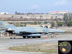 Photographs
by George Dedes
Photographs
by George Dedes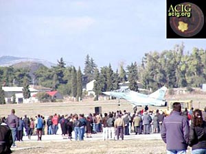 Photographs
by George Dedes
Photographs
by George Dedes