 |
 |
|
||||
|
Opened before 1945. Used by RAF until 1961. GERMAN AIR FORCE fighter-bomber base.
[ Contact Günter Grondstein ]
Runway 10/288136 x 98 feet
|
||||||||||||||||||||||||||||||||||||||||||||||||||||||||||||||||||||||||||||||||||||||||||||||||||||||||||||||||||||||||||||||||||||||||||||||||||||||||||||||||||||||||||||||||||||||||||||||||||||||||||||||||||||||||||||||||||||||||||||||||
| Runway 10 | |
|---|---|
| Surface | PART CONCRETE, PART ASPHALT, OR PART BITUMEN-BOUND MACADAM. |
| True Heading | 102.0 |
| Latitude | 53.535833 53° 32' 09.00" N |
| Longitude | 7.870333 007° 52' 13.20" E |
| Elevation | 18.0 feet 5 meters |
| Slope | 0.0° |
| Landing Distance | 8136 feet 2480 meters |
| Takeoff Distance | 9038 feet 2755 meters |
| Overrun Length | 902 feet 275 meters |
| Overrun Surface | CONCRETE. |
| Lighting System | SF
HIRL REIL BP PAPI PORTABLE |
| Runway 28 | |
|---|---|
| Surface | PART CONCRETE, PART ASPHALT, OR PART BITUMEN-BOUND MACADAM. |
| True Heading | 282.0 |
| Latitude | 53.531333 53° 31' 52.80" N |
| Longitude | 7.907000 007° 54' 25.20" E |
| Elevation | 19.0 feet 6 meters |
| Slope | 0.0° |
| Landing Distance | 8136 feet 2480 meters |
| Takeoff Distance | 9038 feet 2755 meters |
| Overrun Length | 902 feet 275 meters |
| Overrun Surface | CONCRETE. |
| Lighting System | SF
HIRL REIL BP PAPI PORTABLE |
| WITTMUNDHAFEN | |||||
|---|---|---|---|---|---|
| Type | ID | Channel | Freq | Country | State |
| TACAN | WTM | 082X | - | Germany | - |
| Latitude | Longitude | Airport |
| 53.554333 53° 33' 15.60" N |
7.725167 007° 43' 30.60" E |
ETNJ |
| JEVER | |||||
|---|---|---|---|---|---|
| Type | ID | Channel | Freq | Country | State |
| NDB | JEV | - | 390 | Germany | - |
| Latitude | Longitude | Airport |
| 53.517003 53° 31' 01.21" N |
8.019019 008° 01' 08.47" E |
ETNJ |
The content above was published at Airports-Worldwide.com in 2005.
We don't guarantee the information is fresh and accurate. The data may be wrong or outdated.
For more up-to-date information please refer to other sources.

 |
|
Copyright 2004-2026 © by Airports-Worldwide.com, Vyshenskoho st. 36, Lviv 79010, Ukraine Legal Disclaimer |
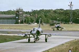 Photo © by Günter Grondstein
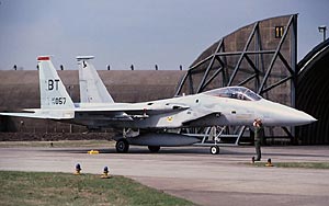 Photo © by Mark Carlisle