 |
|
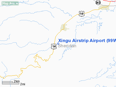
Location & QuickFacts
| FAA Information Effective: | 2008-09-25 |
| Airport Identifier: | 99WY |
| Airport Status: | Operational |
| Longitude/Latitude: | 107-16-36.2800W/44-50-44.8800N
-107.276744/44.845800 (Estimated) |
| Elevation: | 4340 ft / 1322.83 m (Estimated) |
| Land: | 90 acres |
| From nearest city: | 2 nautical miles SW of Dayton, WY |
| Location: | Sheridan County, WY |
| Magnetic Variation: | 13E (1995) |
Owner & Manager
| Ownership: | Privately owned |
| Owner: | David A Perfetti |
| Address: | Po Box 245
Dayton, WY 82836 |
| Phone number: | 307-655-9058 |
| Manager: | David A Perfetti |
| Address: | Po Box 245
Dayton, WY 82836 |
| Phone number: | 307-655-9058 |
Airport Operations and Facilities
| Airport Use: | Private |
| Wind indicator: | Yes |
| Segmented Circle: | No |
| Control Tower: | No |
| Sectional chart: | Billings |
| Region: | ANM - Northwest Mountain |
| Boundary ARTCC: | ZLC - Salt Lake City |
| Tie-in FSS: | CPR - Casper |
| FSS Toll Free: | 1-800-WX-BRIEF |
Runway Information
Runway 18/36
| Dimension: | 2700 x 100 ft / 823.0 x 30.5 m |
| Surface: | TURF-DIRT, |
| |
Runway 18 |
Runway 36 |
| Traffic Pattern: | Left | Left |
|
Radio Navigation Aids
| ID |
Type |
Name |
Ch |
Freq |
Var |
Dist |
| GEY | NDB | Greybull | | 275.00 | 14E | 39.9 nm |
| HCY | NDB | Cowley | | 257.00 | 14E | 49.8 nm |
| SHR | VORTAC | Sheridan | 100X | 115.30 | 13E | 9.2 nm |
Remarks
Images and information placed above are from
http://www.airport-data.com/airport/99WY/
We thank them for the data!
| General Info
|
| Country |
United States
|
| State |
WYOMING
|
| FAA ID |
99WY
|
| Latitude |
44-50-44.880N
|
| Longitude |
107-16-36.280W
|
| Elevation |
4340 feet
|
| Near City |
DAYTON
|
We don't guarantee the information is fresh and accurate. The data may
be wrong or outdated.
For more up-to-date information please refer to other sources.
|
|


