 |
|
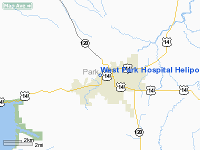
West Park Hospital Heliport |
Location & QuickFacts
| FAA Information Effective: | 2008-09-25 |
| Airport Identifier: | WY62 |
| Airport Status: | Operational |
| Longitude/Latitude: | 109-04-23.5140W/44-31-36.8310N
-109.073198/44.526898 (Estimated) |
| Elevation: | 4995 ft / 1522.48 m (Estimated) |
| Land: | 0 acres |
| From nearest city: | 0 nautical miles N of Cody, WY |
| Location: | Park County, WY |
| Magnetic Variation: | 15E (1980) |
Owner & Manager
| Ownership: | Publicly owned |
| Owner: | Trustees West Park Hospital |
| Address: | 707 Sheridan Ave.
Cody, WY 82414 |
| Phone number: | 307-527-7501
OR 307-578-2443. |
| Manager: | Hospital Administrator |
| Address: | 707 Sheridan Ave.
Cody, WY 82414 |
| Phone number: | 307-527-7501 |
Airport Operations and Facilities
| Airport Use: | Private
MEDICAL USE. |
| Wind indicator: | Yes |
| Segmented Circle: | No |
| Control Tower: | No |
| Sectional chart: | Great Falls |
| Region: | ANM - Northwest Mountain |
| Boundary ARTCC: | ZLC - Salt Lake City |
| Tie-in FSS: | CPR - Casper |
| FSS Toll Free: | 1-800-WX-BRIEF |
Runway Information
Helipad H1
| Dimension: | 30 x 20 ft / 9.1 x 6.1 m |
| Surface: | CONC, |
| |
Runway H1 |
Runway |
| Traffic Pattern: | Left | Left |
|
Radio Navigation Aids
| ID |
Type |
Name |
Ch |
Freq |
Var |
Dist |
| POY | NDB | Powell | | 344.00 | 15E | 23.8 nm |
| HCY | NDB | Cowley | | 257.00 | 14E | 35.6 nm |
| GEY | NDB | Greybull | | 275.00 | 14E | 42.5 nm |
| RED | NDB | Red Lodge | | 203.00 | 17E | 43.6 nm |
| COD | VOR/DME | Cody | 055X | 111.80 | 14E | 7.3 nm |
Images and information placed above are from
http://www.airport-data.com/airport/WY62/
We thank them for the data!
| General Info
|
| Country |
United States
|
| State |
WYOMING
|
| FAA ID |
WY62
|
| Latitude |
44-31-36.831N
|
| Longitude |
109-04-23.514W
|
| Elevation |
4995 feet
|
| Near City |
CODY
|
We don't guarantee the information is fresh and accurate. The data may
be wrong or outdated.
For more up-to-date information please refer to other sources.
|
|


