 |
|
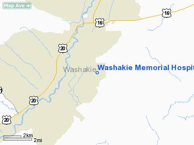
Washakie Memorial Hospital Heliport |
Location & QuickFacts
| FAA Information Effective: | 2008-09-25 |
| Airport Identifier: | WY35 |
| Airport Status: | Operational |
| Longitude/Latitude: | 107-57-01.3360W/43-57-55.8440N
-107.950371/43.965512 (Estimated) |
| Elevation: | 4200 ft / 1280.16 m (Estimated) |
| Land: | 0 acres |
| From nearest city: | 0 nautical miles N of Worland, WY |
| Location: | Washakie County, WY |
| Magnetic Variation: | 14E (1990) |
Owner & Manager
| Ownership: | Privately owned |
| Owner: | Washakie County |
| Address: | Washakie County Commissioners
Worland, WY 82401 |
| Phone number: | 307-347-3221 |
| Manager: | Jodell Gleason |
| Address: | P.o. Box 700
Worland, WY 82401 |
| Phone number: | 307-347-6958 |
Airport Operations and Facilities
| Airport Use: | Private
MEDICAL. |
| Segmented Circle: | No |
| Control Tower: | No |
| Lighting Schedule: | DUSK-DAWN |
| Sectional chart: | Cheyenne |
| Region: | ANM - Northwest Mountain |
| Boundary ARTCC: | ZLC - Salt Lake City |
| Tie-in FSS: | CPR - Casper |
| FSS on Airport: | No |
| FSS Toll Free: | 1-800-WX-BRIEF |
Runway Information
Helipad H1
| Dimension: | 40 x 40 ft / 12.2 x 12.2 m |
| Surface: | CONC, |
| |
Runway H1 |
Runway |
| Traffic Pattern: | Left | Left |
|
Radio Navigation Aids
| ID |
Type |
Name |
Ch |
Freq |
Var |
Dist |
| GEY | NDB | Greybull | | 275.00 | 14E | 33.3 nm |
| BOY | VOR/DME | Boysen Reservoir | 125X | 117.80 | 16E | 33.8 nm |
Remarks
- PRVDD A CLEAR 8:1 INGRESS/EGRESS ROUTE IS ESTABLISHED/MAINTAINED AND NOT BE LCTD OVER NEARBY MIDDLE SCHOOL.
Images and information placed above are from
http://www.airport-data.com/airport/WY35/
We thank them for the data!
| General Info
|
| Country |
United States
|
| State |
WYOMING
|
| FAA ID |
WY35
|
| Latitude |
43-57-55.844N
|
| Longitude |
107-57-01.336W
|
| Elevation |
4200 feet
|
| Near City |
WORLAND
|
We don't guarantee the information is fresh and accurate. The data may
be wrong or outdated.
For more up-to-date information please refer to other sources.
|
|


