 |
|
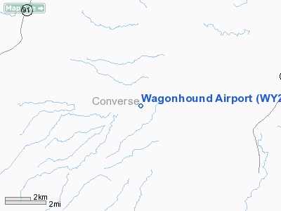
Location & QuickFacts
| FAA Information Effective: | 2008-09-25 |
| Airport Identifier: | WY27 |
| Airport Status: | Operational |
| Longitude/Latitude: | 105-32-18.0000W/42-35-12.0000N
-105.538333/42.586667 (Estimated) |
| Elevation: | 5470 ft / 1667.26 m (Estimated) |
| Land: | 0 acres |
| From nearest city: | 14 nautical miles SW of Douglas, WY |
| Location: | Converse County, WY |
| Magnetic Variation: | () |
Owner & Manager
| Ownership: | Privately owned |
| Owner: | Wagonhound Land & Livestock |
| Address: | 1061 Poisen Lake Rd.
Douglas, WY 82633 |
| Phone number: | 307-358-5439 |
| Manager: | Bob Patterson |
| Address: | 1061 Poisen Lake Rd.
Douglas, WY 82633 |
| Phone number: | 307-358-5439 |
Airport Operations and Facilities
| Airport Use: | Private |
| Wind indicator: | Yes |
| Segmented Circle: | No |
| Control Tower: | No |
| Region: | ANM - Northwest Mountain |
| Boundary ARTCC: | ZDV - Denver |
| Tie-in FSS: | CPR - Casper |
| FSS Toll Free: | 1-800-WX-BRIEF |
Runway Information
Runway 08/26
| Dimension: | 3100 x 60 ft / 944.9 x 18.3 m |
| Surface: | TURF, |
| |
Runway 08 |
Runway 26 |
| Traffic Pattern: | Left | Left |
|
Radio Navigation Aids
| ID |
Type |
Name |
Ch |
Freq |
Var |
Dist |
| GYZ | NDB | Camp Guernsey | | 280.00 | 11E | 42.1 nm |
| CP | NDB | Johno | | 375.00 | 12E | 49.4 nm |
| IIP | VOR/DME | Hipsher | 023X | 108.60 | 12E | 14.8 nm |
| MBW | VOR/DME | Medicine Bow | 053X | 111.60 | 14E | 49.1 nm |
| DDY | VORTAC | Muddy Mountain | 109X | 116.20 | 12E | 44.5 nm |
Images and information placed above are from
http://www.airport-data.com/airport/WY27/
We thank them for the data!
|
|


