 |
|
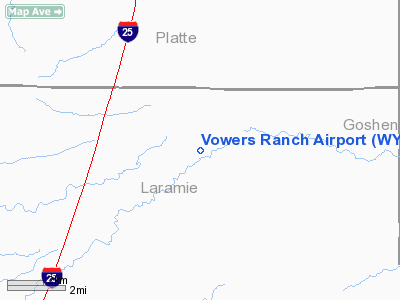
Location & QuickFacts
| FAA Information Effective: | 2008-09-25 |
| Airport Identifier: | WY29 |
| Airport Status: | Operational |
| Longitude/Latitude: | 104-47-06.8820W/41-37-19.9090N
-104.785245/41.622197 (Estimated) |
| Elevation: | 5550 ft / 1691.64 m (Estimated) |
| Land: | 50 acres |
| From nearest city: | 8 nautical miles S of Chugwater, WY |
| Location: | Laramie County, WY |
| Magnetic Variation: | 12E (1985) |
Owner & Manager
| Ownership: | Privately owned |
| Owner: | Vowers Ranch Inc |
| Address: | 2560 Rd. 242
Cheyenne, WY 82009 |
| Phone number: | 307-422-3561 |
| Manager: | Karl Wilkerson |
| Address: | 2560 Rd. 242
Cheyenne, WY 82009 |
| Phone number: | 307-422-3561 |
Airport Operations and Facilities
| Airport Use: | Private |
| Wind indicator: | Yes |
| Segmented Circle: | No |
| Control Tower: | No |
| Sectional chart: | Cheyenne |
| Region: | ANM - Northwest Mountain |
| Boundary ARTCC: | ZDV - Denver |
| Tie-in FSS: | CPR - Casper |
| FSS on Airport: | No |
| FSS Toll Free: | 1-800-WX-BRIEF |
Runway Information
Runway 06/24
| Dimension: | 4000 x 60 ft / 1219.2 x 18.3 m |
| Surface: | GRVL, |
| |
Runway 06 |
Runway 24 |
| Traffic Pattern: | Left | Left |
|
Radio Navigation Aids
| ID |
Type |
Name |
Ch |
Freq |
Var |
Dist |
| GYZ | NDB | Camp Guernsey | | 280.00 | 11E | 37.3 nm |
| TOR | NDB | Torrington | | 293.00 | 11E | 38.9 nm |
| CYS | VORTAC | Cheyenne | 078X | 113.10 | 13E | 24.7 nm |
| LAR | VORTAC | Laramie | 123X | 117.60 | 14E | 45.5 nm |
Remarks
- PRVDD 20:1 APCH SLOPE IS ESTABLISHED & MAINTAINED.
Images and information placed above are from
http://www.airport-data.com/airport/WY29/
We thank them for the data!
| General Info
|
| Country |
United States
|
| State |
WYOMING
|
| FAA ID |
WY29
|
| Latitude |
41-37-19.909N
|
| Longitude |
104-47-06.882W
|
| Elevation |
5550 feet
|
| Near City |
CHUGWATER
|
We don't guarantee the information is fresh and accurate. The data may
be wrong or outdated.
For more up-to-date information please refer to other sources.
|
|


