 |
|
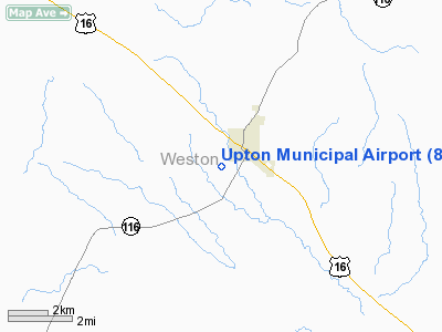
Location & QuickFacts
| FAA Information Effective: | 2008-09-25 |
| Airport Identifier: | 83V |
| Airport Status: | Operational |
| Longitude/Latitude: | 104-38-26.8590W/44-05-25.9320N
-104.640794/44.090537 (Estimated) |
| Elevation: | 4290 ft / 1307.59 m (Estimated) |
| Land: | 140 acres |
| From nearest city: | 1 nautical miles SW of Upton, WY |
| Location: | Weston County, WY |
| Magnetic Variation: | 12E (1985) |
Owner & Manager
| Ownership: | Publicly owned |
| Owner: | Town Of Upton & Weston Co
ALSO NATIONAL FOREST SERVICE. |
| Address: | Po Box 679
Upton, WY 82730 |
| Phone number: | 307-468-2441 |
| Manager: | Steve Hampton |
| Address: | Box 679
Upton, WY 82730 |
| Phone number: | 307-468-2635 |
Airport Operations and Facilities
| Airport Use: | Open to public |
| Wind indicator: | Yes |
| Segmented Circle: | No |
| Control Tower: | No |
| Lighting Schedule: | DUSK-DAWN
OTS INDEFLY. |
| Beacon Color: | Clear-Green (lighted land airport) |
| Landing fee charge: | No |
| Sectional chart: | Cheyenne |
| Region: | ANM - Northwest Mountain |
| Boundary ARTCC: | ZDV - Denver |
| Tie-in FSS: | CPR - Casper |
| FSS on Airport: | No |
| FSS Toll Free: | 1-800-WX-BRIEF |
| NOTAMs Facility: | CPR (NOTAM-d service avaliable) |
Airport Communications
| CTAF: | 122.800 |
| Unicom: | 122.800 |
Airport Services
| Airframe Repair: | NONE |
| Power Plant Repair: | NONE |
| Bottled Oxygen: | NONE |
| Bulk Oxygen: | NONE |
Runway Information
Runway 13/31
| Dimension: | 3710 x 80 ft / 1130.8 x 24.4 m |
| Surface: | GRVL, Poor Condition
+1' MOUNDS AND RUTTING ON ENTIRE RWY
FINELY CRUSHED SHALE. |
| Edge Lights: | Medium
BASE OF RY LGTS ARE SURROUNDED BY REFLECTOR CONES. MIRL RY 13/31 OTS INDEFLY. |
| |
Runway 13 |
Runway 31 |
| Traffic Pattern: | Left | Left |
| Crossing Height: | 25.00 ft | 25.00 ft |
| VASI: | 2-box SAVASI on left side
VASI RYS 13 & 31 OTS INDEFINITELY. | 2-box SAVASI on left side |
| Visual Glide Angle: | 3.00° | 3.00° |
| Runway End Identifier: | Yes
REIL RYS 13 & 31 OTS INDEFLY. | Yes |
|
Radio Navigation Aids
| ID |
Type |
Name |
Ch |
Freq |
Var |
Dist |
| GC | NDB | Deryk | | 380.00 | 12E | 39.5 nm |
| SPF | NDB | Black Hills | | 300.00 | 11E | 43.8 nm |
| ECS | VOR | Newcastle | | 108.20 | 11E | 19.1 nm |
| GCC | VOR/DME | Gillette | 093X | 114.60 | 12E | 41.8 nm |
Remarks
- CONTACT AMGR FOR RY CONDITIONS PRIOR TO WINTER OPERATIONS PHONE 307-468-9253.
- RY 13/31 MARGINAL LINE OF SIGHT FM RY ENDS.
- HANGARS WITHIN TRANSITIONAL SURFACE.
- NO REGULAR SNOW REMOVAL.
- WILDLIFE ON AND INVOF ARPT
- +3' BERMS ALONG RWY EDGES
Images and information placed above are from
http://www.airport-data.com/airport/83V/
We thank them for the data!
| General Info
|
| Country |
United States
|
| State |
WYOMING
|
| FAA ID |
83V
|
| Latitude |
44-05-25.932N
|
| Longitude |
104-38-26.859W
|
| Elevation |
4290 feet
|
| Near City |
UPTON
|
We don't guarantee the information is fresh and accurate. The data may
be wrong or outdated.
For more up-to-date information please refer to other sources.
|
|


