 |
|
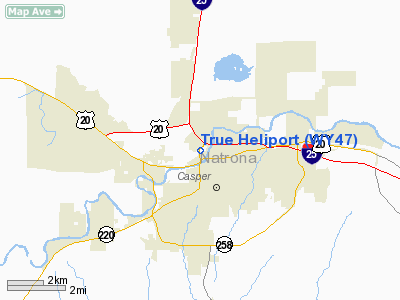
Location & QuickFacts
| FAA Information Effective: | 2008-09-25 |
| Airport Identifier: | WY47 |
| Airport Status: | Operational |
| Longitude/Latitude: | 106-20-11.0940W/42-51-12.8740N
-106.336415/42.853576 (Estimated) |
| Elevation: | 5153 ft / 1570.63 m (Estimated) |
| Land: | 0 acres |
| From nearest city: | 9 nautical miles NW of Casper, WY |
| Location: | Natrona County, WY |
| Magnetic Variation: | 13E (1985) |
Owner & Manager
| Ownership: | Privately owned |
| Owner: | True Oil Co. |
| Address: | Po Box 2360
Casper, WY 82602 |
| Manager: | John W. Campbell |
| Address: | Po Box 2360
Casper, WY 82602 |
| Phone number: | 307-266-0395 |
Airport Operations and Facilities
| Airport Use: | Private |
| Wind indicator: | Yes |
| Segmented Circle: | No |
| Control Tower: | No |
| Landing fee charge: | No |
| Sectional chart: | Cheyenne |
| Region: | ANM - Northwest Mountain |
| Boundary ARTCC: | ZDV - Denver |
| Tie-in FSS: | CPR - Casper |
| FSS on Airport: | No |
| FSS Toll Free: | 1-800-WX-BRIEF |
Runway Information
Helipad H1
| Dimension: | 60 x 45 ft / 18.3 x 13.7 m |
| Surface: | CONC,
HELIPAD LCTD ON ROOFTOP. |
| |
Runway H1 |
Runway |
| Traffic Pattern: | Left | Left |
|
Radio Navigation Aids
| ID |
Type |
Name |
Ch |
Freq |
Var |
Dist |
| CP | NDB | Johno | | 375.00 | 12E | 10.8 nm |
| DDY | VORTAC | Muddy Mountain | 109X | 116.20 | 12E | 14.5 nm |
Images and information placed above are from
http://www.airport-data.com/airport/WY47/
We thank them for the data!
| General Info
|
| Country |
United States
|
| State |
WYOMING
|
| FAA ID |
WY47
|
| Latitude |
42-51-12.874N
|
| Longitude |
106-20-11.094W
|
| Elevation |
5153 feet
|
| Near City |
CASPER
|
We don't guarantee the information is fresh and accurate. The data may
be wrong or outdated.
For more up-to-date information please refer to other sources.
|
|


