 |
|
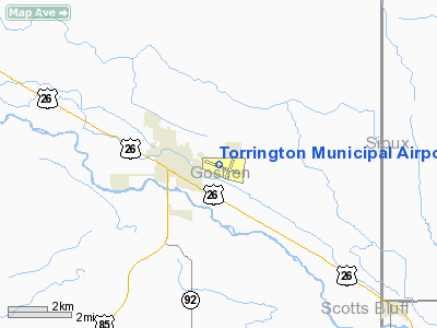
Location & QuickFacts
| FAA Information Effective: | 2008-09-25 |
| Airport Identifier: | TOR |
| Airport Status: | Operational |
| Longitude/Latitude: | 104-09-09.7000W/42-03-52.3000N
-104.152694/42.064528 (Estimated) |
| Elevation: | 4207 ft / 1282.29 m (Surveyed) |
| Land: | 256 acres |
| From nearest city: | 2 nautical miles E of Torrington, WY |
| Location: | Goshen County, WY |
| Magnetic Variation: | 11E (1995) |
Owner & Manager
| Ownership: | Publicly owned |
| Owner: | City Of Torrington |
| Address: | 2042 E A St
Torrington, WY 82240 |
| Phone number: | 307-532-5666 |
| Manager: | Jerry Wright |
| Address: | 2000 E 20th
Torrington, WY 82240 |
| Phone number: | 307-532-8551 |
Airport Operations and Facilities
| Airport Use: | Open to public |
| Wind indicator: | Yes |
| Segmented Circle: | Yes |
| Control Tower: | No |
| Lighting Schedule: | DUSK-DAWN
ACTVT MIRL RY 10/28, PAPI RY 10 & 28 AND REIL RY 10/28 - CTAF. MIRL WILL ONLY ACTIVATE IF BEACON IS OPERATING DURING DARK OR OVERCAST PERIODS. |
| Beacon Color: | Clear-Green (lighted land airport) |
| Landing fee charge: | No |
| Sectional chart: | Cheyenne |
| Region: | ANM - Northwest Mountain |
| Traffic Pattern Alt: | 1000 ft |
| Boundary ARTCC: | ZDV - Denver |
| Tie-in FSS: | CPR - Casper |
| FSS on Airport: | No |
| FSS Toll Free: | 1-800-WX-BRIEF |
| NOTAMs Facility: | TOR (NOTAM-d service avaliable) |
| Federal Agreements: | NGY |
Airport Communications
| CTAF: | 122.800 |
| Unicom: | 122.800 |
Airport Services
| Fuel available: | 100LLA
FOR FUEL AFTER HOURS CALL 307-532-2941 OR 307-532-7353 |
| Airframe Repair: | MAJOR |
| Power Plant Repair: | MAJOR |
| Bottled Oxygen: | NONE |
| Bulk Oxygen: | NONE |
Runway Information
Runway 02/20
| Dimension: | 3001 x 60 ft / 914.7 x 18.3 m |
| Surface: | ASPH, Good Condition |
| |
Runway 02 |
Runway 20 |
| Longitude: | 104-09-06.9453W | 104-08-47.9593W |
| Latitude: | 42-03-44.3799N | 42-04-10.4257N |
| Elevation: | 4198.00 ft | 4195.00 ft |
| Alignment: | 28 | 127 |
| Traffic Pattern: | Right | Left |
| Markings: | Basic, Good Condition | Basic, Good Condition |
| Obstruction: | 6 ft gnd, 387.0 ft from runway, 34:1 slope to clear
+4' GND 80' FM & 60' R OF CNTRLN. APCH SLOPE 20:1. | , 50:1 slope to clear |
|
Runway 10/28
| Dimension: | 5703 x 75 ft / 1738.3 x 22.9 m |
| Surface: | ASPH, Good Condition |
| Weight Limit: | Single wheel: 33000 lbs.
Dual wheel: 45000 lbs. |
| Edge Lights: | Medium |
| |
Runway 10 |
Runway 28 |
| Longitude: | 104-09-50.2982W | 104-08-42.0352W |
| Latitude: | 42-04-01.7783N | 42-03-37.5788N |
| Elevation: | 4205.00 ft | 4197.00 ft |
| Alignment: | 115 | 127 |
| Traffic Pattern: | Left | Left |
| Markings: | Non-precision instrument, Good Condition | Non-precision instrument, Good Condition |
| Crossing Height: | 40.00 ft | 40.00 ft |
| VASI: | 2-light PAPI on left side | 2-light PAPI on left side |
| Visual Glide Angle: | 3.00° | 3.00° |
| Runway End Identifier: | Yes | Yes |
| Obstruction: | , 50:1 slope to clear | 13 ft hill, 666.0 ft from runway, 53 ft right of centerline, 35:1 slope to clear |
|
Radio Navigation Aids
| ID |
Type |
Name |
Ch |
Freq |
Var |
Dist |
| GIG | NDB | Gering | | 341.00 | 11E | 22.2 nm |
| GYZ | NDB | Camp Guernsey | | 280.00 | 11E | 27.2 nm |
| CDR | VOR/DME | Chadron | 081X | 113.40 | 13E | 47.7 nm |
| BFF | VORTAC | Scottsbluff | 073X | 112.60 | 13E | 31.7 nm |
Remarks
- DEER & WATERFOWL ON & INVOF ARPT.
- RY 20 -7' DROP OFF; 60'L AND R OF CNTRLN AT THR; RY 10 -7' DROP 100' FROM THR AND 75'R.
- REFLECTORS ALONG PARALLEL TAXIWAYS ONLY; OTHERS LIGHTED.
- EXISTED PRIOR TO 1959.
Images and information placed above are from
http://www.airport-data.com/airport/TOR/
We thank them for the data!
| General Info
|
| Country |
United States
|
| State |
WYOMING
|
| FAA ID |
TOR
|
| Latitude |
42-03-52.371N
|
| Longitude |
104-09-09.715W
|
| Elevation |
4205 feet
|
| Near City |
TORRINGTON
|
We don't guarantee the information is fresh and accurate. The data may
be wrong or outdated.
For more up-to-date information please refer to other sources.
|
|


