 |
|
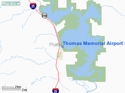
Location & QuickFacts
| FAA Information Effective: | 2008-09-25 |
| Airport Identifier: | 76V |
| Airport Status: | Operational |
| Longitude/Latitude: | 105-01-08.8980W/42-31-07.8870N
-105.019138/42.518857 (Estimated) |
| Elevation: | 4665 ft / 1421.89 m (Estimated) |
| Land: | 107 acres |
| From nearest city: | 1 nautical miles N of Glendo, WY |
| Location: | Platte County, WY |
| Magnetic Variation: | 12E (1985) |
Owner & Manager
| Ownership: | Publicly owned |
| Owner: | Town Of Glendo |
| Address: | Po Box 396
Glendo, WY 82213 |
| Phone number: | 307-735-4242 |
| Manager: | Chuck Haggerty |
| Address: | Po Box 164
Glendo, WY 82213 |
| Phone number: | 307-921-9623 |
Airport Operations and Facilities
| Airport Use: | Open to public |
| Wind indicator: | Yes |
| Segmented Circle: | No |
| Control Tower: | No |
| Landing fee charge: | No |
| Sectional chart: | Cheyenne |
| Region: | ANM - Northwest Mountain |
| Boundary ARTCC: | ZDV - Denver |
| Tie-in FSS: | CPR - Casper |
| FSS on Airport: | No |
| FSS Toll Free: | 1-800-WX-BRIEF |
| NOTAMs Facility: | CPR (NOTAM-d service avaliable) |
Airport Communications
Airport Services
| Airframe Repair: | NONE |
| Power Plant Repair: | NONE |
| Bottled Oxygen: | NONE |
| Bulk Oxygen: | NONE |
Runway Information
Runway 16/34
| Dimension: | 4397 x 70 ft / 1340.2 x 21.3 m |
| Surface: | TURF-DIRT, Fair Condition
FIRST 500 FT SE END VERY ROUGH & 1+ FT GRASS ENTIRE LENGTH OF RY. |
| |
Runway 16 |
Runway 34 |
| Elevation: | 4665.00 ft | 4662.00 ft |
| Traffic Pattern: | Left | Left |
| Obstruction: | 33 ft tree, 636.0 ft from runway, 75 ft right of centerline, 19:1 slope to clear | 22 ft road, 165.0 ft from runway, 7:1 slope to clear |
|
Radio Navigation Aids
| ID |
Type |
Name |
Ch |
Freq |
Var |
Dist |
| GYZ | NDB | Camp Guernsey | | 280.00 | 11E | 21.5 nm |
| TOR | NDB | Torrington | | 293.00 | 11E | 47.1 nm |
| IIP | VOR/DME | Hipsher | 023X | 108.60 | 12E | 13.2 nm |
Remarks
- RY 16/34 MUDDY; SLICK & SOFT WHEN WET; OCNL GOPHER HOLES.
- FOR GROUND TRANSPORTATION, USE PHONES AT TRAILER HOMES.
- UNRESTRICTED VEHICLE ACCESS.
- CTN: OCNL ANTELOPE ON RWY.
- CONTACT AMGR 307-921-9623 PRIOR TO USE FOR SFC CONDITION.
- EXISTED PRIOR TO 1959.
Images and information placed above are from
http://www.airport-data.com/airport/76V/
We thank them for the data!
| General Info
|
| Country |
United States
|
| State |
WYOMING
|
| FAA ID |
76V
|
| Latitude |
42-31-07.887N
|
| Longitude |
105-01-08.898W
|
| Elevation |
4665 feet
|
| Near City |
GLENDO
|
We don't guarantee the information is fresh and accurate. The data may
be wrong or outdated.
For more up-to-date information please refer to other sources.
|
|


