 |
|
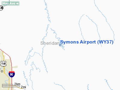
Location & QuickFacts
| FAA Information Effective: | 2008-09-25 |
| Airport Identifier: | WY37 |
| Airport Status: | Operational |
| Longitude/Latitude: | 106-49-24.2330W/44-50-26.9020N
-106.823398/44.840806 (Estimated) |
| Elevation: | 3681 ft / 1121.97 m (Estimated) |
| Land: | 0 acres |
| From nearest city: | 7 nautical miles NE of Sheridan, WY |
| Location: | Sheridan County, WY |
| Magnetic Variation: | 13E (1985) |
Owner & Manager
| Ownership: | Privately owned |
| Owner: | Edgar W Symons |
| Address: | P.o. Box 7160
Sheridan, WY 82801 |
| Phone number: | 307-737-2477 |
| Manager: | Edgar W. Symons |
| Address: | 128 W Whitney
Sheridan, WY 82801 |
| Phone number: | 307-737-2477 |
Airport Operations and Facilities
| Airport Use: | Private |
| Wind indicator: | Yes |
| Segmented Circle: | No |
| Control Tower: | No |
| Landing fee charge: | No |
| Sectional chart: | Billings |
| Region: | ANM - Northwest Mountain |
| Boundary ARTCC: | ZLC - Salt Lake City |
| Tie-in FSS: | CPR - Casper |
| FSS on Airport: | No |
| FSS Toll Free: | 1-800-WX-BRIEF |
Airport Services
| Airframe Repair: | NONE |
| Power Plant Repair: | NONE |
Runway Information
Runway 14/32
| Dimension: | 1900 x 50 ft / 579.1 x 15.2 m |
| Surface: | TURF, |
| |
Runway 14 |
Runway 32 |
| Traffic Pattern: | Left | Left |
|
Radio Navigation Aids
| ID |
Type |
Name |
Ch |
Freq |
Var |
Dist |
| SHR | VORTAC | Sheridan | 100X | 115.30 | 13E | 10.1 nm |
Images and information placed above are from
http://www.airport-data.com/airport/WY37/
We thank them for the data!
| General Info
|
| Country |
United States
|
| State |
WYOMING
|
| FAA ID |
WY37
|
| Latitude |
44-50-26.902N
|
| Longitude |
106-49-24.233W
|
| Elevation |
3681 feet
|
| Near City |
SHERIDAN
|
We don't guarantee the information is fresh and accurate. The data may
be wrong or outdated.
For more up-to-date information please refer to other sources.
|
|


