 |
|
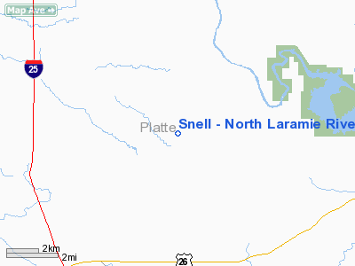
Snell - North Laramie River Airport |
Location & QuickFacts
| FAA Information Effective: | 2008-09-25 |
| Airport Identifier: | WY25 |
| Airport Status: | Operational |
| Longitude/Latitude: | 104-56-11.8940W/42-18-24.8900N
-104.936637/42.306914 (Estimated) |
| Elevation: | 4490 ft / 1368.55 m (Estimated) |
| Land: | 3 acres |
| From nearest city: | 5 nautical miles N of Wheatland, WY |
| Location: | Platte County, WY |
| Magnetic Variation: | 12E (1990) |
Owner & Manager
| Ownership: | Privately owned |
| Owner: | Ed Snell |
| Address: | 542 N Wheatland Highway
Wheatland, WY 82201 |
| Phone number: | 307-322-2657 |
| Manager: | Ed Snell |
| Address: | 542 N Wheatland Highway
Wheatland, WY 82201 |
| Phone number: | 307-322-2657 |
Airport Operations and Facilities
| Airport Use: | Private |
| Wind indicator: | Yes |
| Segmented Circle: | No |
| Control Tower: | No |
| Sectional chart: | Cheyenne |
| Region: | ANM - Northwest Mountain |
| Boundary ARTCC: | ZDV - Denver |
| Tie-in FSS: | CPR - Casper |
| FSS on Airport: | No |
| FSS Toll Free: | 1-800-WX-BRIEF |
Runway Information
Runway 12/30
| Dimension: | 2000 x 38 ft / 609.6 x 11.6 m |
| Surface: | TURF, |
| |
Runway 12 |
Runway 30 |
| Traffic Pattern: | Left | Left |
|
Radio Navigation Aids
| ID |
Type |
Name |
Ch |
Freq |
Var |
Dist |
| GYZ | NDB | Camp Guernsey | | 280.00 | 11E | 10.7 nm |
| TOR | NDB | Torrington | | 293.00 | 11E | 37.8 nm |
| IIP | VOR/DME | Hipsher | 023X | 108.60 | 12E | 25.6 nm |
Remarks
- OWNER DESIRES ARPT NOT BE CHARTED.
Images and information placed above are from
http://www.airport-data.com/airport/WY25/
We thank them for the data!
| General Info
|
| Country |
United States
|
| State |
WYOMING
|
| FAA ID |
WY25
|
| Latitude |
42-18-24.890N
|
| Longitude |
104-56-11.894W
|
| Elevation |
4490 feet
|
| Near City |
WHEATLAND
|
We don't guarantee the information is fresh and accurate. The data may
be wrong or outdated.
For more up-to-date information please refer to other sources.
|
|


