 |
|
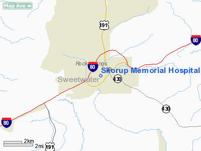
Skorup Memorial Hospital Heliport |
Location & QuickFacts
| FAA Information Effective: | 2008-09-25 |
| Airport Identifier: | WY49 |
| Airport Status: | Operational |
| Longitude/Latitude: | 109-14-05.4610W/41-35-05.8720N
-109.234850/41.584964 (Estimated) |
| Elevation: | 6454 ft / 1967.18 m (Estimated) |
| Land: | 0 acres |
| From nearest city: | 0 nautical miles N of Rock Springs, WY |
| Location: | Sweetwater County, WY |
| Magnetic Variation: | 14E (1985) |
Owner & Manager
| Ownership: | Publicly owned |
| Owner: | Mem'l Hosp Of Sweetwater Co |
| Address: | 1200 College Drive
Rock Springs, WY 82901 |
| Manager: | John M. Ferry |
| Address: | P.o. Box 1359
Rock Springs, WY 82901 |
| Phone number: | 307-362-3711 |
Airport Operations and Facilities
| Airport Use: | Private
MEDICAL USE. |
| Wind indicator: | Yes |
| Segmented Circle: | No |
| Control Tower: | No |
| Landing fee charge: | No |
| Sectional chart: | Salt Lake City |
| Region: | ANM - Northwest Mountain |
| Boundary ARTCC: | ZLC - Salt Lake City |
| Tie-in FSS: | CPR - Casper |
| FSS on Airport: | No |
| FSS Toll Free: | 1-800-WX-BRIEF |
Runway Information
Helipad H1
| Dimension: | 50 x 50 ft / 15.2 x 15.2 m |
| Surface: | CONC, |
| |
Runway H1 |
Runway |
| Traffic Pattern: | Left | Left |
|
Radio Navigation Aids
| ID |
Type |
Name |
Ch |
Freq |
Var |
Dist |
| AOP | NDB | Antelope | | 290.00 | 13E | 10.5 nm |
| OCS | VORTAC | Rock Springs | 107X | 116.00 | 13E | 9.9 nm |
Images and information placed above are from
http://www.airport-data.com/airport/WY49/
We thank them for the data!
| General Info
|
| Country |
United States
|
| State |
WYOMING
|
| FAA ID |
WY49
|
| Latitude |
41-35-05.872N
|
| Longitude |
109-14-05.461W
|
| Elevation |
6454 feet
|
| Near City |
ROCK SPRINGS
|
We don't guarantee the information is fresh and accurate. The data may
be wrong or outdated.
For more up-to-date information please refer to other sources.
|
|


