 |
|
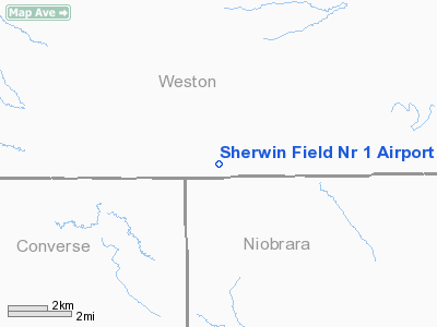
Sherwin Field Nr 1 Airport |
Location & QuickFacts
| FAA Information Effective: | 2008-09-25 |
| Airport Identifier: | WY09 |
| Airport Status: | Operational |
| Longitude/Latitude: | 104-52-41.6000W/43-30-21.9000N
-104.878222/43.506083 (Estimated) |
| Elevation: | 4190 ft / 1277.11 m (Estimated) |
| Land: | 0 acres |
| From nearest city: | 7 nautical miles NE of Dull Center/sw Clareton/, WY |
| Location: | Weston County, WY |
| Magnetic Variation: | 12E (1985) |
Owner & Manager
| Ownership: | Privately owned |
| Owner: | Mr. & Mrs. Robert Harshburger |
| Address: | 1162 Lynch Rd
Newcastle, WY 82701 |
| Phone number: | 307-746-2815 |
| Manager: | Mr, & Mrs. Robert Harshburger |
| Address: | 1162 Lynch Rd
Newcastle, WY 82701 |
| Phone number: | 307-746-2815 |
Airport Operations and Facilities
| Airport Use: | Private |
| Wind indicator: | Yes |
| Segmented Circle: | No |
| Control Tower: | No |
| Landing fee charge: | No |
| Sectional chart: | Cheyenne |
| Region: | ANM - Northwest Mountain |
| Boundary ARTCC: | ZDV - Denver |
| Tie-in FSS: | CPR - Casper |
| FSS on Airport: | No |
| FSS Toll Free: | 1-800-WX-BRIEF |
Airport Services
| Airframe Repair: | NONE |
| Power Plant Repair: | NONE |
Runway Information
Runway NW/SE
| Dimension: | 3300 x 100 ft / 1005.8 x 30.5 m |
| Surface: | TURF-GRVL, |
| |
Runway NW |
Runway SE |
| Traffic Pattern: | Left | Left |
|
Radio Navigation Aids
| ID |
Type |
Name |
Ch |
Freq |
Var |
Dist |
| ECS | VOR | Newcastle | | 108.20 | 11E | 33.5 nm |
Remarks
Images and information placed above are from
http://www.airport-data.com/airport/WY09/
We thank them for the data!
| General Info
|
| Country |
United States
|
| State |
WYOMING
|
| FAA ID |
WY09
|
| Latitude |
43-30-26.000N
|
| Longitude |
104-52-54.000W
|
| Elevation |
4190 feet
|
| Near City |
DULL CENTER/SW CLARETON/
|
We don't guarantee the information is fresh and accurate. The data may
be wrong or outdated.
For more up-to-date information please refer to other sources.
|
|


