 |
|
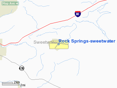
Rock Springs-sweetwater County Airport |
| Rock Springs-Sweetwater County Airport |
| IATA: RKS – ICAO: KRKS – FAA LID: RKS |
| Summary |
| Airport type |
Public |
| Operator |
City of Rock Springs |
| Location |
Rock Springs, Wyoming |
| Elevation AMSL |
6,760 ft / 2,060.4 m |
| Coordinates |
41°35′39″N 109°03′55″W / 41.59417°N 109.06528°W / 41.59417; -109.06528Coordinates: 41°35′39″N 109°03′55″W / 41.59417°N 109.06528°W / 41.59417; -109.06528 |
| Runways |
| Direction |
Length |
Surface |
| ft |
m |
| 9/27 |
10,000 |
3,048 |
Asphalt |
| 3/21 |
5,223 |
1,592 |
Asphalt |
Rock Springs-Sweetwater County Airport (IATA: RKS, ICAO: KRKS, FAA LID: RKS) is a public airport located seven miles (11 km) east of the central business district (CBD) of Rock Springs, a city in Sweetwater County, Wyoming, USA. The airport covers 1,242 acres (503 ha) and has two runways, 9/27 and 3/21. It is mainly used for general aviation, but is also served by three commercial airlines.
Service was subsidized by the Essential Air Service program, but Great Lakes Airlines has chosen to continue operating flights to Denver without the subsidy effective October 1, 2006. Airlines and destinations
| Airlines |
Destinations |
| Delta Connection operated by SkyWest Airlines |
Salt Lake City |
| Great Lakes Airlines |
Denver |
| United Express operated by SkyWest Airlines |
Denver |
The above content comes from Wikipedia and is published under free licenses – click here to read more.
Location & QuickFacts
| FAA Information Effective: | 2008-09-25 |
| Airport Identifier: | RKS |
| Airport Status: | Operational |
| Longitude/Latitude: | 109-03-54.6940W/41-35-39.1830N
-109.065193/41.594217 (Estimated) |
| Elevation: | 6760 ft / 2060.45 m (Surveyed) |
| Land: | 1242 acres |
| From nearest city: | 7 nautical miles E of Rock Springs, WY |
| Location: | Sweetwater County, WY |
| Magnetic Variation: | 13E (1995) |
Owner & Manager
| Ownership: | Publicly owned |
| Owner: | City Of Rock Springs
AND CO OF SWEETWATER. |
| Address: | Box 1987
Rock Springs, WY 82902-1987 |
| Phone number: | 307-352-6880 |
| Manager: | Gary D. Valentine |
| Address: | Box 1987
Rock Springs, WY 82902-1987 |
| Phone number: | 307-352-6880 |
Airport Operations and Facilities
| Airport Use: | Open to public |
| Wind indicator: | Yes |
| Segmented Circle: | Yes |
| Control Tower: | No |
| Lighting Schedule: | DUSK-DAWN
ACTVT MIRL RY 03/21, HIRL RY 09/27, ODALS RY 09, MALSR RY 27, REILS RYS 03 & 21, AND TWY LGTS - CTAF. |
| Beacon Color: | Clear-Green (lighted land airport) |
| Landing fee charge: | No
COMMERCIAL LANDING FEE FOR ACFT OVER 12500 LBS. |
| Sectional chart: | Salt Lake City |
| Region: | ANM - Northwest Mountain |
| Boundary ARTCC: | ZLC - Salt Lake City |
| Tie-in FSS: | CPR - Casper |
| FSS Toll Free: | 1-800-WX-BRIEF |
| NOTAMs Facility: | RKS (NOTAM-d service avaliable) |
| Certification type/date: | I A S 05/1973
PPR FOR ACR OPNS WITH MORE THAN 30 PSGR SEATS 2100-0600 CALL AMGR 307-352-6880 OR 307-352-6888. |
| Federal Agreements: | NGSY3 |
Airport Communications
| CTAF: | 122.800 |
| Unicom: | 122.800 |
Airport Services
| Fuel available: | 100LLA1+ |
| Bulk Oxygen: | HIGH/LOW |
Runway Information
Runway 03/21
| Dimension: | 5223 x 75 ft / 1592.0 x 22.9 m |
| Surface: | ASPH, Good Condition |
| Surface Treatment: | Porous Friction Course |
| Weight Limit: | Single wheel: 12000 lbs.
Dual wheel: 25000 lbs. |
| Edge Lights: | Medium |
| |
Runway 03 |
Runway 21 |
| Longitude: | 109-04-24.3260W | 109-03-35.5580W |
| Latitude: | 41-35-18.8000N | 41-35-55.1450N |
| Elevation: | 6730.00 ft | 6744.00 ft |
| Alignment: | 45 | 127 |
| Traffic Pattern: | Left | Left |
| Markings: | Basic, Good Condition | Basic, Good Condition |
| Crossing Height: | 30.00 ft | 30.00 ft |
| VASI: | 2-light PAPI on left side | 2-light PAPI on left side |
| Visual Glide Angle: | 3.00° | 3.00° |
| Runway End Identifier: | Yes | Yes |
|
Runway 09/27
| Dimension: | 10000 x 150 ft / 3048.0 x 45.7 m |
| Surface: | ASPH, Good Condition |
| Surface Treatment: | Saw-cut or plastic Grooved |
| Weight Limit: | Single wheel: 55000 lbs.
Dual wheel: 110000 lbs. |
| Edge Lights: | High |
| |
Runway 09 |
Runway 27 |
| Longitude: | 109-04-56.0000W | 109-02-47.9080W |
| Latitude: | 41-35-51.6200N | 41-35-29.0500N |
| Elevation: | 6728.00 ft | 6760.00 ft |
| Alignment: | 103 | 127 |
| ILS Type: | | ILS/DME
|
| Traffic Pattern: | Left | Left |
| Markings: | Precision instrument, Good Condition | Precision instrument, Good Condition |
| Crossing Height: | 54.00 ft | 54.00 ft |
| VASI: | 4-box on left side | 4-box on right side |
| Visual Glide Angle: | 3.00° | 3.00° |
| Approach lights: | ODALS | MALSR |
|
Radio Navigation Aids
| ID |
Type |
Name |
Ch |
Freq |
Var |
Dist |
| AOP | NDB | Antelope | | 290.00 | 13E | 2.9 nm |
| OCS | VORTAC | Rock Springs | 107X | 116.00 | 13E | 2.3 nm |
Remarks
- ITINERANT ACFT TIE DOWN S OF GENERAL AVAIATION TERMINAL.
- EXISTED PRIOR TO 1959.
Images and information placed above are from
http://www.airport-data.com/airport/RKS/
We thank them for the data!
| General Info
|
| Country |
United States
|
| State |
WYOMING
|
| FAA ID |
RKS
|
| Latitude |
41-35-39.183N
|
| Longitude |
109-03-54.694W
|
| Elevation |
6760 feet
|
| Near City |
ROCK SPRINGS
|
We don't guarantee the information is fresh and accurate. The data may
be wrong or outdated.
For more up-to-date information please refer to other sources.
|
|


