 |
|
| Riverton Regional Airport |
| IATA: RIW – ICAO: KRIW – FAA LID: RIW |
| Summary |
| Airport type |
Public |
| Operator |
City of Riverton |
| Location |
Riverton, Wyoming |
| Elevation AMSL |
5,525 ft / 1,684 m |
| Coordinates |
43°03′51″N 108°27′35″W / 43.06417°N 108.45972°W / 43.06417; -108.45972Coordinates: 43°03′51″N 108°27′35″W / 43.06417°N 108.45972°W / 43.06417; -108.45972 |
| Runways |
| Direction |
Length |
Surface |
| ft |
m |
| 10/28 |
8,203 |
2,500 |
Asphalt |
| 1/19 |
4,800 |
1,463 |
Asphalt |
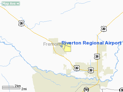
Riverton Regional Airport (IATA: RIW, ICAO: KRIW, FAA LID: RIW) is a public airport located three miles (5 km) northwest of the central business district (CBD) of Riverton, a city in Fremont County, Wyoming, USA. The airport covers 1,250 acres (506 ha) and has two runways. It is mostly used for general aviation, but is also served by one commercial airline.
Service was subsidized by the Essential Air Service program until October 1, 2006, when Great Lakes Airlines began providing subsidy-free service. Airlines and destinations
| Airlines |
Destinations |
| Great Lakes Airlines |
Denver |
The above content comes from Wikipedia and is published under free licenses – click here to read more.
Location & QuickFacts
| FAA Information Effective: | 2008-09-25 |
| Airport Identifier: | RIW |
| Airport Status: | Operational |
| Longitude/Latitude: | 108-27-35.4280W/43-03-51.2460N
-108.459841/43.064235 (Estimated) |
| Elevation: | 5525 ft / 1684.02 m (Surveyed) |
| Land: | 1250 acres |
| From nearest city: | 3 nautical miles NW of Riverton, WY |
| Location: | Fremont County, WY |
| Magnetic Variation: | 14E (1985) |
Owner & Manager
| Ownership: | Publicly owned |
| Owner: | City Of Riverton |
| Address: | 816 N Federal Blvd.
Riverton, WY 82501 |
| Phone number: | 307-856-2227 |
| Manager: | William A. Urbigkit |
| Address: | 816 North Federal Blvd
Riverton, WY 82501 |
| Phone number: | 307-856-2227 |
Airport Operations and Facilities
| Airport Use: | Open to public |
| Wind indicator: | Yes |
| Segmented Circle: | Yes |
| Control Tower: | No |
| Lighting Schedule: | DUSK-DAWN
ACTIVATE HIRL RY 10/28; MIRL & REIL RY 01/19; REIL RY 10 & MALSR RY 28 -CTAF. VASI RY 28 AND PAPI RYS 01,10 & 19 OPERATE 24 HRS. |
| Beacon Color: | Clear-Green (lighted land airport) |
| Landing fee charge: | No |
| Sectional chart: | Cheyenne |
| Region: | ANM - Northwest Mountain |
| Boundary ARTCC: | ZLC - Salt Lake City |
| Tie-in FSS: | CPR - Casper |
| FSS on Airport: | No |
| FSS Toll Free: | 1-800-WX-BRIEF |
| NOTAMs Facility: | RIW (NOTAM-d service avaliable) |
| Certification type/date: | I A S 05/1973
PPR FOR UNSKED OPNS WITH MORE THAN 30 PSGR SEATS CALL AMGR 307-856-7063/7980. |
| Federal Agreements: | NGSY |
Airport Communications
| CTAF: | 122.800 |
| Unicom: | 122.800 |
Airport Services
| Fuel available: | 100LLA |
| Airframe Repair: | MAJOR |
| Power Plant Repair: | MAJOR |
| Bottled Oxygen: | LOW |
Runway Information
Runway 01/19
| Dimension: | 4800 x 70 ft / 1463.0 x 21.3 m |
| Surface: | ASPH, Good Condition |
| Surface Treatment: | Saw-cut or plastic Grooved |
| Weight Limit: | Single wheel: 30000 lbs.
Dual wheel: 50000 lbs. |
| Edge Lights: | Medium |
| |
Runway 01 |
Runway 19 |
| Longitude: | 108-27-56.5890W | 108-27-29.9740W |
| Latitude: | 43-03-25.4100N | 43-04-08.6020N |
| Elevation: | 5459.00 ft | 5475.00 ft |
| Alignment: | 24 | 127 |
| Traffic Pattern: | Left | Left |
| Markings: | Non-precision instrument, Good Condition | Non-precision instrument, Good Condition |
| Crossing Height: | 40.00 ft | 39.00 ft |
| VASI: | 2-light PAPI on left side | 2-light PAPI on left side |
| Visual Glide Angle: | 2.75° | 2.75° |
| Runway End Identifier: | Yes | Yes |
|
Runway 10/28
| Dimension: | 8203 x 150 ft / 2500.3 x 45.7 m |
| Surface: | ASPH, Fair Condition |
| Surface Treatment: | Porous Friction Course |
| Weight Limit: | Single wheel: 85000 lbs.
Dual wheel: 110000 lbs.
Dual tandem wheel: 165000 lbs. |
| Edge Lights: | High |
| |
Runway 10 |
Runway 28 |
| Longitude: | 108-28-21.1750W | 108-26-40.4960W |
| Latitude: | 43-04-10.3870N | 43-03-37.0600N |
| Elevation: | 5524.00 ft | 5437.00 ft |
| Alignment: | 114 | 127 |
| ILS Type: | | ILS
|
| Traffic Pattern: | Left | Left |
| Markings: | Precision instrument, Good Condition | Precision instrument, Good Condition |
| Crossing Height: | 45.00 ft | 50.00 ft |
| VASI: | 4-light PAPI on left side | 4-box on left side |
| Visual Glide Angle: | 2.83° | 3.00° |
| Approach lights: | | MALSR |
| Runway End Identifier: | Yes | |
| Obstruction: | 121 ft pline, 3950.0 ft from runway, 30:1 slope to clear | , 50:1 slope to clear |
|
Radio Navigation Aids
| ID |
Type |
Name |
Ch |
Freq |
Var |
Dist |
| RIW | VOR/DME | Riverton | 025X | 108.80 | 16E | 0.2 nm |
| BOY | VOR/DME | Boysen Reservoir | 125X | 117.80 | 16E | 25.0 nm |
Remarks
- GA ACFT NOT AUZD ON WEST RAMP.
Images and information placed above are from
http://www.airport-data.com/airport/RIW/
We thank them for the data!
| General Info
|
| Country |
United States
|
| State |
WYOMING
|
| FAA ID |
RIW
|
| Latitude |
43-03-51.246N
|
| Longitude |
108-27-35.428W
|
| Elevation |
5525 feet
|
| Near City |
RIVERTON
|
We don't guarantee the information is fresh and accurate. The data may
be wrong or outdated.
For more up-to-date information please refer to other sources.
|
|


