|
|
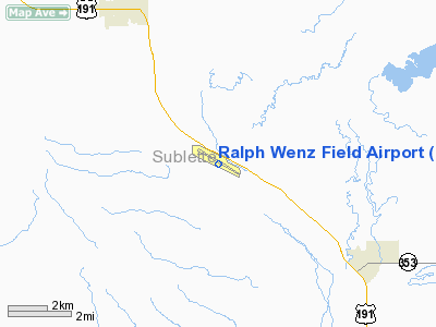
| Ralph Wenz Field |
| IATA: none – ICAO: KPNA – FAA LID: PNA |
| Summary |
| Airport type |
Public |
| Owner |
Town of Pinedale |
| Serves |
Pinedale, Wyoming |
| Elevation AMSL |
7,086 ft / 2,160 m |
| Coordinates |
42°47′44″N 109°48′26″W / 42.79556°N 109.80722°W / 42.79556; -109.80722 |
| Runways |
| Direction |
Length |
Surface |
| ft |
m |
| 11/29 |
7,100 |
2,164 |
Asphalt |
| Statistics (2007) |
| Aircraft operations |
9,516 |
| Source: Federal Aviation Administration |
Ralph Wenz Field (ICAO: KPNA, FAA LID: PNA) is a town-owned public-use airport located five nautical miles (9 km) southeast of the central business district of the town of Pinedale in Sublette County, Wyoming, United States.
Although most U.S. airports use the same three-letter location identifier for the FAA and IATA, this airport is assigned PNA by the FAA but has no designation from the IATA (which assigned PNA to Pamplona Airport in Pamplona, Spain).
Facilities and aircraft
Ralph Wenz Field covers an area of 485 acres (196 ha) at an elevation of 7,086 feet (2,160 m) above mean sea level. It has one asphalt paved runway designated 11/29 which measures 7,100 by 100 feet (2,164 x 30 m). For the 12-month period ending July 31, 2007, the airport had 9,516 aircraft operations, an average of 26 per day: 63% general aviation, 37% air taxi, <1% military.
The above content comes from Wikipedia and is published under free licenses – click here to read more.
 |
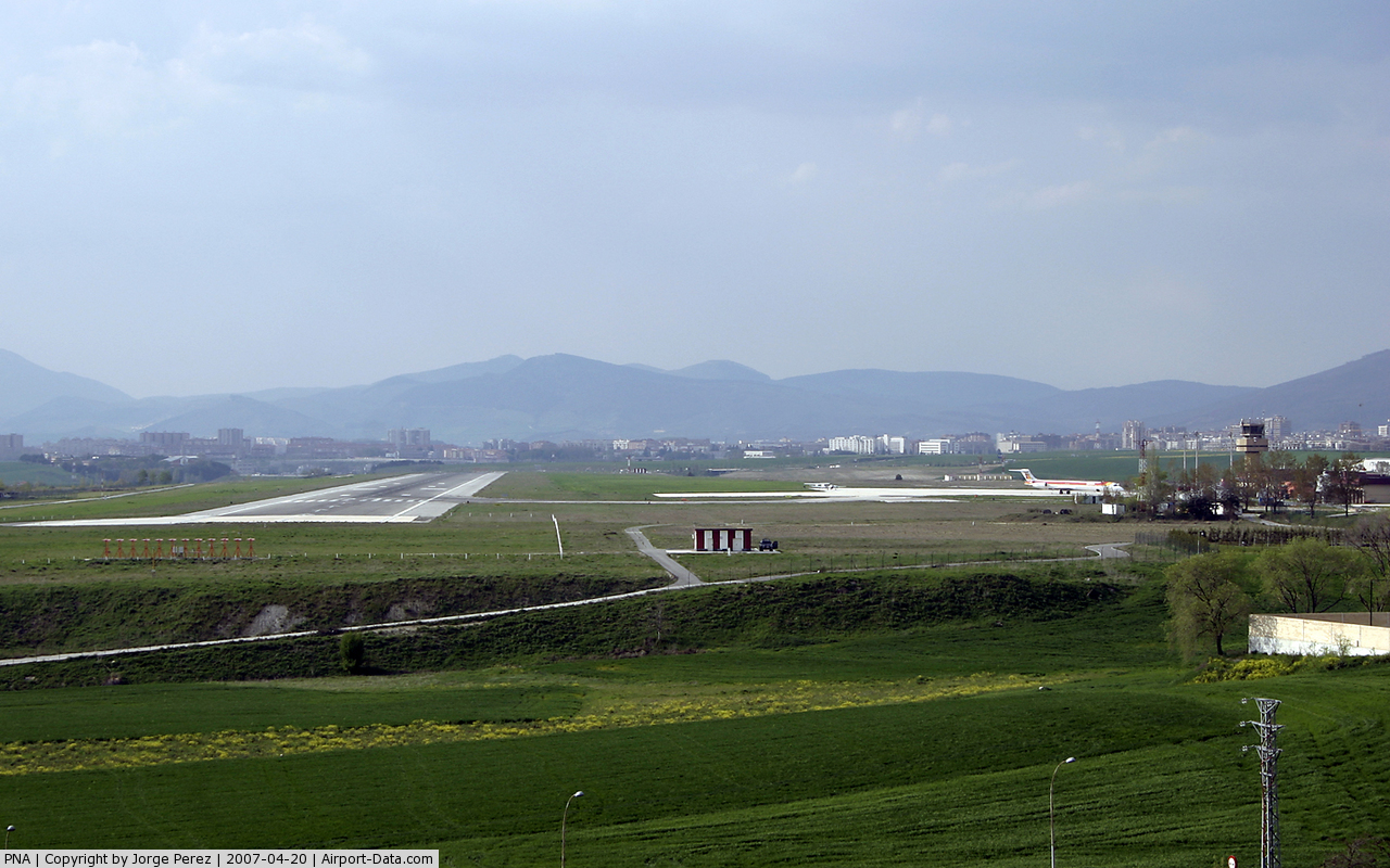
(Click on the photo to enlarge) |
Location & QuickFacts
| FAA Information Effective: | 2008-09-25 |
| Airport Identifier: | PNA |
| Airport Status: | Operational |
| Longitude/Latitude: | 109-48-25.5000W/42-47-43.7000N
-109.807083/42.795472 (Estimated) |
| Elevation: | 7086 ft / 2159.81 m (Estimated) |
| Land: | 485 acres |
| From nearest city: | 5 nautical miles SE of Pinedale, WY |
| Location: | Sublette County, WY |
| Magnetic Variation: | 13E (2005) |
Owner & Manager
| Ownership: | Publicly owned |
| Owner: | Town Of Pinedale |
| Address: | P. O. Box 709
Pinedale, WY 82941 |
| Phone number: | 307-367-4136 |
| Manager: | Jim Parker |
| Address: | P O Box 1766
Pinedale, WY 82941 |
| Phone number: | 307-360-9025 |
Airport Operations and Facilities
| Airport Use: | Open to public |
| Wind indicator: | Yes |
| Segmented Circle: | Yes |
| Control Tower: | No |
| Lighting Schedule: | DUSK-DAWN
ACTVT MIRL RY 11/29, PAPI RYS 11 & 29, AND REIL RY 29 - CTAF. |
| Beacon Color: | Clear-Green (lighted land airport) |
| Landing fee charge: | Yes |
| Sectional chart: | Salt Lake City |
| Region: | ANM - Northwest Mountain |
| Boundary ARTCC: | ZLC - Salt Lake City |
| Tie-in FSS: | CPR - Casper |
| FSS on Airport: | No |
| FSS Toll Free: | 1-800-WX-BRIEF |
| NOTAMs Facility: | PNA (NOTAM-d service avaliable) |
| Federal Agreements: | NGY |
Airport Communications
| CTAF: | 122.800 |
| Unicom: | 122.800 |
Airport Services
| Fuel available: | 100LLA
FOR FUEL AFTER HOURS CALL 307-537-5211 OR 307-360-6776 |
| Airframe Repair: | MAJOR |
| Power Plant Repair: | MAJOR |
| Bottled Oxygen: | NONE |
| Bulk Oxygen: | NONE |
Runway Information
Runway 11/29
| Dimension: | 7100 x 100 ft / 2164.1 x 30.5 m |
| Surface: | ASPH, Good Condition |
| Weight Limit: | Single wheel: 45000 lbs. |
| Edge Lights: | Medium |
| |
Runway 11 |
Runway 29 |
| Longitude: | 109-49-09.9900W | 109-47-50.0200W |
| Latitude: | 42-48-04.5500N | 42-47-26.5200N |
| Elevation: | 7086.00 ft | 7065.00 ft |
| Alignment: | 123 | 127 |
| Traffic Pattern: | Left | Left |
| Markings: | Non-precision instrument, Fair Condition | Non-precision instrument, Fair Condition |
| Crossing Height: | 41.00 ft | 42.00 ft |
| VASI: | 2-light PAPI on left side | 2-light PAPI on left side |
| Visual Glide Angle: | 3.00° | 3.00° |
| Runway End Identifier: | | Yes |
|
Radio Navigation Aids
| ID |
Type |
Name |
Ch |
Freq |
Var |
Dist |
| PNA | NDB | Wenz | | 392.00 | 13E | 0.2 nm |
| BPI | VOR/DME | Big Piney | 112X | 116.50 | 16E | 18.6 nm |
Remarks
- ALL HELICOPTER TFC TO COME & GO VIA THE TWY. FLYING OVER BLDGS ADJACENT TO RAMP IS PROHIBITED.
Images and information placed above are from
http://www.airport-data.com/airport/PNA/
We thank them for the data!
| General Info
|
| Country |
United States
|
| State |
WYOMING
|
| FAA ID |
PNA
|
| Latitude |
42-47-43.797N
|
| Longitude |
109-48-25.540W
|
| Elevation |
7085 feet
|
| Near City |
PINEDALE
|
We don't guarantee the information is fresh and accurate. The data may
be wrong or outdated.
For more up-to-date information please refer to other sources.
|
|