 |
|
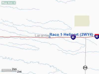
Location & QuickFacts
| FAA Information Effective: | 2008-09-25 |
| Airport Identifier: | 2WY4 |
| Airport Status: | Operational |
| Longitude/Latitude: | 104-26-44.0000W/41-09-29.0000N
-104.445556/41.158056 (Estimated) |
| Elevation: | 5575 ft / 1699.26 m (Estimated) |
| Land: | 1 acres |
| From nearest city: | 6 nautical miles NE of Burns, WY |
| Location: | Laramie County, WY |
| Magnetic Variation: | 10E (2000) |
Owner & Manager
| Ownership: | Privately owned |
| Owner: | Roberts Aircraft Company |
| Address: | 4101 Evans Ave
Cheyenne, WY 82001-1469 |
| Phone number: | 970-484-1048 |
| Manager: | Kevin Shields |
| Address: | 4101 Evans Ave
Cheyenne, WY 82001-1469 |
| Phone number: | 970-492-1029 |
Airport Operations and Facilities
| Airport Use: | Private |
| Wind indicator: | Yes |
| Segmented Circle: | No |
| Control Tower: | No |
| Sectional chart: | Cheyenne |
| Region: | ANM - Northwest Mountain |
| Boundary ARTCC: | ZDV - Denver |
| Tie-in FSS: | CPR - Casper |
| FSS Toll Free: | 1-800-WX-BRIEF |
Runway Information
Helipad H1
| Dimension: | 50 x 50 ft / 15.2 x 15.2 m |
| Surface: | CONC-TURF, |
| |
Runway H1 |
Runway |
| Traffic Pattern: | Left | Left |
|
Radio Navigation Aids
| ID |
Type |
Name |
Ch |
Freq |
Var |
Dist |
| IBM | NDB | Kimball | | 317.00 | 10E | 35.2 nm |
| CYS | VORTAC | Cheyenne | 078X | 113.10 | 13E | 15.1 nm |
| GLL | VORTAC | Gill | 089X | 114.20 | 13E | 39.6 nm |
Images and information placed above are from
http://www.airport-data.com/airport/2WY4/
We thank them for the data!
| General Info
|
| Country |
United States
|
| State |
WYOMING
|
| FAA ID |
2WY4
|
| Latitude |
41-09-29.000N
|
| Longitude |
104-26-44.000W
|
| Elevation |
5575 feet
|
| Near City |
BURNS
|
We don't guarantee the information is fresh and accurate. The data may
be wrong or outdated.
For more up-to-date information please refer to other sources.
|
|


