 |
|
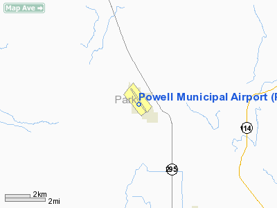
Location & QuickFacts
| FAA Information Effective: | 2008-09-25 |
| Airport Identifier: | POY |
| Airport Status: | Operational |
| Longitude/Latitude: | 108-47-36.3390W/44-52-01.7790N
-108.793427/44.867161 (Estimated) |
| Elevation: | 5092 ft / 1552.04 m (Surveyed) |
| Land: | 820 acres |
| From nearest city: | 7 nautical miles N of Powell, WY |
| Location: | Park County, WY |
| Magnetic Variation: | 15E (1985) |
Owner & Manager
| Ownership: | Publicly owned |
| Owner: | City Of Powell |
| Address: | Po Box 1008
Powell, WY 82435 |
| Phone number: | 307-754-5106 |
| Manager: | Orville Moore |
| Address: | P. O. Box 1157
Powell, WY 82435 |
| Phone number: | 307-754-5234
AFTER HOURS CALL 307-254-0977 |
Airport Operations and Facilities
| Airport Use: | Open to public |
| Wind indicator: | Yes |
| Segmented Circle: | Yes |
| Control Tower: | No |
| Lighting Schedule: | DUSK-DAWN
ACTVT MIRL RY 13/31, REIL RY 31 AND PAPI RYS 13 & 31 - CTAF. |
| Beacon Color: | Clear-Green (lighted land airport) |
| Landing fee charge: | No |
| Sectional chart: | Billings |
| Region: | ANM - Northwest Mountain |
| Boundary ARTCC: | ZLC - Salt Lake City |
| Tie-in FSS: | CPR - Casper |
| FSS on Airport: | No |
| FSS Toll Free: | 1-800-WX-BRIEF |
| NOTAMs Facility: | CPR (NOTAM-d service avaliable) |
| Federal Agreements: | NGSY |
Airport Communications
| CTAF: | 122.700 |
| Unicom: | 122.700 |
Airport Services
| Fuel available: | 100LLA
FUEL 24 HR. SELF SERV CREDIT CARD. |
| Airframe Repair: | MAJOR |
| Power Plant Repair: | MAJOR |
| Bottled Oxygen: | NONE |
| Bulk Oxygen: | NONE |
Runway Information
Runway 03/21
| Dimension: | 2176 x 100 ft / 663.2 x 30.5 m |
| Surface: | TURF-DIRT, Fair Condition |
| |
Runway 03 |
Runway 21 |
| Longitude: | 108-47-55.8000W | 108-47-34.8430W |
| Latitude: | 44-51-42.5000N | 44-51-57.9750N |
| Elevation: | 5092.00 ft | 5062.00 ft |
| Alignment: | 44 | 127 |
| Traffic Pattern: | Left | Left |
| Obstruction: | 12 ft fence, 252.0 ft from runway, 21 ft right of centerline, 21:1 slope to clear | , 50:1 slope to clear |
|
Runway 13/31
| Dimension: | 6205 x 100 ft / 1891.3 x 30.5 m |
| Surface: | ASPH, Good Condition |
| Weight Limit: | Single wheel: 15000 lbs. |
| Edge Lights: | Medium |
| |
Runway 13 |
Runway 31 |
| Longitude: | 108-47-57.1360W | 108-47-07.4140W |
| Latitude: | 44-52-33.6300N | 44-51-43.6190N |
| Elevation: | 4994.00 ft | 5092.00 ft |
| Alignment: | 127 | 127 |
| Traffic Pattern: | Left | Left |
| Markings: | Non-precision instrument, Fair Condition | Non-precision instrument, Fair Condition |
| Crossing Height: | 38.00 ft | 36.00 ft |
| VASI: | 2-light PAPI on left side | 2-light PAPI on left side |
| Visual Glide Angle: | 3.00° | 3.00° |
| Runway End Identifier: | | Yes |
| Obstruction: | , 50:1 slope to clear | 25 ft fence, 1150.0 ft from runway, 38:1 slope to clear |
|
Runway 16/34
| Dimension: | 2400 x 100 ft / 731.5 x 30.5 m |
| Surface: | TURF-DIRT, Fair Condition |
| |
Runway 16 |
Runway 34 |
| Longitude: | 108-47-38.7000W | 108-47-38.7000W |
| Latitude: | 44-52-06.3970N | 44-51-42.7000N |
| Elevation: | 5010.00 ft | 5055.00 ft |
| Alignment: | 127 | 0 |
| Traffic Pattern: | Left | Left |
| Obstruction: | , 50:1 slope to clear | 14 ft fence, 234.0 ft from runway, 16:1 slope to clear |
|
Radio Navigation Aids
| ID |
Type |
Name |
Ch |
Freq |
Var |
Dist |
| POY | NDB | Powell | | 344.00 | 15E | 0.3 nm |
| HCY | NDB | Cowley | | 257.00 | 14E | 15.2 nm |
| RED | NDB | Red Lodge | | 203.00 | 17E | 30.0 nm |
| GEY | NDB | Greybull | | 275.00 | 14E | 37.1 nm |
| COD | VOR/DME | Cody | 055X | 111.80 | 14E | 16.5 nm |
Remarks
- +8 FT FENCE 243 FT FROM EOR 34 BOTH SIDES OF CENTER LINE.
- AFTER HOURS EMERGENCY CONTACT POLICE DEPT. 307-754-2212
Images and information placed above are from
http://www.airport-data.com/airport/POY/
We thank them for the data!
| General Info
|
| Country |
United States
|
| State |
WYOMING
|
| FAA ID |
POY
|
| Latitude |
44-52-04.700N
|
| Longitude |
108-47-34.800W
|
| Elevation |
5092 feet
|
| Near City |
POWELL
|
We don't guarantee the information is fresh and accurate. The data may
be wrong or outdated.
For more up-to-date information please refer to other sources.
|
|


