|
|

 |
(Click on the photo to enlarge) |
Location & QuickFacts
| FAA Information Effective: | 2008-09-25 |
| Airport Identifier: | 82V |
| Airport Status: | Operational |
| Longitude/Latitude: | 104-07-48.8250W/41-09-11.9350N
-104.130229/41.153315 (Estimated) |
| Elevation: | 5152 ft / 1570.33 m (Estimated) |
| Land: | 271 acres |
| From nearest city: | 3 nautical miles SW of Pine Bluffs, WY |
| Location: | Laramie County, WY |
| Magnetic Variation: | 11E (1985) |
Owner & Manager
| Ownership: | Publicly owned |
| Owner: | Town Of Pine Bluffs |
| Address: | Box 378
Pine Bluffs, WY 82082 |
| Phone number: | 307-245-3746 |
| Manager: | John Marquardt |
| Address: | Box 83
Pine Bluffs, WY 82082 |
| Phone number: | 307-245-9257 |
Airport Operations and Facilities
| Airport Use: | Open to public |
| Wind indicator: | Yes |
| Segmented Circle: | Yes |
| Control Tower: | No |
| Lighting Schedule: | DUSK-DAWN
ACTVT MIRL RY 08/26, PAPI RYS 08 & 26, REIL RYS 08 & 26 & WIND TEE - CTAF. |
| Beacon Color: | Clear-Green (lighted land airport) |
| Landing fee charge: | No |
| Sectional chart: | Cheyenne |
| Region: | ANM - Northwest Mountain |
| Boundary ARTCC: | ZDV - Denver |
| Tie-in FSS: | CPR - Casper |
| FSS on Airport: | No |
| FSS Toll Free: | 1-800-WX-BRIEF |
| NOTAMs Facility: | CPR (NOTAM-d service avaliable) |
| Federal Agreements: | NGY |
Airport Communications
| CTAF: | 122.800 |
| Unicom: | 122.800 |
Airport Services
| Airframe Repair: | NONE |
| Power Plant Repair: | NONE |
| Bottled Oxygen: | NONE |
| Bulk Oxygen: | NONE |
Runway Information
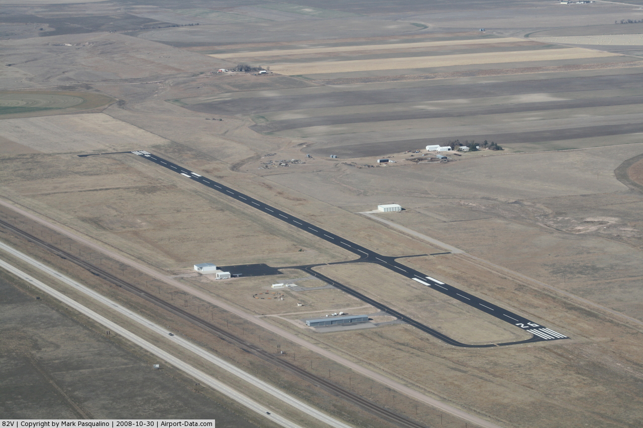
Runway 08/26
| Dimension: | 5336 x 75 ft / 1626.4 x 22.9 m |
| Surface: | ASPH, Good Condition |
| Weight Limit: | Single wheel: 12500 lbs. |
| Edge Lights: | Medium |
| |
Runway 08 |
Runway 26 |
| Traffic Pattern: | Left | Left |
| Markings: | Non-precision instrument, Good Condition | Non-precision instrument, Good Condition |
| Crossing Height: | 40.00 ft | 40.00 ft |
| VASI: | 2-light PAPI on left side | 2-light PAPI on left side |
| Visual Glide Angle: | 3.00° | 3.00° |
| Runway End Identifier: | Yes | Yes |
|
Radio Navigation Aids
| ID |
Type |
Name |
Ch |
Freq |
Var |
Dist |
| IBM | NDB | Kimball | | 317.00 | 10E | 21.0 nm |
| CYS | VORTAC | Cheyenne | 078X | 113.10 | 13E | 29.3 nm |
| GLL | VORTAC | Gill | 089X | 114.20 | 13E | 43.5 nm |
Remarks
- UNRESTRICTED VEHICLE ACCESS.
Images and information placed above are from
http://www.airport-data.com/airport/82V/
We thank them for the data!
| General Info
|
| Country |
United States
|
| State |
WYOMING
|
| FAA ID |
82V
|
| Latitude |
41-09-11.935N
|
| Longitude |
104-07-48.825W
|
| Elevation |
5152 feet
|
| Near City |
PINE BLUFFS
|
We don't guarantee the information is fresh and accurate. The data may
be wrong or outdated.
For more up-to-date information please refer to other sources.
|
|