 |
|
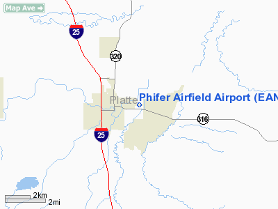
Location & QuickFacts
| FAA Information Effective: | 2008-09-25 |
| Airport Identifier: | EAN |
| Airport Status: | Operational |
| Longitude/Latitude: | 104-55-43.0150W/42-03-19.8400N
-104.928615/42.055511 (Estimated) |
| Elevation: | 4774 ft / 1455.12 m (Surveyed) |
| Land: | 61 acres |
| From nearest city: | 1 nautical miles E of Wheatland, WY |
| Location: | Platte County, WY |
| Magnetic Variation: | 09E (2010) |
Owner & Manager
| Ownership: | Publicly owned |
| Owner: | Town Of Wheatland |
| Address: | 600 9th St
Wheatland, WY 82201 |
| Phone number: | 307-322-2962 |
| Manager: | Cindy Kahler |
| Address: | 600 9th Street
Wheatland, WY 82201 |
| Phone number: | 307-322-2962 |
Airport Operations and Facilities
| Airport Use: | Open to public |
| Wind indicator: | Yes |
| Segmented Circle: | No |
| Control Tower: | No |
| Lighting Schedule: | DUSK-DAWN
ACTVT MIRL RY 08/26 - CTAF. PAPIS ON CONT. |
| Beacon Color: | Clear-Green (lighted land airport) |
| Landing fee charge: | No |
| Sectional chart: | Cheyenne |
| Region: | ANM - Northwest Mountain |
| Boundary ARTCC: | ZDV - Denver |
| Tie-in FSS: | CPR - Casper |
| FSS on Airport: | No |
| FSS Toll Free: | 1-800-WX-BRIEF |
| NOTAMs Facility: | CPR (NOTAM-d service avaliable) |
| Federal Agreements: | NGY |
Airport Communications
Airport Services
| Airframe Repair: | NONE |
| Power Plant Repair: | NONE |
| Bottled Oxygen: | NONE |
| Bulk Oxygen: | NONE |
Runway Information
Runway 08/26
| Dimension: | 5900 x 75 ft / 1798.3 x 22.9 m |
| Surface: | ASPH, Fair Condition |
| Weight Limit: | Single wheel: 15000 lbs. |
| Edge Lights: | Non-standard lighting system
ONLY THREE LGTS PER SET OF THLD LGTS. |
| |
Runway 08 |
Runway 26 |
| Longitude: | 104-56-22.1200W | 104-55-03.9100W |
| Latitude: | 42-03-19.5400N | 42-03-20.1400N |
| Elevation: | 4774.00 ft | 4766.00 ft |
| Alignment: | 89 | 127 |
| Traffic Pattern: | Left | Left |
| Markings: | Nonstandard, Fair Condition
RY 08/26 MKGS FADED. | Nonstandard, Fair Condition |
| Crossing Height: | 31.00 ft | 26.00 ft |
| VASI: | 2-light PAPI on left side | 2-light PAPI on left side |
| Visual Glide Angle: | 3.15° | 3.00° |
| Obstruction: | 45 ft tree, 669.0 ft from runway, 20 ft right of centerline, 10:1 slope to clear | , 50:1 slope to clear |
|
Radio Navigation Aids
| ID |
Type |
Name |
Ch |
Freq |
Var |
Dist |
| GYZ | NDB | Camp Guernsey | | 280.00 | 11E | 14.6 nm |
| TOR | NDB | Torrington | | 293.00 | 11E | 34.6 nm |
| IIP | VOR/DME | Hipsher | 023X | 108.60 | 12E | 39.6 nm |
| MBW | VOR/DME | Medicine Bow | 053X | 111.60 | 14E | 49.7 nm |
Remarks
- MARGINAL LINE OF SIGHT RY 26 THR TO AREA 3000 FT W.
- ESTAB PRIOR TO 1959.
Images and information placed above are from
http://www.airport-data.com/airport/EAN/
We thank them for the data!
| General Info
|
| Country |
United States
|
| State |
WYOMING
|
| FAA ID |
EAN
|
| Latitude |
42-03-19.891N
|
| Longitude |
104-55-57.897W
|
| Elevation |
4775 feet
|
| Near City |
WHEATLAND
|
We don't guarantee the information is fresh and accurate. The data may
be wrong or outdated.
For more up-to-date information please refer to other sources.
|
|


