 |
|
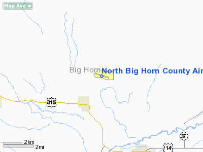
North Big Horn County Airport |
Location & QuickFacts
| FAA Information Effective: | 2008-09-25 |
| Airport Identifier: | U68 |
| Airport Status: | Operational |
| Longitude/Latitude: | 108-26-43.8330W/44-54-42.0130N
-108.445509/44.911670 (Estimated) |
| Elevation: | 4090 ft / 1246.63 m (Surveyed) |
| Land: | 1120 acres |
| From nearest city: | 2 nautical miles N of Cowley/lovell/byron, WY |
| Location: | Big Horn County, WY |
| Magnetic Variation: | 14E (1985) |
Owner & Manager
| Ownership: | Publicly owned |
| Owner: | Big Horn County |
| Address: | Box 31
Basin, WY 82410 |
| Phone number: | 307-568-2357 |
| Manager: | Kolleen Haynes |
| Address: | P.o. Box 31, Po Box 31
Cowley, WY 82420 |
| Phone number: | 307-548-6236 |
Airport Operations and Facilities
| Airport Use: | Open to public |
| Wind indicator: | Yes |
| Segmented Circle: | Yes |
| Control Tower: | No |
| Lighting Schedule: | DUSK-DAWN
ACTVT MIRL RY 09/27 AND VASI RYS 09 & 27 AND REIL RY 27- CTAF. |
| Beacon Color: | Clear-Green (lighted land airport) |
| Landing fee charge: | No |
| Sectional chart: | Billings |
| Region: | ANM - Northwest Mountain |
| Boundary ARTCC: | ZLC - Salt Lake City |
| Tie-in FSS: | CPR - Casper |
| FSS on Airport: | No |
| FSS Toll Free: | 1-800-WX-BRIEF |
| NOTAMs Facility: | CPR (NOTAM-d service avaliable) |
| Federal Agreements: | NGSY |
Airport Communications
| CTAF: | 122.800 |
| Unicom: | 122.800 |
Airport Services
| Fuel available: | 100LL |
| Bottled Oxygen: | NONE |
| Bulk Oxygen: | NONE |
Runway Information
Runway 09/27
| Dimension: | 5199 x 75 ft / 1584.7 x 22.9 m |
| Surface: | ASPH, Good Condition |
| Surface Treatment: | Porous Friction Course |
| Weight Limit: | Single wheel: 12500 lbs. |
| Edge Lights: | Medium |
| |
Runway 09 |
Runway 27 |
| Longitude: | 108-27-12.4190W | 108-26-02.9060W |
| Latitude: | 44-54-50.4790N | 44-54-36.5260N |
| Elevation: | 4080.00 ft | 4090.00 ft |
| Alignment: | 106 | 127 |
| Traffic Pattern: | Left | Left |
| Markings: | Non-precision instrument, Good Condition | Non-precision instrument, Good Condition |
| Crossing Height: | 35.00 ft | 35.00 ft |
| VASI: | 2-box on left side | 2-box on left side |
| Visual Glide Angle: | 3.00° | 3.00° |
| Runway End Identifier: | | Yes |
| Obstruction: | 8 ft hill, 315.0 ft from runway, 90 ft right of centerline, 14:1 slope to clear | 91 ft hill, 3673.0 ft from runway, 40 ft left of centerline, 38:1 slope to clear |
|
Runway 16/34
| Dimension: | 1866 x 65 ft / 568.8 x 19.8 m |
| Surface: | DIRT, Good Condition |
| |
Runway 16 |
Runway 34 |
| Longitude: | 108-27-02.8840W | 108-26-59.1670W |
| Latitude: | 44-54-46.9790N | 44-54-28.7420N |
| Elevation: | 4080.00 ft | 4085.00 ft |
| Alignment: | 127 | 127 |
| Traffic Pattern: | Left | Left |
|
Radio Navigation Aids
| ID |
Type |
Name |
Ch |
Freq |
Var |
Dist |
| HCY | NDB | Cowley | | 257.00 | 14E | 0.2 nm |
| POY | NDB | Powell | | 344.00 | 15E | 14.8 nm |
| GEY | NDB | Greybull | | 275.00 | 14E | 28.6 nm |
| RED | NDB | Red Lodge | | 203.00 | 17E | 40.0 nm |
| COD | VOR/DME | Cody | 055X | 111.80 | 14E | 28.2 nm |
Remarks
- RY 16/34 SOFT WHEN WET.
- REFLECTIVE MKRS MARK ENTRANCE TO TWY & TURNAROUND.
Images and information placed above are from
http://www.airport-data.com/airport/U68/
We thank them for the data!
| General Info
|
| Country |
United States
|
| State |
WYOMING
|
| FAA ID |
U68
|
| Latitude |
44-54-42.013N
|
| Longitude |
108-26-43.833W
|
| Elevation |
4090 feet
|
| Near City |
COWLEY/LOVELL/BYRON
|
We don't guarantee the information is fresh and accurate. The data may
be wrong or outdated.
For more up-to-date information please refer to other sources.
|
|


