 |
|
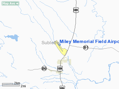
Miley Memorial Field Airport |
Coordinates: 42°35′06″N 110°06′40″W / 42.585°N 110.11111°W / 42.585; -110.11111
| Miley Memorial Field |
| IATA: BPI – ICAO: KBPI – FAA LID: BPI |
| Summary |
| Airport type |
Public |
| Owner |
Big Piney-Marbleton Airport Board |
| Serves |
Big Piney / Marbleton, Wyoming |
| Elevation AMSL |
6,990 ft / 2,131 m |
| Runways |
| Direction |
Length |
Surface |
| ft |
m |
| 13/31 |
6,803 |
2,074 |
Asphalt |
| 8/26 |
3,300 |
1,006 |
Turf |
| Statistics (2004) |
| Aircraft operations |
4,700 |
| Source: Federal Aviation Administration |
Miley Memorial Field (IATA: BPI, ICAO: KBPI, FAA LID: BPI), formerly known as Big Piney-Marbleton Airport, is a public airport located three miles (5 km) north of Big Piney and two miles (3 km) north of Marbleton, both towns in Sublette County, Wyoming, United States. It is owned by the Big Piney-Marbleton Airport Board.
Facilities and aircraft
Miley Memorial Field covers an area of 1,409 acres (570 ha) which contains two runways: 13/31 has a 6,803 x 75 ft (2,074 x 23 m) asphalt surface, while 8/26 has a 3,300 x 140 ft (1,006 x 43 m) turf surface. For the 12-month period ending June 30, 2004, the airport had 4,700 aircraft operations, an average of 12 per day: 64% general aviation, 34% air taxi and 2% military.
The above content comes from Wikipedia and is published under free licenses – click here to read more.
Location & QuickFacts
| FAA Information Effective: | 2008-09-25 |
| Airport Identifier: | BPI |
| Airport Status: | Operational |
| Longitude/Latitude: | 110-06-40.1510W/42-35-06.2510N
-110.111153/42.585070 (Estimated) |
| Elevation: | 6990 ft / 2130.55 m (Surveyed) |
| Land: | 1199 acres |
| From nearest city: | 3 nautical miles N of Big Piney, WY |
| Location: | Sublette County, WY |
| Magnetic Variation: | 16E (1975) |
Owner & Manager
| Ownership: | Publicly owned |
| Owner: | Big Piney-marbleton Airport Board |
| Address: | P.o. Box 307
Big Piney, WY 83113 |
| Phone number: | 307-276-3714 |
| Manager: | Jim Gray |
| Address: | Po Box 307
Big Piney, WY 83113 |
| Phone number: | 307-260-5140 |
Airport Operations and Facilities
| Airport Use: | Open to public |
| Wind indicator: | Yes |
| Segmented Circle: | Yes |
| Control Tower: | No |
| Lighting Schedule: | DUSK-DAWN
ACTVT MIRL RY 13/31; PAPI RYS 13 & 31; REIL RYS 13 & 31 - 122.7. |
| Beacon Color: | Clear-Green (lighted land airport) |
| Landing fee charge: | No |
| Sectional chart: | Salt Lake City |
| Region: | ANM - Northwest Mountain |
| Boundary ARTCC: | ZLC - Salt Lake City |
| Tie-in FSS: | CPR - Casper |
| FSS on Airport: | No |
| FSS Toll Free: | 1-800-WX-BRIEF |
| NOTAMs Facility: | BPI (NOTAM-d service avaliable) |
| Federal Agreements: | NGSY |
Airport Communications
| CTAF: | 122.800 |
| Unicom: | 122.800 |
Airport Services
| Fuel available: | 100LLA
FUEL AVAILABLE 24 HR. CREDIT CARD SERVICE. |
| Airframe Repair: | NONE |
| Power Plant Repair: | NONE |
| Bottled Oxygen: | NONE |
| Bulk Oxygen: | NONE |
Runway Information
Runway 08/26
| Dimension: | 3300 x 140 ft / 1005.8 x 42.7 m |
| Surface: | TURF-DIRT, Good Condition |
| |
Runway 08 |
Runway 26 |
| Longitude: | 110-06-37.0700W | 110-05-53.0700W |
| Latitude: | 42-34-35.9900N | 42-34-34.5900N |
| Elevation: | 6942.00 ft | 6925.00 ft |
| Alignment: | 92 | 127 |
| Traffic Pattern: | Left | Left |
| Obstruction: | 17 ft pole, 798.0 ft from runway, 21 ft right of centerline, 46:1 slope to clear | , 50:1 slope to clear |
|
Runway 13/31
| Dimension: | 6803 x 75 ft / 2073.6 x 22.9 m |
| Surface: | ASPH, Fair Condition |
| Surface Treatment: | Porous Friction Course |
| Weight Limit: | Single wheel: 22000 lbs.
Dual wheel: 33600 lbs. |
| Edge Lights: | Medium |
| |
Runway 13 |
Runway 31 |
| Longitude: | 110-07-04.4450W | 110-06-15.8630W |
| Latitude: | 42-35-34.6400N | 42-34-37.8610N |
| Elevation: | 6990.00 ft | 6945.00 ft |
| Alignment: | 127 | 127 |
| Traffic Pattern: | Left | Left |
| Markings: | Non-precision instrument, Good Condition | Non-precision instrument, Good Condition |
| Crossing Height: | 30.00 ft | 30.00 ft |
| VASI: | 2-light PAPI on left side | 2-light PAPI on left side |
| Visual Glide Angle: | 3.00° | 3.00° |
| Runway End Identifier: | Yes | Yes |
|
Radio Navigation Aids
| ID |
Type |
Name |
Ch |
Freq |
Var |
Dist |
| PNA | NDB | Wenz | | 392.00 | 13E | 18.6 nm |
| BPI | VOR/DME | Big Piney | 112X | 116.50 | 16E | 0.3 nm |
Remarks
- 3 FT TO 5 FT SNOW BANKS ALONG RY & TWY EDGES DURG WINTER MONTHS.
- RY 08/26 NO LINE OF SIGHT.
- WILDLIFE ON & INVOF ARPT.
- RY 31 LAST 1000 FT ROLLOUT END OF RY AMBER & WHITE MIRL.
Images and information placed above are from
http://www.airport-data.com/airport/BPI/
We thank them for the data!
| General Info
|
| Country |
United States
|
| State |
WYOMING
|
| FAA ID |
BPI
|
| Latitude |
42-35-06.251N
|
| Longitude |
110-06-40.151W
|
| Elevation |
6990 feet
|
| Near City |
BIG PINEY
|
We don't guarantee the information is fresh and accurate. The data may
be wrong or outdated.
For more up-to-date information please refer to other sources.
|
|


