 |
|
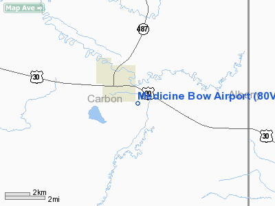
Location & QuickFacts
| FAA Information Effective: | 2008-09-25 |
| Airport Identifier: | 80V |
| Airport Status: | Operational |
| Longitude/Latitude: | 106-10-51.0540W/41-52-59.8760N
-106.180848/41.883299 (Estimated) |
| Elevation: | 6646 ft / 2025.70 m (Surveyed) |
| Land: | 153 acres |
| From nearest city: | 2 nautical miles SE of Medicine Bow, WY |
| Location: | Carbon County, WY |
| Magnetic Variation: | 12E (1985) |
Owner & Manager
| Ownership: | Publicly owned |
| Owner: | Town Of Medicine Bow & Wy |
| Address: | Po Box 156
Medicine Bow, WY 82329 |
| Phone number: | 307-379-2225 |
| Manager: | Charlie George |
| Address: | P. O. Box 156
Medicine Bow, WY 82329 |
| Phone number: | 307-379-2224
CITY HALL PHONE 379-2225. |
Airport Operations and Facilities
| Airport Use: | Open to public |
| Wind indicator: | Yes |
| Segmented Circle: | No |
| Control Tower: | No |
| Landing fee charge: | No |
| Sectional chart: | Cheyenne |
| Region: | ANM - Northwest Mountain |
| Boundary ARTCC: | ZDV - Denver |
| Tie-in FSS: | CPR - Casper |
| FSS on Airport: | No |
| FSS Toll Free: | 1-800-WX-BRIEF |
| NOTAMs Facility: | CPR (NOTAM-d service avaliable) |
Airport Communications
Airport Services
| Airframe Repair: | NONE |
| Power Plant Repair: | NONE |
| Bottled Oxygen: | NONE |
| Bulk Oxygen: | NONE |
Runway Information
Runway 06/24
| Dimension: | 2680 x 50 ft / 816.9 x 15.2 m |
| Surface: | TURF-DIRT, Poor Condition
ROUGH & UNEVEN FULL LENGTH; NUMEROUS GOPHER HOLES.
RY 10/28 HAS SOME GOPHER HOLES. |
| |
Runway 06 |
Runway 24 |
| Traffic Pattern: | Left | Left |
| Obstruction: | 4 ft fence | 4 ft fence, 0.0 ft from runway |
|
Runway 10/28
| Dimension: | 3170 x 80 ft / 966.2 x 24.4 m |
| Surface: | TURF-DIRT, Fair Condition
ROUGH & UNEVEN FULL LENGTH; NUMEROUS GOPHER HOLES.
RY 10/28 HAS SOME GOPHER HOLES. |
| |
Runway 10 |
Runway 28 |
| Traffic Pattern: | Left | Left |
| Obstruction: | 8 ft fence, 228.0 ft from runway, 28:1 slope to clear | 8 ft fence, 243.0 ft from runway, 30:1 slope to clear |
|
Radio Navigation Aids
| ID |
Type |
Name |
Ch |
Freq |
Var |
Dist |
| SAA | NDB | Saratoga | | 266.00 | 12E | 39.4 nm |
| SIR | NDB | Sinclair | | 368.00 | 13E | 41.1 nm |
| MBW | VOR/DME | Medicine Bow | 053X | 111.60 | 14E | 8.2 nm |
| RWL | VOR/DME | Rawlins | 031X | 109.40 | 13E | 46.1 nm |
| LAR | VORTAC | Laramie | 123X | 117.60 | 14E | 38.8 nm |
Remarks
- RWY 06/24 - 9 TO 12 INCH BERMS BOTH SIDES; RWY 10/28 GRADED; GOPHER HOLES ON RWY SFCS; RWYS VERY SOFT WHEN WET.
- BCN & WND SOCK ARE SIDE SLOPE OBSTNS.
- CAUTION: ANTELOPE OCCASIONALLY ON RWYS.
- RY 10/28 ONE FOOT DITCH SOUTH OF RY.
- ESTABLISHED PRIOR TO 1959
Images and information placed above are from
http://www.airport-data.com/airport/80V/
We thank them for the data!
| General Info
|
| Country |
United States
|
| State |
WYOMING
|
| FAA ID |
80V
|
| Latitude |
41-52-59.876N
|
| Longitude |
106-10-51.054W
|
| Elevation |
6646 feet
|
| Near City |
MEDICINE BOW
|
We don't guarantee the information is fresh and accurate. The data may
be wrong or outdated.
For more up-to-date information please refer to other sources.
|
|


