 |
|
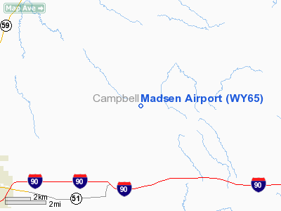
Location & QuickFacts
| FAA Information Effective: | 2008-09-25 |
| Airport Identifier: | WY65 |
| Airport Status: | Operational |
| Longitude/Latitude: | 105-20-14.9700W/44-20-55.9310N
-105.337492/44.348870 (Estimated) |
| Elevation: | 4500 ft / 1371.60 m (Estimated) |
| Land: | 40 acres |
| From nearest city: | 10 nautical miles NE of Gillette, WY |
| Location: | Campbell County, WY |
| Magnetic Variation: | 13E (1985) |
Owner & Manager
| Ownership: | Privately owned |
| Owner: | B. Madsen & C. Overby |
| Address: | Box 1978
Gillette, WY 82716 |
| Phone number: | 307-682-4390 |
| Manager: | B. Madsen |
| Address: | Box 1978
Gillette, WY 82716 |
| Phone number: | 307-682-4390 |
Airport Operations and Facilities
| Airport Use: | Private |
| Wind indicator: | Yes |
| Segmented Circle: | No |
| Control Tower: | No |
| Sectional chart: | Cheyenne |
| Region: | ANM - Northwest Mountain |
| Boundary ARTCC: | ZDV - Denver |
| Tie-in FSS: | CPR - Casper |
| FSS Toll Free: | 1-800-WX-BRIEF |
Runway Information
Runway 09/27
| Dimension: | 2400 x 40 ft / 731.5 x 12.2 m |
| Surface: | TURF, |
| |
Runway 09 |
Runway 27 |
| Traffic Pattern: | Left | Left |
| Obstruction: | 4 ft fence | 4 ft fence |
|
Radio Navigation Aids
| ID |
Type |
Name |
Ch |
Freq |
Var |
Dist |
| GC | NDB | Deryk | | 380.00 | 12E | 9.2 nm |
| GCC | VOR/DME | Gillette | 093X | 114.60 | 12E | 8.9 nm |
Remarks
- LIVESTOCK AND WILDLIFE ON RWY.
Images and information placed above are from
http://www.airport-data.com/airport/WY65/
We thank them for the data!
| General Info
|
| Country |
United States
|
| State |
WYOMING
|
| FAA ID |
WY65
|
| Latitude |
44-20-55.931N
|
| Longitude |
105-20-14.970W
|
| Elevation |
4500 feet
|
| Near City |
GILLETTE
|
We don't guarantee the information is fresh and accurate. The data may
be wrong or outdated.
For more up-to-date information please refer to other sources.
|
|


