 |
|
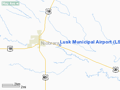
Location & QuickFacts
| FAA Information Effective: | 2008-09-25 |
| Airport Identifier: | LSK |
| Airport Status: | Operational |
| Longitude/Latitude: | 104-24-16.3930W/42-45-13.7090N
-104.404554/42.753808 (Estimated) |
| Elevation: | 4964 ft / 1513.03 m (Surveyed) |
| Land: | 160 acres |
| From nearest city: | 3 nautical miles E of Lusk, WY |
| Location: | Niobrara County, WY |
| Magnetic Variation: | 12E (1985) |
Owner & Manager
| Ownership: | Publicly owned |
| Owner: | Town Of Lusk |
| Address: | Box 390
Lusk, WY 82225 |
| Phone number: | 307-334-3612 |
| Manager: | Denis Peterson |
| Address: | Box 390
Lusk, WY 82225 |
| Phone number: | 307-334-3622 |
Airport Operations and Facilities
| Airport Use: | Open to public |
| Wind indicator: | Yes |
| Segmented Circle: | No |
| Control Tower: | No |
| Lighting Schedule: | DUSK-DAWN
ACTVT MIRL RY 10/28 - CTAF. PAPI RY 28 ON CONT. |
| Beacon Color: | Clear-Green (lighted land airport) |
| Landing fee charge: | No |
| Sectional chart: | Cheyenne |
| Region: | ANM - Northwest Mountain |
| Boundary ARTCC: | ZDV - Denver |
| Tie-in FSS: | CPR - Casper |
| FSS on Airport: | No |
| FSS Toll Free: | 1-800-WX-BRIEF |
| NOTAMs Facility: | CPR (NOTAM-d service avaliable) |
| Federal Agreements: | NGY |
Airport Communications
| CTAF: | 122.800 |
| Unicom: | 122.800 |
Airport Services
| Fuel available: | 100LL
FOR FUEL CALL AMGR 307-334-3622 OR 307-340-0548. |
| Airframe Repair: | NONE |
| Power Plant Repair: | NONE |
| Bottled Oxygen: | NONE |
| Bulk Oxygen: | NONE |
Runway Information
Runway 10/28
| Dimension: | 5058 x 75 ft / 1541.7 x 22.9 m |
| Surface: | ASPH, Fair Condition |
| Weight Limit: | Single wheel: 12500 lbs. |
| Edge Lights: | Medium |
| |
Runway 10 |
Runway 28 |
| Longitude: | 104-24-46.9730W | 104-23-45.8150W |
| Latitude: | 42-45-24.4790N | 42-45-02.9370N |
| Elevation: | 4964.00 ft | 4952.00 ft |
| Alignment: | 116 | 127 |
| Traffic Pattern: | Left | Left |
| Markings: | Basic, Fair Condition | Basic, Fair Condition |
| Crossing Height: | 0.00 ft | 40.00 ft |
| VASI: | | 2-light PAPI on left side |
| Visual Glide Angle: | 0.00° | 3.00° |
| Runway End Identifier: | | Yes |
| Obstruction: | 44 ft pline, 1478.0 ft from runway, 126 ft left of centerline, 29:1 slope to clear | , 50:1 slope to clear |
|
Radio Navigation Aids
| ID |
Type |
Name |
Ch |
Freq |
Var |
Dist |
| GYZ | NDB | Camp Guernsey | | 280.00 | 11E | 33.8 nm |
| TOR | NDB | Torrington | | 293.00 | 11E | 42.8 nm |
| IIP | VOR/DME | Hipsher | 023X | 108.60 | 12E | 36.6 nm |
| CDR | VOR/DME | Chadron | 081X | 113.40 | 13E | 49.7 nm |
Remarks
- UNLIMITED VEHICLE ACCESS TO RY.
Images and information placed above are from
http://www.airport-data.com/airport/LSK/
We thank them for the data!
| General Info
|
| Country |
United States
|
| State |
WYOMING
|
| FAA ID |
LSK
|
| Latitude |
42-45-13.709N
|
| Longitude |
104-24-16.393W
|
| Elevation |
4964 feet
|
| Near City |
LUSK
|
We don't guarantee the information is fresh and accurate. The data may
be wrong or outdated.
For more up-to-date information please refer to other sources.
|
|


