 |
|
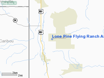
Lone Pine Flying Ranch Airport |
Location & QuickFacts
| FAA Information Effective: | 2008-09-25 |
| Airport Identifier: | WY64 |
| Airport Status: | Operational |
| Longitude/Latitude: | 110-58-57.7560W/42-57-26.7210N
-110.982710/42.957422 (Estimated) |
| Elevation: | 6000 ft / 1828.80 m (Estimated) |
| Land: | 3 acres |
| From nearest city: | 4 nautical miles S of Thayne, WY |
| Location: | Lincoln County, WY |
| Magnetic Variation: | 16E (1980) |
Owner & Manager
| Ownership: | Privately owned |
| Owner: | Jerry Humphery |
| Address: | 1595 County Rd 119
Thayne, WY 83127 |
| Phone number: | / |
| Manager: | Jerry Humphery |
| Address: | 1595 County Rd 119
Thayne, WY 83127 |
| Phone number: | 307-883-2550 |
Airport Operations and Facilities
| Airport Use: | Private |
| Wind indicator: | Yes |
| Segmented Circle: | No |
| Control Tower: | No |
| Sectional chart: | Salt Lake City |
| Region: | ANM - Northwest Mountain |
| Boundary ARTCC: | ZLC - Salt Lake City |
| Tie-in FSS: | CPR - Casper |
| FSS Toll Free: | 1-800-WX-BRIEF |
Runway Information
Runway N/S
| Dimension: | 2640 x 200 ft / 804.7 x 61.0 m |
| Surface: | DIRT, |
| |
Runway N |
Runway S |
| Traffic Pattern: | Left | Left |
|
Radio Navigation Aids
| ID |
Type |
Name |
Ch |
Freq |
Var |
Dist |
| JAC | FAN MARKER | Teton | | | 17E | 37.0 nm |
| JAC | VOR/DME | Jackson | 101X | 115.40 | 13E | 41.4 nm |
| BPI | VOR/DME | Big Piney | 112X | 116.50 | 16E | 44.7 nm |
Remarks
- PRVDD PROPONENT ENTERS INTO A LOA WITH STAR VALLEY RANCH REGARDING COMPATIBLE TRAFFIC PATTERNS.
Images and information placed above are from
http://www.airport-data.com/airport/WY64/
We thank them for the data!
| General Info
|
| Country |
United States
|
| State |
WYOMING
|
| FAA ID |
WY64
|
| Latitude |
42-57-26.721N
|
| Longitude |
110-58-57.756W
|
| Elevation |
6000 feet
|
| Near City |
THAYNE
|
We don't guarantee the information is fresh and accurate. The data may
be wrong or outdated.
For more up-to-date information please refer to other sources.
|
|


