 |
|
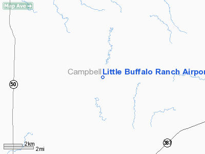
Little Buffalo Ranch Airport |
Location & QuickFacts
| FAA Information Effective: | 2008-09-25 |
| Airport Identifier: | WY13 |
| Airport Status: | Operational |
| Longitude/Latitude: | 105-39-52.0050W/43-47-09.8990N
-105.664446/43.786083 (Estimated) |
| Elevation: | 4919 ft / 1499.31 m (Surveyed) |
| Land: | 0 acres |
| From nearest city: | 32 nautical miles S of Gillette, WY |
| Location: | Campbell County, WY |
| Magnetic Variation: | 13E (1985) |
Owner & Manager
| Ownership: | Privately owned |
| Owner: | Gary Marquiss |
| Address: | 2653 Clarkelen Rd, Hc-82
Gillette, WY 82718 |
| Phone number: | 307-939-1287 |
| Manager: | Gary Marquiss |
| Address: | 2653 Clarkelen Rd, Hc-82
Gillette, WY 82718 |
| Phone number: | 307-939-1287 |
Airport Operations and Facilities
| Airport Use: | Private |
| Wind indicator: | No |
| Segmented Circle: | No |
| Control Tower: | No |
| Landing fee charge: | No |
| Sectional chart: | Cheyenne |
| Region: | ANM - Northwest Mountain |
| Boundary ARTCC: | ZDV - Denver |
| Tie-in FSS: | CPR - Casper |
| FSS on Airport: | No |
| FSS Toll Free: | 1-800-WX-BRIEF |
Airport Services
| Airframe Repair: | NONE |
| Power Plant Repair: | NONE |
Runway Information
Runway N/S
| Dimension: | 2250 x 60 ft / 685.8 x 18.3 m |
| Surface: | TURF, |
| |
Runway N |
Runway S |
| Traffic Pattern: | Left | Left |
|
Runway NEL/SWR
| Dimension: | 4700 x 60 ft / 1432.6 x 18.3 m |
| Surface: | TURF, |
| |
Runway NEL |
Runway SWR |
| Traffic Pattern: | Left | Left |
| Obstruction: | 65 ft pline, 1500.0 ft from runway | |
|
Runway NER/SWL
| Dimension: | 1800 x 60 ft / 548.6 x 18.3 m |
| Surface: | TURF, |
| |
Runway NER |
Runway SWL |
| Traffic Pattern: | Left | Left |
|
Runway NW/SE
| Dimension: | 2000 x 60 ft / 609.6 x 18.3 m |
| Surface: | TURF, |
| |
Runway NW |
Runway SE |
| Traffic Pattern: | Left | Left |
|
Radio Navigation Aids
| ID |
Type |
Name |
Ch |
Freq |
Var |
Dist |
| GC | NDB | Deryk | | 380.00 | 12E | 29.8 nm |
| GCC | VOR/DME | Gillette | 093X | 114.60 | 12E | 34.2 nm |
| CZI | VOR/DME | Crazy Woman | 120X | 117.30 | 13E | 35.8 nm |
| DDY | VORTAC | Muddy Mountain | 109X | 116.20 | 12E | 49.6 nm |
Images and information placed above are from
http://www.airport-data.com/airport/WY13/
We thank them for the data!
| General Info
|
| Country |
United States
|
| State |
WYOMING
|
| FAA ID |
WY13
|
| Latitude |
43-47-09.899N
|
| Longitude |
105-39-52.005W
|
| Elevation |
4919 feet
|
| Near City |
GILLETTE
|
We don't guarantee the information is fresh and accurate. The data may
be wrong or outdated.
For more up-to-date information please refer to other sources.
|
|


