 |
|
| Kemmerer Municipal Airport |
| IATA: EMM – ICAO: KEMM – FAA LID: EMM |
| Summary |
| Airport type |
Public |
| Owner |
City of Kemmerer |
| Serves |
Kemmerer, Wyoming |
| Elevation AMSL |
7,285 ft / 2,220 m |
| Coordinates |
41°49′27″N 110°33′25″W / 41.82417°N 110.55694°W / 41.82417; -110.55694 |
| Runways |
| Direction |
Length |
Surface |
| ft |
m |
| 4/22 |
2,668 |
813 |
Concrete |
| 10/28 |
3,250 |
991 |
Turf/Dirt |
| 16/34 |
8,208 |
2,502 |
Asphalt |
| Statistics (2007) |
| Aircraft operations |
3,400 |
| Source: Federal Aviation Administration |
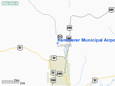
Kemmerer Municipal Airport (IATA: EMM, ICAO: KEMM, FAA LID: EMM) is a city-owned, public-use airport located two nautical miles (3.7 km) northwest of the central business district of Kemmerer, a city in Lincoln County, Wyoming, United States.
This airport is included in the FAA's National Plan of Integrated Airport Systems (2009-2013), which categorizes it as a general aviation airport.
Facilities and aircraft
Kemmerer Municipal Airport covers an area of 400 acres (162 ha) at an elevation of 7,285 feet (2,220 m) above mean sea level. It has three runways: 4/22 is 2,668 by 60 feet (813 x 18 m) with a concrete surface; 10/28 is 3,250 by 60 feet (991 x 18 m) with a turf/dirt surface; 16/34 is 8,208 by 75 feet (2,502 x 23 m) with an asphalt surface.
For the 12-month period ending April 30, 2007, the airport had 3,400 aircraft operations, an average of 283 per month: 97% general aviation and 3% military aviation.
The above content comes from Wikipedia and is published under free licenses – click here to read more.
Location & QuickFacts
| FAA Information Effective: | 2008-09-25 |
| Airport Identifier: | EMM |
| Airport Status: | Operational |
| Longitude/Latitude: | 110-33-25.1050W/41-49-26.6340N
-110.556974/41.824065 (Estimated) |
| Elevation: | 7285 ft / 2220.47 m (Surveyed) |
| Land: | 400 acres |
| From nearest city: | 2 nautical miles NW of Kemmerer, WY |
| Location: | Lincoln County, WY |
| Magnetic Variation: | 14E (2000) |
Owner & Manager
| Ownership: | Publicly owned |
| Owner: | City Of Kemmerer
ALSO LINCOLN COUNTY - 800-422-9001 |
| Address: | 220 Wyo Hiway 233
Kemmerer, WY 83101 |
| Phone number: | 307-828-2350 |
| Manager: | Trent Archibald |
| Address: | 220 Wyo Hiway. 233
Kemmerer, WY 83101 |
| Phone number: | 307-828-2370
AFTER HOURS PHONE LOCAL POLICE FOR ASSISSTANCE 307-877-3971. |
Airport Operations and Facilities
| Airport Use: | Open to public |
| Wind indicator: | Yes |
| Segmented Circle: | Yes
SEGMENTED CIRCLE DOES NOT DEPICT RIGHT HAND TRAFFIC FOR RY 22. |
| Control Tower: | No |
| Lighting Schedule: | DUSK-DAWN
ACTVT MIRL RYS 04/22 & 16/34, VASI RY 22, REIL & PAPI RYS 16 & 34 - CTAF. |
| Beacon Color: | Clear-Green (lighted land airport) |
| Landing fee charge: | No |
| Sectional chart: | Salt Lake City |
| Region: | ANM - Northwest Mountain |
| Boundary ARTCC: | ZLC - Salt Lake City |
| Tie-in FSS: | CPR - Casper |
| FSS on Airport: | No |
| FSS Toll Free: | 1-800-WX-BRIEF |
| NOTAMs Facility: | CPR (NOTAM-d service avaliable) |
| Federal Agreements: | NGSY |
Airport Communications
| CTAF: | 122.800 |
| Unicom: | 122.800 |
Airport Services
| Fuel available: | 100LLA
FUEL AVBL 24 HRS VIA SELF-SERVE CREDIT CARD PUMP. |
| Airframe Repair: | NONE |
| Power Plant Repair: | NONE |
| Bottled Oxygen: | NONE |
| Bulk Oxygen: | NONE |
Runway Information
Runway 04/22
| Dimension: | 2668 x 60 ft / 813.2 x 18.3 m |
| Surface: | CONC, Fair Condition
LARGE ROCKS, DEPRESSIONS AND MOUNDS ON RWY SFC. |
| Weight Limit: | Single wheel: 9000 lbs. |
| Edge Lights: | Medium |
| |
Runway 04 |
Runway 22 |
| Longitude: | 110-33-37.2440W | 110-33-06.6710W |
| Latitude: | 41-49-24.8710N | 41-49-38.0020N |
| Elevation: | 7283.00 ft | 7281.00 ft |
| Traffic Pattern: | Left | Right |
| Markings: | Basic, Fair Condition | Basic, Fair Condition |
| VASI: | | 2-box on left side |
|
Runway 10/28
| Dimension: | 3250 x 60 ft / 990.6 x 18.3 m |
| Surface: | TURF-DIRT, Fair Condition
LARGE ROCKS, DEPRESSIONS AND MOUNDS ON RWY SFC. |
| |
Runway 10 |
Runway 28 |
| Longitude: | 110-33-40.5900W | 110-33-03.6100W |
| Latitude: | 41-49-50.3000N | 41-49-33.9900N |
| Elevation: | 7282.00 ft | 7277.00 ft |
| Traffic Pattern: | Left | Left |
| Obstruction: | 3 ft fence, 50:1 slope to clear | 10 ft road, 267.0 ft from runway, 26:1 slope to clear |
|
Runway 16/34
| Dimension: | 8208 x 75 ft / 2501.8 x 22.9 m |
| Surface: | ASPH, Good Condition
LARGE ROCKS, DEPRESSIONS AND MOUNDS ON RWY SFC. |
| Surface Treatment: | Porous Friction Course
PFC MOSTLY SEALED AND COVERED WITH SURFACE TREATMENTS (SEALCOATS) |
| Weight Limit: | Single wheel: 18000 lbs. |
| Edge Lights: | Medium |
| |
Runway 16 |
Runway 34 |
| Longitude: | 110-33-26.5480W | 110-33-25.9260W |
| Latitude: | 41-49-59.9020N | 41-48-38.8190N |
| Elevation: | 7285.00 ft | 7271.00 ft |
| Traffic Pattern: | Left | Left |
| Markings: | Non-precision instrument, Good Condition | Non-precision instrument, Good Condition |
| VASI: | 2-light PAPI on left side | 2-light PAPI on left side |
| Runway End Identifier: | Yes | Yes |
|
Radio Navigation Aids
| ID |
Type |
Name |
Ch |
Freq |
Var |
Dist |
| FBR | VOR/DME | Fort Bridger | 023X | 108.60 | 14E | 27.4 nm |
| EVW | VOR/DME | Evanston | 33X | 109.60 | 13E | 39.8 nm |
| BPI | VOR/DME | Big Piney | 112X | 116.50 | 16E | 49.6 nm |
Remarks
- TERRAIN DROPS OFF STEEPLY 55' PRIOR TO APCH END RY 10.
- RY 16/34 -2' DITCH, 85'L/R OF CNTRLN, FULL LENGTH.
- RY 10/28 INTERSECTION WITH RYS 16/34 & 04/22 UNEVEN.
- RWY 10/28 CLSD WINTER MONTHS.
- ACFT OVER 33000 LBS PROHIBITED.
- TERRAIN DROPS OFF STEEPLY 81' PRIOR TO APCH END RY 4.
Images and information placed above are from
http://www.airport-data.com/airport/EMM/
We thank them for the data!
| General Info
|
| Country |
United States
|
| State |
WYOMING
|
| FAA ID |
EMM
|
| Latitude |
41-49-26.634N
|
| Longitude |
110-33-25.105W
|
| Elevation |
7285 feet
|
| Near City |
KEMMERER
|
We don't guarantee the information is fresh and accurate. The data may
be wrong or outdated.
For more up-to-date information please refer to other sources.
|
|


