 |
|
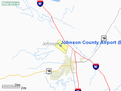
Location & QuickFacts
| FAA Information Effective: | 2008-09-25 |
| Airport Identifier: | BYG |
| Airport Status: | Operational |
| Longitude/Latitude: | 106-43-18.4430W/44-22-51.9070N
-106.721790/44.381085 (Estimated) |
| Elevation: | 4968 ft / 1514.25 m (Surveyed) |
| Land: | 247 acres |
| From nearest city: | 3 nautical miles NW of Buffalo, WY |
| Location: | Johnson County, WY |
| Magnetic Variation: | 12E (2005) |
Owner & Manager
| Ownership: | Publicly owned |
| Owner: | Johnson County |
| Address: | County Court House
Buffalo, WY 82834 |
| Phone number: | 307-684-7555 |
| Manager: | Jim Mc Laughlin |
| Address: | 158 Airport Rd
Buffalo, WY 82834 |
| Phone number: | 307-684-9672 |
Airport Operations and Facilities
| Airport Use: | Open to public |
| Wind indicator: | Yes |
| Segmented Circle: | Yes |
| Control Tower: | No |
| Lighting Schedule: | DUSK-DAWN
ACTVT MIRL RY 13/31 & VASI RYS 13 & 31 AND REIL RY 31 - CTAF. |
| Beacon Color: | Clear-Green (lighted land airport) |
| Landing fee charge: | No |
| Sectional chart: | Cheyenne |
| Region: | ANM - Northwest Mountain |
| Boundary ARTCC: | ZLC - Salt Lake City |
| Tie-in FSS: | CPR - Casper |
| FSS on Airport: | No |
| FSS Toll Free: | 1-800-WX-BRIEF |
| NOTAMs Facility: | BYG (NOTAM-d service avaliable) |
| Federal Agreements: | NGY |
Airport Communications
| CTAF: | 122.800 |
| Unicom: | 122.800 |
Airport Services
| Fuel available: | 100LLA |
| Airframe Repair: | MINOR |
| Power Plant Repair: | MINOR |
| Bottled Oxygen: | NONE |
| Bulk Oxygen: | HIGH |
Runway Information
Runway 13/31
| Dimension: | 6143 x 75 ft / 1872.4 x 22.9 m |
| Surface: | ASPH, Good Condition |
| Weight Limit: | Single wheel: 12500 lbs. |
| Edge Lights: | Medium |
| |
Runway 13 |
Runway 31 |
| Longitude: | 106-43-46.7090W | 106-42-50.1830W |
| Latitude: | 44-23-14.4610N | 44-22-29.3520N |
| Elevation: | 4968.00 ft | 4902.00 ft |
| Alignment: | 127 | 127 |
| Traffic Pattern: | Left | Left |
| Markings: | Non-precision instrument, Good Condition | Non-precision instrument, Good Condition |
| Crossing Height: | 36.00 ft | 32.00 ft |
| VASI: | 2-box on left side | 2-box on left side |
| Visual Glide Angle: | 4.00° | 3.00° |
| Runway End Identifier: | | Yes |
| Obstruction: | 39 ft fence, 795.0 ft from runway, 205 ft left of centerline, 15:1 slope to clear | , 50:1 slope to clear |
|
Radio Navigation Aids
| ID |
Type |
Name |
Ch |
Freq |
Var |
Dist |
| CZI | VOR/DME | Crazy Woman | 120X | 117.30 | 13E | 26.0 nm |
| SHR | VORTAC | Sheridan | 100X | 115.30 | 13E | 31.3 nm |
Remarks
- TERRAIN DROPS OFF BOTH SIDES OF RY 13/31.
- DEER ON AND INVOF ARPT.
- RWY 31 +250' DROP 170'L FIRST 417'
Images and information placed above are from
http://www.airport-data.com/airport/BYG/
We thank them for the data!
| General Info
|
| Country |
United States
|
| State |
WYOMING
|
| FAA ID |
BYG
|
| Latitude |
44-22-51.907N
|
| Longitude |
106-43-18.443W
|
| Elevation |
4968 feet
|
| Near City |
BUFFALO
|
We don't guarantee the information is fresh and accurate. The data may
be wrong or outdated.
For more up-to-date information please refer to other sources.
|
|


