|
|
Coordinates: 43°36′26″N 110°44′16″W / 43.60722°N 110.73778°W / 43.60722; -110.73778
| Jackson Hole Airport |
 |
| IATA: JAC – ICAO: KJAC – FAA LID: JAC |
| Summary |
| Airport type |
Public |
| Owner |
Jackson Hole Airport Board |
| Serves |
Jackson, Wyoming |
| Elevation AMSL |
6,451 ft / 1,966 m |
| Website |
www.JacksonHoleAirport.com |
| Runways |
| Direction |
Length |
Surface |
| ft |
m |
| 1/19 |
6,300 |
1,920 |
Asphalt |
| Statistics (2007) |
| Aircraft operations |
33,259 |
| Based aircraft |
52 |
| Cattle Shipped |
15,342 |
| Sources: airport web site and FAA |
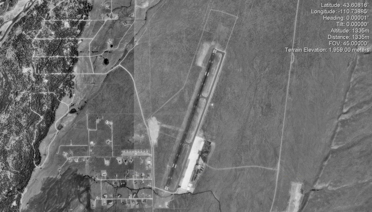
Jackson Hole Airport (IATA: JAC, ICAO: KJAC, FAA LID: JAC) is a public airport located seven miles (11 km) north of the central business district of Jackson, a town in Teton County, Wyoming, United States. It is owned by the Jackson Hole Airport Board.
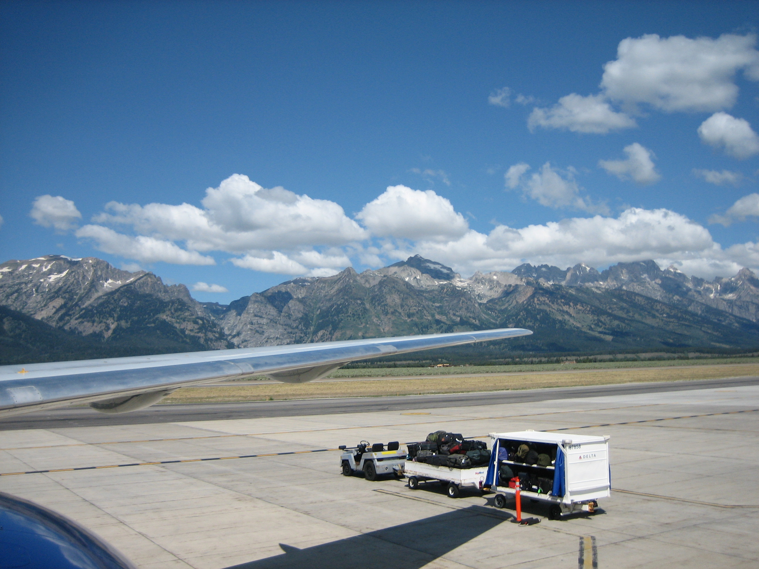
It is one of two airports in the United States located inside a national park, in this case Grand Teton (the other airport is Provincetown Municipal Airport in Massachusetts). A large fraction of air travellers headed to Grand Teton National Park or nearby Yellowstone National Park and western Wyoming go through the airport. The airport at one time had an unusual terminal building resembling a pioneer log cabin which blended with the surrounding environment and served to attract visitors. Starting in 2009, a major $30 million terminal expansion project began. The design; however, still blends with the unique surroundings of the national park and Jackson Hole preservation area. The entrance from the outside is a wood walkway that heads to the main terminal building. The airport has 6 gates and United and American Airlines serve 757-200's there.
History
The airport was created in the 1930s as the best place to put an airport in Teton County. The airport was declared a national monument in 1943, and merged with Grand Teton National Park in 1950. In 1959 the runway was extended to its current length to better accommodate larger planes, especially the DC-3. In the 1960s and 1970s, the possibility of extending the runway to 8,000 feet (2,400 m) to accommodate jet aircraft was considered. Strong opposition from the National Park Service over noise and other environmental effects prevented such an extension. However, development of better jet engines in the late 1970s made it possible to land jets on the existing runway. Being inside a national park and the Jackson Hole area, the region is very noise sensitive and the airport currently allows only stage III jet aircraft which have newer, quieter engines. The airport is a popular mating ground to the rare Sage Grouse. Currently, it is the busiest commercial airport in Wyoming. On December 20, 2000, Sandra Bullock survived the crash of a chartered business jet at Jackson Hole Airport. The aircraft hit a snowbank instead of the runway, shearing off the nose gear and nose cone and damaging the wings. On June 27, 2005, John T. Walton died when his CGS Hawk Arrow homebuilt aircraft (registered as an "experimental aircraft" under FAA regulations) that he was piloting crashed in Jackson, Wyoming. Walton's plane crashed at 12:20 p.m. local time (1820 GMT) shortly after taking off from Jackson Hole Airport.
Facilities and aircraft
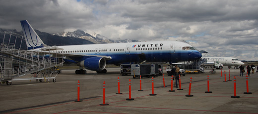 | |
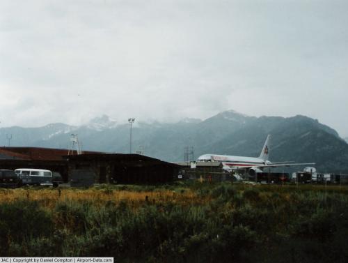
Ramp at Jackson Hole Airport |
Jackson Hole Airport covers an area of 533 acres (216 ha) which contains one runway designated 1/19 with a 6,300 x 150 ft (1,920 x 46 m) asphalt pavement. For the 12-month period ending August 30, 2008, the airport had 30,865 aircraft operations, an average of 85 per day: 52% general aviation, 25% air taxi, 22% scheduled commercial and <1% military. There are 52 aircraft based at this airport: 69% single-engine, 6% multi-engine, 21% jet, 3% glider, and 1% cattle cargo. Jackson Hole Airport is very noise sensitive being in a national park, and has a ban on aircraft with stage-II engines which are older, noisier jet engines. Few aircraft for charter are based at Jackson Hole Airport. New Flight Charters has a Cessna T206 based there and several other charter aircraft nearby for departures from Jackson Hole Airport.
The largest aircraft to operate to the airport on a regular basis is a Boeing 757-200. American Airlines operates with this daily on a seasonal basis to Dallas; United Airlines also operates it several times a day during the summer to Denver. Delta also provides 757 service of various frequencies to their hubs of Salt Lake and Atlanta. A United Boeing 757 is shown in the picture to the right.
Airlines and destinations
| Airlines |
Destinations |
| American Airlines |
Chicago-O'Hare, Dallas/Fort Worth [All seasonal] |
| Delta Air Lines |
Atlanta, Salt Lake City [All Seasonal] |
| Delta Connection operated by SkyWest Airlines |
Salt Lake City |
| Frontier Airlines |
Denver [seasonal] |
| United Airlines |
Chicago-O'Hare, Denver [All seasonal] |
| United Express operated by SkyWest Airlines |
Denver, Los Angeles [seasonal] |
Other services
- Jackson Hole Aviation private aviation services
- New Flight Charters private jet and aircraft charters
- Flight Services of Jackson Hole aircraft rentals and flight instruction
Images
The above content comes from Wikipedia and is published under free licenses – click here to read more.
 |
(Click on the photo to enlarge) |
Location & QuickFacts
| FAA Information Effective: | 2008-09-25 |
| Airport Identifier: | JAC |
| Airport Status: | Operational |
| Longitude/Latitude: | 110-44-15.9000W/43-36-26.4000N
-110.737750/43.607333 (Estimated) |
| Elevation: | 6451 ft / 1966.26 m (Surveyed) |
| Land: | 533 acres |
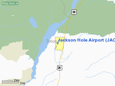
| From nearest city: | 7 nautical miles N of Jackson, WY |
| Location: | Teton County, WY |
| Magnetic Variation: | 13E (2005) |
Owner & Manager
| Ownership: | Publicly owned |
| Owner: | Jackson Hole Airport Board
LEASED FROM U S PARK SERVICE. |
| Address: | Box 159
Jackson, WY 83001 |
| Phone number: | 307-733-7682 |
| Manager: | Ray Bishop |
| Address: | Box 159
Jackson, WY 83001 |
| Phone number: | 307-733-7682 |
Airport Operations and Facilities
| Airport Use: | Open to public |
| Wind indicator: | Yes |
| Segmented Circle: | Yes |
| Control Tower: | Yes |
| Lighting Schedule: | DUSK-DAWN
WHEN ATCT CLSD ACTVT HIRL RY 01/19, MALS RYS 01 & 19, TWY LGTS & WIND TEE - CTAF. |
| Beacon Color: | Clear-Green (lighted land airport) |
| Landing fee charge: | No |
| Sectional chart: | Salt Lake City |
| Region: | ANM - Northwest Mountain |
| Boundary ARTCC: | ZLC - Salt Lake City |
| Tie-in FSS: | CPR - Casper |
| FSS on Airport: | No |
| FSS Toll Free: | 1-800-WX-BRIEF |
| NOTAMs Facility: | JAC (NOTAM-d service avaliable) |
| Certification type/date: | I C S 05/1973
ONLY ARFF INDEX B AVBL JUNE1 THROUGH OCT 31 AND APRIL16 THROUGH MAY 30. ARFF AVBL ONLY DURING SCHEDULED ACR OPNS UNLESS PPR. PPR FOR UNSKED ACR OPNS WITH MORE THAN 30 PSGR SEATS CALL AMGR 307-733-7682. |
| Federal Agreements: | NGY |
Airport Communications
| CTAF: | 118.075 |
| Unicom: | 122.950 |
Airport Services
| Fuel available: | 100 A |
| Airframe Repair: | MAJOR |
| Power Plant Repair: | MAJOR |
| Bottled Oxygen: | HIGH |
| Bulk Oxygen: | NONE |
Runway Information
Runway 01/19
| Dimension: | 6300 x 150 ft / 1920.2 x 45.7 m |
| Surface: | ASPH, Good Condition |
| Surface Treatment: | Porous Friction Course |
| Weight Limit: | Single wheel: 75000 lbs.
Dual wheel: 200000 lbs.
Dual tandem wheel: 380000 lbs. |
| Edge Lights: | High |
| |
Runway 01 |
Runway 19 |
| Longitude: | 110-44-30.1905W | 110-44-01.5978W |
| Latitude: | 43-35-57.0985N | 43-36-55.7277N |
| Elevation: | 6413.00 ft | 6450.00 ft |
| Alignment: | 20 | 127 |
| ILS Type: | | ILS/DME
|
| Traffic Pattern: | Left | Left |
| Markings: | Precision instrument, Good Condition | Precision instrument, Good Condition |
| Crossing Height: | 50.00 ft | 38.00 ft |
| VASI: | 4-light PAPI on left side | 4-light PAPI on left side |
| Visual Glide Angle: | 3.00° | 3.00° |
| Approach lights: | MALS | MALS |
| Runway End Identifier: | | No |
| Obstruction: | 10 ft road, 249.0 ft from runway, 505 ft left of centerline, 5:1 slope to clear | , 50:1 slope to clear |
|
Radio Navigation Aids
| ID |
Type |
Name |
Ch |
Freq |
Var |
Dist |
| JAC | FAN MARKER | Teton | | | 17E | 3.5 nm |
| JAC | VOR/DME | Jackson | 101X | 115.40 | 13E | 0.9 nm |
| DNW | VOR/DME | Dunoir | 119X | 117.20 | 15E | 21.9 nm |
Remarks
- 35'-53' TREES 700'-800' WEST OF THR RY 01.
- NOISE ABATEMENT PROCEDURES IN EFFECT FOR ACFT DEPARTURES ON RWY 19.
- SAGE GROUSE ON & INVOF ARPT APR THRU OCT.
- POSSIBLE SEVERE WINTER CONDITIONS FROM NOV-APR; CHECK NOTAMS FOR ARPT CONDITIONS; NO ARPT INFO NOR SNOW REMOVAL GUARANTEED DURING HOURS OF NON ATTENDANCE.
- HANG GLIDING OPNS 9 MILES S OF ARPT NEAR SKI ARE & 9 MILES SSW OF ARPT ALONG THE RIDGE.
- BALLOON OPERATIONS IN VICINITY OF AIRPORT, W AND SW, MAY-OCT.
- ALL STAGE 2 ACFT, REGARDLESS OF WT, PROHIBITED. FOR PUBLIC HEALTH & SAFETY FLIGHTS, CONTACT AMGR @ 307-733-6474.
Images and information placed above are from
http://www.airport-data.com/airport/JAC/
We thank them for the data!
| General Info
|
| Country |
United States
|
| State |
WYOMING
|
| FAA ID |
JAC
|
| Latitude |
43-36-26.367N
|
| Longitude |
110-44-15.860W
|
| Elevation |
6447 feet
|
| Near City |
JACKSON
|
We don't guarantee the information is fresh and accurate. The data may
be wrong or outdated.
For more up-to-date information please refer to other sources.
|
|