 |
|
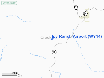
Location & QuickFacts
| FAA Information Effective: | 2008-09-25 |
| Airport Identifier: | WY14 |
| Airport Status: | Operational |
| Longitude/Latitude: | 104-41-18.8740W/44-38-14.9420N
-104.688576/44.637484 (Estimated) |
| Elevation: | 3960 ft / 1207.01 m (Estimated) |
| Land: | 0 acres |
| From nearest city: | 4 nautical miles SW of Hulett, WY |
| Location: | Crook County, WY |
| Magnetic Variation: | 12E (1985) |
Owner & Manager
| Ownership: | Privately owned |
| Owner: | Ipy Ranch, Ltd |
| Address: | P.o. Box 50
Devils Tower, WY 82714 |
| Phone number: | 307-467-5540 |
| Manager: | George White |
| Address: | P.o. Box 50
Devils Tower, WY 82714 |
| Phone number: | 307-467-5540 |
Airport Operations and Facilities
| Airport Use: | Private |
| Wind indicator: | Yes |
| Segmented Circle: | No |
| Control Tower: | No |
| Landing fee charge: | No |
| Sectional chart: | Billings |
| Region: | ANM - Northwest Mountain |
| Boundary ARTCC: | ZDV - Denver |
| Tie-in FSS: | CPR - Casper |
| FSS on Airport: | No |
| FSS Toll Free: | 1-800-WX-BRIEF |
Airport Services
| Airframe Repair: | NONE |
| Power Plant Repair: | NONE |
Runway Information
Runway 11/29
| Dimension: | 3000 x 60 ft / 914.4 x 18.3 m |
| Surface: | DIRT, |
| |
Runway 11 |
Runway 29 |
| Traffic Pattern: | Left | Left |
|
Radio Navigation Aids
| ID |
Type |
Name |
Ch |
Freq |
Var |
Dist |
| EFC | NDB | Belle Fourche | | 269.00 | 11E | 35.9 nm |
| SPF | NDB | Black Hills | | 300.00 | 11E | 39.8 nm |
| GC | NDB | Deryk | | 380.00 | 12E | 42.0 nm |
| ECS | VOR | Newcastle | | 108.20 | 11E | 48.3 nm |
| GCC | VOR/DME | Gillette | 093X | 114.60 | 12E | 40.6 nm |
Remarks
- FOR RECORD PURPOSES ONLY.
Images and information placed above are from
http://www.airport-data.com/airport/WY14/
We thank them for the data!
| General Info
|
| Country |
United States
|
| State |
WYOMING
|
| FAA ID |
WY14
|
| Latitude |
44-38-14.942N
|
| Longitude |
104-41-18.874W
|
| Elevation |
3960 feet
|
| Near City |
HULETT
|
We don't guarantee the information is fresh and accurate. The data may
be wrong or outdated.
For more up-to-date information please refer to other sources.
|
|


