 |
|
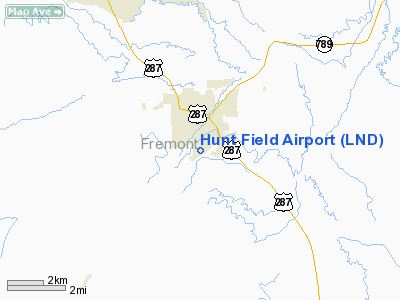
Location & QuickFacts
| FAA Information Effective: | 2008-09-25 |
| Airport Identifier: | LND |
| Airport Status: | Operational |
| Longitude/Latitude: | 108-43-47.4210W/42-48-54.8500N
-108.729839/42.815236 (Estimated) |
| Elevation: | 5586 ft / 1702.61 m (Estimated) |
| Land: | 200 acres |
| From nearest city: | 1 nautical miles S of Lander, WY |
| Location: | Fremont County, WY |
| Magnetic Variation: | 14E (1985) |
Owner & Manager
| Ownership: | Publicly owned |
| Owner: | City Of Lander |
| Address: | 240 Lincoln St
Lander, WY 82520 |
| Phone number: | 307-332-2870 |
| Manager: | Gary Loose |
| Address: | Box 1331
Lander, WY 82520 |
| Phone number: | 307-332-3134 |
Airport Operations and Facilities
| Airport Use: | Open to public |
| Wind indicator: | Yes |
| Segmented Circle: | Yes |
| Control Tower: | No |
| Lighting Schedule: | DUSK-DAWN
ACTVT NSTD MIRL RY 03/21 AND PAPI RYS 03 & 21 - CTAF. |
| Beacon Color: | Clear-Green (lighted land airport) |
| Landing fee charge: | No |
| Sectional chart: | Cheyenne |
| Region: | ANM - Northwest Mountain |
| Boundary ARTCC: | ZLC - Salt Lake City |
| Tie-in FSS: | CPR - Casper |
| FSS on Airport: | No |
| FSS Toll Free: | 1-800-WX-BRIEF |
| NOTAMs Facility: | LND (NOTAM-d service avaliable) |
| Federal Agreements: | NGY |
Airport Communications
| CTAF: | 122.800 |
| Unicom: | 122.800 |
Airport Services
| Fuel available: | 100LLA |
| Airframe Repair: | MAJOR |
| Power Plant Repair: | MAJOR |
| Bottled Oxygen: | NONE |
| Bulk Oxygen: | NONE |
Runway Information
Runway 03/21
| Dimension: | 5000 x 100 ft / 1524.0 x 30.5 m |
| Surface: | ASPH, Fair Condition |
| Surface Treatment: | Porous Friction Course |
| Weight Limit: | Single wheel: 30000 lbs. |
| Edge Lights: | Non-standard lighting system
RY 03/21 NSTD MIRL: THLD LGTS RY 03 IRREGULAR SPACING WITH 3 LGTS ON RIGHT AND FOUR LGTS ON LEFT. |
| |
Runway 03 |
Runway 21 |
| Elevation: | 5586.00 ft | 0.00 ft |
| Traffic Pattern: | Left | Left |
| Markings: | Basic, Fair Condition | Basic, Fair Condition |
| VASI: | 2-light PAPI on left side | 2-light PAPI on left side |
| Visual Glide Angle: | 3.00° | 3.00° |
| Obstruction: | 109 ft tree, 3538.0 ft from runway, 250 ft right of centerline, 30:1 slope to clear | , 50:1 slope to clear |
|
Helipad H1
| Dimension: | 40 x 40 ft / 12.2 x 12.2 m |
| Surface: | ASPH, Good Condition |
| |
Runway H1 |
Runway |
| Traffic Pattern: | Left | Left |
|
Radio Navigation Aids
| ID |
Type |
Name |
Ch |
Freq |
Var |
Dist |
| PNA | NDB | Wenz | | 392.00 | 13E | 47.4 nm |
| RIW | VOR/DME | Riverton | 025X | 108.80 | 16E | 19.3 nm |
| BOY | VOR/DME | Boysen Reservoir | 125X | 117.80 | 16E | 43.3 nm |
Remarks
- +4' REFLECTORS ALONG TWY & RY EDGES FOR WINTER PLOWING.
- BIRD ACTIVITY INVOF ARPT.
Images and information placed above are from
http://www.airport-data.com/airport/LND/
We thank them for the data!
| General Info
|
| Country |
United States
|
| State |
WYOMING
|
| FAA ID |
LND
|
| Latitude |
42-48-54.850N
|
| Longitude |
108-43-47.421W
|
| Elevation |
5586 feet
|
| Near City |
LANDER
|
We don't guarantee the information is fresh and accurate. The data may
be wrong or outdated.
For more up-to-date information please refer to other sources.
|
|


