 |
|
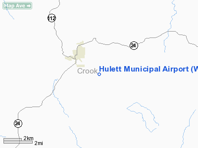
Location & QuickFacts
| FAA Information Effective: | 2008-09-25 |
| Airport Identifier: | W43 |
| Airport Status: | Operational |
| Longitude/Latitude: | 104-34-04.1550W/44-39-46.3050N
-104.567821/44.662862 (Estimated) |
| Elevation: | 4264 ft / 1299.67 m (Surveyed) |
| Land: | 330 acres |
| From nearest city: | 2 nautical miles SE of Hulett, WY |
| Location: | Crook County, WY |
| Magnetic Variation: | 10E (2005) |
Owner & Manager
| Ownership: | Publicly owned |
| Owner: | Town Of Hulett |
| Address: | P.o. Box 278
Hulett, WY 82720 |
| Phone number: | 307-467-5771 |
| Manager: | Charlie Tyrell |
| Address: | P.o. Box 343
Hulett, WY 82720 |
| Phone number: | 307-290-2308 |
Airport Operations and Facilities
| Airport Use: | Open to public |
| Wind indicator: | Yes |
| Segmented Circle: | Yes |
| Control Tower: | No |
| Lighting Schedule: | DUSK-DAWN
ACTVT MIRL RY 13/31 & REIL RYS 13 & 31- CTAF. PAPI RYS 13 & 31 OPER 24 HRS. |
| Beacon Color: | Clear-Green (lighted land airport) |
| Sectional chart: | Billings |
| Region: | ANM - Northwest Mountain |
| Boundary ARTCC: | ZDV - Denver |
| Tie-in FSS: | CPR - Casper |
| FSS Toll Free: | 1-800-WX-BRIEF |
| Federal Agreements: | NGY |
Airport Communications
| CTAF: | 122.800 |
| Unicom: | 122.800 |
Airport Services
| Fuel available: | 100LL
24 HR SELF SVC CREDIT CARD FUEL AVBL. |
Runway Information
Runway 13/31
| Dimension: | 5500 x 75 ft / 1676.4 x 22.9 m |
| Surface: | ASPH, Good Condition |
| Weight Limit: | Single wheel: 12500 lbs. |
| Edge Lights: | Medium |
| |
Runway 13 |
Runway 31 |
| Longitude: | 104-34-27.5200W | 104-33-40.7900W |
| Latitude: | 44-40-07.7300N | 44-39-24.8800N |
| Elevation: | 4195.00 ft | 4264.00 ft |
| Traffic Pattern: | Left | Right |
| Markings: | Non-precision instrument, Good Condition | Non-precision instrument, Good Condition |
| Crossing Height: | 40.00 ft | 40.00 ft |
| VASI: | 2-light PAPI on left side | 2-light PAPI on left side |
| Visual Glide Angle: | 4.00° | 4.00° |
| Runway End Identifier: | Yes | Yes |
| Obstruction: | , 50:1 slope to clear | 165 ft hill, 3900.0 ft from runway, 425 ft right of centerline, 22:1 slope to clear |
|
Radio Navigation Aids
| ID |
Type |
Name |
Ch |
Freq |
Var |
Dist |
| EFC | NDB | Belle Fourche | | 269.00 | 11E | 30.6 nm |
| SPF | NDB | Black Hills | | 300.00 | 11E | 35.2 nm |
| GC | NDB | Deryk | | 380.00 | 12E | 47.2 nm |
| ECS | VOR | Newcastle | | 108.20 | 11E | 48.3 nm |
| GCC | VOR/DME | Gillette | 093X | 114.60 | 12E | 45.9 nm |
Remarks
- RADIO CONTROLLED ACFT OCCASIONAL OPERATION 0.5 MILES E OF AER RY 31 BLO 400 FT AGL.
- DEVILS TOWER NATIONAL MONUMENT LOCATED APRXLY 7 MILES SW OF THE ARPT. VOLUNTARY 2 MILE FLIGHT AVOIDANCE RADIUS IN EFFECT JAN-MAY AND JUL-DEC. VOLUNTARY 3 MILE FLIGHT AVOIDANCE RADIUS IN EFFECT IN JUN.
- RETRO-REFLECTIVE MARKERS ALONG TAXIWAYS
Images and information placed above are from
http://www.airport-data.com/airport/W43/
We thank them for the data!
| General Info
|
| Country |
United States
|
| State |
WYOMING
|
| FAA ID |
W43
|
| Latitude |
44.662861
44° 39' 46.30" N
|
| Longitude |
-104.567822
104° 34' 04.16" W
|
| Elevation |
4264 feet
1300 meters
|
| Magnetic Variation |
010° E (01/06)
|
| Beacon |
Yes
|
| Operating Agency |
MUNICIPAL
|
We don't guarantee the information is fresh and accurate. The data may
be wrong or outdated.
For more up-to-date information please refer to other sources.
|
|


