 |
|
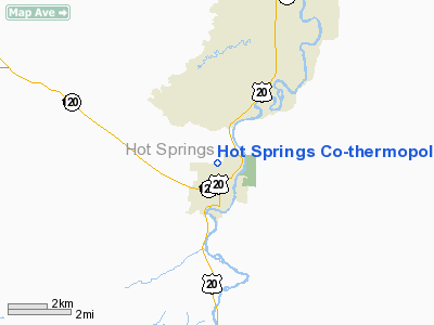
Hot Springs Co-thermopolis Muni Airport |
Location & QuickFacts
| FAA Information Effective: | 2008-09-25 |
| Airport Identifier: | THP |
| Airport Status: | Operational |
| Longitude/Latitude: | 108-12-47.3550W/43-39-29.8410N
-108.213154/43.658289 (Estimated) |
| Elevation: | 4592 ft / 1399.64 m (Estimated) |
| Land: | 228 acres |
| From nearest city: | 1 nautical miles N of Thermopolis, WY |
| Location: | Hot Springs County, WY |
| Magnetic Variation: | 14E (1985) |
Owner & Manager
| Ownership: | Publicly owned |
| Owner: | Hot Springs County |
| Address: | Box 1368
Thermopolis, WY 82443 |
| Phone number: | 307-864-3515 |
| Manager: | Ray Arey |
| Address: | Box 205
Thermopolis, WY 82443 |
| Phone number: | 307-864-2488 |
Airport Operations and Facilities
| Airport Use: | Open to public |
| Wind indicator: | Yes |
| Segmented Circle: | No |
| Control Tower: | No |
| Lighting Schedule: | DUSK-DAWN
ACTVT MIRL RY 01/19 & VASI RY 19 - CTAF. |
| Beacon Color: | Clear-Green (lighted land airport) |
| Landing fee charge: | No |
| Sectional chart: | Cheyenne |
| Region: | ANM - Northwest Mountain |
| Boundary ARTCC: | ZLC - Salt Lake City |
| Tie-in FSS: | CPR - Casper |
| FSS on Airport: | No |
| FSS Toll Free: | 1-800-WX-BRIEF |
| NOTAMs Facility: | CPR (NOTAM-d service avaliable) |
| Federal Agreements: | N |
Airport Communications
| CTAF: | 122.800 |
| Unicom: | 122.800 |
Airport Services
| Fuel available: | 100LL
SELF-SERV CREDIT CARD FUEL AVBL 24 HRS. |
| Power Plant Repair: | NONE |
| Bottled Oxygen: | NONE |
| Bulk Oxygen: | NONE |
Runway Information
Runway 01/19
| Dimension: | 4800 x 100 ft / 1463.0 x 30.5 m |
| Surface: | ASPH, Fair Condition |
| Surface Treatment: | Porous Friction Course |
| Weight Limit: | Single wheel: 13000 lbs. |
| Edge Lights: | Medium |
| |
Runway 01 |
Runway 19 |
| Longitude: | 108-12-47.0600W | 108-12-22.1230W |
| Latitude: | 43-39-25.3150N | 43-40-09.1580N |
| Elevation: | 4592.00 ft | 4474.00 ft |
| Alignment: | 22 | 127 |
| Traffic Pattern: | Left | Left |
| Markings: | Basic, Poor Condition
RY 01/19 MKGS CHIPPED AND FADED. | Basic, Poor Condition |
| Crossing Height: | 0.00 ft | 26.00 ft |
| VASI: | | 2-box SAVASI on left side |
| Visual Glide Angle: | 0.00° | 3.00° |
|
Radio Navigation Aids
| ID |
Type |
Name |
Ch |
Freq |
Var |
Dist |
| BOY | VOR/DME | Boysen Reservoir | 125X | 117.80 | 16E | 12.3 nm |
| RLY | VOR/DME | Worland | 095X | 114.80 | 13E | 21.6 nm |
| RIW | VOR/DME | Riverton | 025X | 108.80 | 16E | 37.2 nm |
Remarks
- DUE TO TERRAIN - OPNS AT NIGHT NOT RECOMMENDED.
-
- GND DROPS OFF 50 FT AT 15 FT FM RY 01 THLD & 15 FT AT 30 FT FM RY 19 THLD.
- RY 01/19 IS 118 FT HIGHER ON SOUTH END. RECOMMEND LDG UPHILL RY 19; TKOF DOWNHILL RY 01 DEPENDING ON WIND.
Images and information placed above are from
http://www.airport-data.com/airport/THP/
We thank them for the data!
| General Info
|
| Country |
United States
|
| State |
WYOMING
|
| FAA ID |
THP
|
| Latitude |
43-39-29.841N
|
| Longitude |
108-12-47.355W
|
| Elevation |
4580 feet
|
| Near City |
THERMOPOLIS
|
We don't guarantee the information is fresh and accurate. The data may
be wrong or outdated.
For more up-to-date information please refer to other sources.
|
|


