 |
|
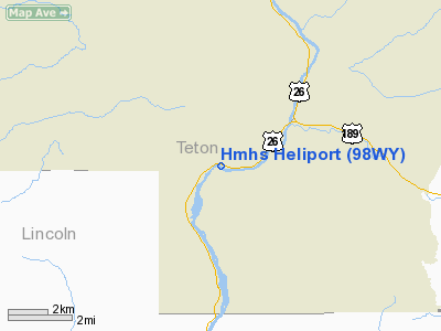
Location & QuickFacts
| FAA Information Effective: | 2008-09-25 |
| Airport Identifier: | 98WY |
| Airport Status: | Operational |
| Longitude/Latitude: | 110-46-32.0400W/43-18-05.2800N
-110.775567/43.301467 (Estimated) |
| Elevation: | 5886 ft / 1794.05 m (Estimated) |
| Land: | 0 acres |
| From nearest city: | 18 nautical miles N of Jackson, WY |
| Location: | Albany County, WY |
| Magnetic Variation: | 14E (1995) |
Owner & Manager
| Ownership: | Privately owned |
| Owner: | Usfs Permit Hmhs |
| Address: | Po Box 173
Teton Village, WY 83025 |
| Phone number: | 307-733-3274 |
| Manager: | John Shick |
| Address: | P.o.box 1366
Jackson, WY 83001 |
| Phone number: | 307-733-6194 |
Airport Operations and Facilities
| Airport Use: | Private |
| Wind indicator: | No |
| Segmented Circle: | No |
| Control Tower: | No |
| Sectional chart: | Salt Lake City |
| Region: | ANM - Northwest Mountain |
| Boundary ARTCC: | ZLC - Salt Lake City |
| Tie-in FSS: | CPR - Casper |
| FSS Toll Free: | 1-800-WX-BRIEF |
Runway Information
Helipad H1
| Dimension: | 20 x 20 ft / 6.1 x 6.1 m |
| Surface: | TURF, |
| |
Runway H1 |
Runway |
| Traffic Pattern: | Left | Left |
|
Radio Navigation Aids
| ID |
Type |
Name |
Ch |
Freq |
Var |
Dist |
| JAC | FAN MARKER | Teton | | | 17E | 15.0 nm |
| JAC | VOR/DME | Jackson | 101X | 115.40 | 13E | 19.3 nm |
| DNW | VOR/DME | Dunoir | 119X | 117.20 | 15E | 37.0 nm |
Images and information placed above are from
http://www.airport-data.com/airport/98WY/
We thank them for the data!
| General Info
|
| Country |
United States
|
| State |
WYOMING
|
| FAA ID |
98WY
|
| Latitude |
43-18-05.280N
|
| Longitude |
110-46-32.040W
|
| Elevation |
5886 feet
|
| Near City |
JACKSON
|
We don't guarantee the information is fresh and accurate. The data may
be wrong or outdated.
For more up-to-date information please refer to other sources.
|
|


