 |
|
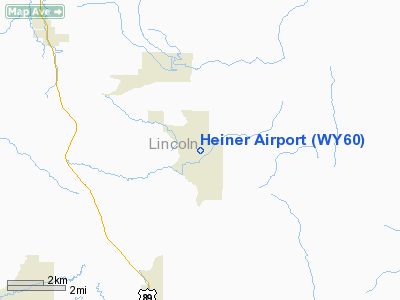
Location & QuickFacts
| FAA Information Effective: | 2008-09-25 |
| Airport Identifier: | WY60 |
| Airport Status: | Operational |
| Longitude/Latitude: | 110-53-52.7290W/42-51-39.7330N
-110.897980/42.861037 (Estimated) |
| Elevation: | 6440 ft / 1962.91 m (Estimated) |
| Land: | 2 acres |
| From nearest city: | 8 nautical miles NE of Afton, WY |
| Location: | Lincoln County, WY |
| Magnetic Variation: | 15E (1985) |
Owner & Manager
| Ownership: | Privately owned |
| Owner: | Gaylon G Heiner |
| Address: |
Bedford, WY 83112 |
| Phone number: | 307-883-2813 |
| Manager: | Gaylon G Heiner |
| Address: |
Bedford, WY 83112 |
| Phone number: | 307-883-2813 |
Airport Operations and Facilities
| Airport Use: | Private |
| Wind indicator: | Yes |
| Segmented Circle: | No |
| Control Tower: | No |
| Sectional chart: | Salt Lake City |
| Region: | ANM - Northwest Mountain |
| Boundary ARTCC: | ZLC - Salt Lake City |
| Tie-in FSS: | CPR - Casper |
| FSS Toll Free: | 1-800-WX-BRIEF |
Airport Services
Runway Information
Runway 04/22
| Dimension: | 2200 x 40 ft / 670.6 x 12.2 m |
| Surface: | TURF, |
| |
Runway 04 |
Runway 22 |
| Traffic Pattern: | Right | Left |
|
Radio Navigation Aids
| ID |
Type |
Name |
Ch |
Freq |
Var |
Dist |
| JAC | FAN MARKER | Teton | | | 17E | 41.9 nm |
| PNA | NDB | Wenz | | 392.00 | 13E | 48.4 nm |
| BPI | VOR/DME | Big Piney | 112X | 116.50 | 16E | 38.7 nm |
| JAC | VOR/DME | Jackson | 101X | 115.40 | 13E | 46.3 nm |
Remarks
- RWY SLOPES UPHILL FROM WEST TO EAST; LNDG DOWNHILL & TKOF UPHILL DISCOURAGED UNLESS WIND DICTATES SUCH ACTION.
- 9000' MTN - 5000' EAST OF RWY.
- 7500' MTN SOUTH AND WEST 5000' AWAY, VALLEY CONTINUES WEST IN DIRECT LINE WITH RWY FOR 12000' THEN OPENS INTO LARGE VALLEY.
- CROPS ON BOTH SIDE OF RWY - DEFINITE EDGES.
- PRVD ALL TFC PAT OPNS ARE CONDUCTED TO THE SOUTH OF RWY 04/22; SUCH AS ALL TURNS TO THE RIGHT WHEN LNDG/DEP TO THE EAST & ALL TURNS TO THE LEFT WHEN LNDG/DEP TO THE WEST.
Images and information placed above are from
http://www.airport-data.com/airport/WY60/
We thank them for the data!
| General Info
|
| Country |
United States
|
| State |
WYOMING
|
| FAA ID |
WY60
|
| Latitude |
42-51-39.733N
|
| Longitude |
110-53-52.729W
|
| Elevation |
6440 feet
|
| Near City |
AFTON
|
We don't guarantee the information is fresh and accurate. The data may
be wrong or outdated.
For more up-to-date information please refer to other sources.
|
|


