 |
|
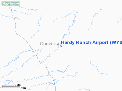
Location & QuickFacts
| FAA Information Effective: | 2008-09-25 |
| Airport Identifier: | WY07 |
| Airport Status: | Operational |
| Longitude/Latitude: | 105-40-31.9850W/43-19-30.8830N
-105.675551/43.325245 (Estimated) |
| Elevation: | 5077 ft / 1547.47 m (Estimated) |
| Land: | 0 acres |
| From nearest city: | 37 nautical miles NW of Douglas, WY |
| Location: | Converse County, WY |
| Magnetic Variation: | 12E (1985) |
Owner & Manager
| Ownership: | Privately owned |
| Owner: | Eugene Hardy |
| Address: | 181 Jenne Trail Road
Douglas, WY 82633 |
| Phone number: | 307-358-3640 |
| Manager: | Eugene Hardy
OTHER CONTACT; SHAUN MUSSELMAN |
| Address: | 181 Jenne Trail Rd.
Douglas, WY 82633 |
| Phone number: | 307-358-3640 |
Airport Operations and Facilities
| Airport Use: | Private |
| Wind indicator: | Yes |
| Segmented Circle: | No |
| Control Tower: | No |
| Beacon Color: | Clear-Green (lighted land airport) |
| Landing fee charge: | No |
| Sectional chart: | Cheyenne |
| Region: | ANM - Northwest Mountain |
| Boundary ARTCC: | ZDV - Denver |
| Tie-in FSS: | CPR - Casper |
| FSS on Airport: | No |
| FSS Toll Free: | 1-800-WX-BRIEF |
Airport Services
| Airframe Repair: | NONE |
| Power Plant Repair: | NONE |
Runway Information
Runway 03/21
| Dimension: | 3665 x 60 ft / 1117.1 x 18.3 m |
| Surface: | TURF, |
| Edge Lights: | Low |
| |
Runway 03 |
Runway 21 |
| Traffic Pattern: | Left | Left |
|
Runway 07/25
| Dimension: | 2770 x 60 ft / 844.3 x 18.3 m |
| Surface: | TURF, |
| Edge Lights: | Low |
| |
Runway 07 |
Runway 25 |
| Traffic Pattern: | Left | Left |
|
Runway 17/35
| Dimension: | 4000 x 60 ft / 1219.2 x 18.3 m |
| Surface: | TURF, |
| Edge Lights: | Low |
| |
Runway 17 |
Runway 35 |
| Traffic Pattern: | Left | Left |
|
Radio Navigation Aids
| ID |
Type |
Name |
Ch |
Freq |
Var |
Dist |
| CP | NDB | Johno | | 375.00 | 12E | 46.6 nm |
| IIP | VOR/DME | Hipsher | 023X | 108.60 | 12E | 43.7 nm |
| DDY | VORTAC | Muddy Mountain | 109X | 116.20 | 12E | 29.9 nm |
Remarks
Images and information placed above are from
http://www.airport-data.com/airport/WY07/
We thank them for the data!
| General Info
|
| Country |
United States
|
| State |
WYOMING
|
| FAA ID |
WY07
|
| Latitude |
43-19-30.883N
|
| Longitude |
105-40-31.985W
|
| Elevation |
5077 feet
|
| Near City |
DOUGLAS
|
We don't guarantee the information is fresh and accurate. The data may
be wrong or outdated.
For more up-to-date information please refer to other sources.
|
|


