 |
|
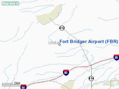
Location & QuickFacts
| FAA Information Effective: | 2008-09-25 |
| Airport Identifier: | FBR |
| Airport Status: | Operational |
| Longitude/Latitude: | 110-24-24.4660W/41-23-30.9690N
-110.406796/41.391936 (Estimated) |
| Elevation: | 7034 ft / 2143.96 m (Surveyed) |
| Land: | 309 acres |
| From nearest city: | 4 nautical miles N of Fort Bridger, WY |
| Location: | Uinta County, WY |
| Magnetic Variation: | 14E (1990) |
Owner & Manager
| Ownership: | Publicly owned |
| Owner: | Uinta County |
| Address: | P O Box 810
Evanston, WY 82931 |
| Phone number: | 307-783-7415 |
| Manager: | Phil Weber |
| Address: | P. O . Box 1137
Mt. View, WY 82939 |
| Phone number: | 307-782-3780 |
Airport Operations and Facilities
| Airport Use: | Open to public |
| Wind indicator: | Yes
WIND INDICATOR LIGHT OTS INDEFLY. |
| Segmented Circle: | No |
| Control Tower: | No |
| Lighting Schedule: | DUSK-DAWN
ACTVT MIRL RY 04/22, REIL & VASI RY 22 - CTAF. |
| Beacon Color: | Clear-Green (lighted land airport) |
| Landing fee charge: | No |
| Sectional chart: | Salt Lake City |
| Region: | ANM - Northwest Mountain |
| Boundary ARTCC: | ZLC - Salt Lake City |
| Tie-in FSS: | CPR - Casper |
| FSS on Airport: | No |
| FSS Toll Free: | 1-800-WX-BRIEF |
| NOTAMs Facility: | CPR (NOTAM-d service avaliable) |
| Federal Agreements: | N |
Airport Communications
| CTAF: | 122.800 |
| Unicom: | 122.800 |
Airport Services
| Fuel available: | 100LL
FUEL AVAILABLE BY 24 HOUR CARD SERVICE. |
| Airframe Repair: | MAJOR |
| Power Plant Repair: | MAJOR |
| Bottled Oxygen: | NONE |
| Bulk Oxygen: | NONE |
Runway Information
Runway 04/22
| Dimension: | 6402 x 80 ft / 1951.3 x 24.4 m |
| Surface: | ASPH, Poor Condition
EXTENSIVE CRACKING, UNEVEN SURFACE, & VEGETATION.
RWY 16/34 UNMAINTAINED; NUMEROUS PRAIRIE DOG HOLES, SAGEBRUSH AND DEPRESSIONS ON SFC. |
| Weight Limit: | Single wheel: 12500 lbs.
Dual wheel: 20000 lbs.
Dual tandem wheel: 20000 lbs. |
| Edge Lights: | Non-standard lighting system
IRREGULAR SPACING DUE TO BROKEN AND MISSING LIGHTS. |
| |
Runway 04 |
Runway 22 |
| Longitude: | 110-24-58.6140W | 110-23-50.3130W |
| Latitude: | 41-23-12.5780N | 41-23-49.3570N |
| Elevation: | 7034.00 ft | 7002.00 ft |
| Alignment: | 54 | 127 |
| Traffic Pattern: | Left | Left |
| Markings: | Non-precision instrument, Poor Condition
RYS 04 & 22 MARKINGS ALMOST COMPLETELY FADED. | Non-precision instrument, Poor Condition |
| Crossing Height: | 0.00 ft | 22.00 ft |
| VASI: | | 2-box on left side
VASI RUNWAY 22 OUT OF SERVICE INDEFINITELY. |
| Visual Glide Angle: | 0.00° | 3.00° |
| Runway End Identifier: | | Yes
OTS INDEFLY. |
|
Runway 06/24
| Dimension: | 4042 x 50 ft / 1232.0 x 15.2 m |
| Surface: | TURF-DIRT, Fair Condition
EXTENSIVE CRACKING, UNEVEN SURFACE, & VEGETATION.
RWY 16/34 UNMAINTAINED; NUMEROUS PRAIRIE DOG HOLES, SAGEBRUSH AND DEPRESSIONS ON SFC. |
| |
Runway 06 |
Runway 24 |
| Longitude: | 110-24-43.4800W | 110-23-51.8300W |
| Latitude: | 41-23-41.1200N | 41-23-50.1800N |
| Elevation: | 7016.00 ft | 7000.00 ft |
| Alignment: | 77 | 127 |
| Traffic Pattern: | Left | Left |
| Obstruction: | 4 ft fence, 40.0 ft from runway, 10:1 slope to clear | , 50:1 slope to clear |
|
Runway 16/34
| Dimension: | 4656 x 50 ft / 1419.1 x 15.2 m |
| Surface: | TURF-DIRT, Poor Condition
EXTENSIVE CRACKING, UNEVEN SURFACE, & VEGETATION.
RWY 16/34 UNMAINTAINED; NUMEROUS PRAIRIE DOG HOLES, SAGEBRUSH AND DEPRESSIONS ON SFC. |
| |
Runway 16 |
Runway 34 |
| Longitude: | 110-24-26.4800W | 110-24-26.5800W |
| Latitude: | 41-23-53.8200N | 41-23-07.8200N |
| Elevation: | 7004.00 ft | 7016.00 ft |
| Alignment: | 127 | 0 |
| Traffic Pattern: | Left | Left |
| Obstruction: | 4 ft fence, 5.0 ft from runway, 1:1 slope to clear | 4 ft fence, 5.0 ft from runway, 1:1 slope to clear |
|
Radio Navigation Aids
| ID |
Type |
Name |
Ch |
Freq |
Var |
Dist |
| FBR | VOR/DME | Fort Bridger | 023X | 108.60 | 14E | 1.1 nm |
| EVW | VOR/DME | Evanston | 33X | 109.60 | 13E | 29.8 nm |
Remarks
- 3-5 FT SNOW BANKS ON SOUTH SIDE OF RY 04/22 NOV-MAR.
- RWY 04/22 PLOWED WINTER MONTHS; RWY 16/34 & 06/24 CLSD WINTER MONTHS EXCP FOR SKI EQUIP ACFT; DIRT/TURF RWYS NOT MAINTAINED.
- RY 6 +3FT METAL STRUCTURE AT THLD 58 FT L.
Images and information placed above are from
http://www.airport-data.com/airport/FBR/
We thank them for the data!
| General Info
|
| Country |
United States
|
| State |
WYOMING
|
| FAA ID |
FBR
|
| Latitude |
41-23-30.969N
|
| Longitude |
110-24-24.466W
|
| Elevation |
7034 feet
|
| Near City |
FORT BRIDGER
|
We don't guarantee the information is fresh and accurate. The data may
be wrong or outdated.
For more up-to-date information please refer to other sources.
|
|


