 |
|
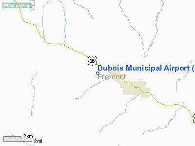
Location & QuickFacts
| FAA Information Effective: | 2008-09-25 |
| Airport Identifier: | U25 |
| Airport Status: | Operational |
| Longitude/Latitude: | 109-41-24.9400W/43-32-54.0500N
-109.690261/43.548347 (Estimated) |
| Elevation: | 7291 ft / 2222.30 m (Estimated) |
| Land: | 211 acres |
| From nearest city: | 3 nautical miles NW of Dubois, WY |
| Location: | Fremont County, WY |
| Magnetic Variation: | 15E (1985) |
Owner & Manager
| Ownership: | Publicly owned |
| Owner: | Town Of Dubois |
| Address: | Box 555
Dubois, WY 82513 |
| Phone number: | 307-455-2345 |
| Manager: | Tim Schell |
| Address: | P.o. Box 2046
Dubois, WY 82513 |
| Phone number: | 307-455-2100 |
Airport Operations and Facilities
| Airport Use: | Open to public |
| Wind indicator: | Yes |
| Segmented Circle: | Yes |
| Control Tower: | No |
| Lighting Schedule: | DUSK-DAWN
ACTVT MIRL RY 10/28 - CTAF. |
| Beacon Color: | Clear-Green (lighted land airport) |
| Landing fee charge: | No |
| Sectional chart: | Salt Lake City |
| Region: | ANM - Northwest Mountain |
| Boundary ARTCC: | ZLC - Salt Lake City |
| Tie-in FSS: | CPR - Casper |
| FSS on Airport: | No |
| FSS Toll Free: | 1-800-WX-BRIEF |
| NOTAMs Facility: | CPR (NOTAM-d service avaliable) |
| Federal Agreements: | NGY |
Airport Communications
Airport Services
| Fuel available: | 100LL
FUEL AVBL PRIOR ARRANGEMENT ONLY; 307-455-2061/2100. |
| Airframe Repair: | NONE |
| Power Plant Repair: | NONE |
| Bottled Oxygen: | NONE |
| Bulk Oxygen: | NONE |
Runway Information
Runway 10/28
| Dimension: | 6100 x 60 ft / 1859.3 x 18.3 m |
| Surface: | ASPH, Good Condition |
| Surface Treatment: | Porous Friction Course |
| Weight Limit: | Single wheel: 24000 lbs. |
| Edge Lights: | Medium |
| |
Runway 10 |
Runway 28 |
| Elevation: | 7272.00 ft | 7238.00 ft |
| Traffic Pattern: | Left | Right |
| Markings: | Non-precision instrument, Good Condition | Non-precision instrument, Good Condition |
| Crossing Height: | 0.00 ft | 40.00 ft |
| VASI: | | 2-light PAPI on left side |
| Visual Glide Angle: | 0.00° | 3.00° |
| Obstruction: | 13 ft gnd, 450.0 ft from runway, 19:1 slope to clear | 9 ft gnd, 420.0 ft from runway, 24:1 slope to clear |
|
Radio Navigation Aids
| ID |
Type |
Name |
Ch |
Freq |
Var |
Dist |
| JAC | FAN MARKER | Teton | | | 17E | 46.8 nm |
| PNA | NDB | Wenz | | 392.00 | 13E | 45.4 nm |
| DNW | VOR/DME | Dunoir | 119X | 117.20 | 15E | 32.7 nm |
| JAC | VOR/DME | Jackson | 101X | 115.40 | 13E | 45.6 nm |
Remarks
- ALL TRAFFIC PATTERNS TO NORTH OF RWY BECAUSE OF MTNS SOUTH.
- ULTRA-LIGHT ACTIVITY AT AIRPORT
Images and information placed above are from
http://www.airport-data.com/airport/U25/
We thank them for the data!
| General Info
|
| Country |
United States
|
| State |
WYOMING
|
| FAA ID |
U25
|
| Latitude |
43-32-54.050N
|
| Longitude |
109-41-24.940W
|
| Elevation |
7291 feet
|
| Near City |
DUBOIS
|
We don't guarantee the information is fresh and accurate. The data may
be wrong or outdated.
For more up-to-date information please refer to other sources.
|
|


