 |
|
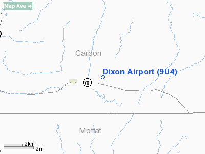
Location & QuickFacts
| FAA Information Effective: | 2008-09-25 |
| Airport Identifier: | 9U4 |
| Airport Status: | Operational |
| Longitude/Latitude: | 107-29-50.2330W/41-02-17.8730N
-107.497287/41.038298 (Estimated) |
| Elevation: | 6520 ft / 1987.30 m (Estimated) |
| Land: | 150 acres |
| From nearest city: | 2 nautical miles E of Dixon, WY |
| Location: | Carbon County, WY |
| Magnetic Variation: | 13E (1985) |
Owner & Manager
| Ownership: | Publicly owned |
| Owner: | Carbon County |
| Address: | Po Box 6
Rawlins, WY 82301 |
| Phone number: | 307-328-2668 |
| Manager: | Robert Golden |
| Address: | Box 57
Baggs, WY 82321 |
| Phone number: | 307-383-6630 |
Airport Operations and Facilities
| Airport Use: | Open to public |
| Wind indicator: | Yes |
| Segmented Circle: | Yes |
| Control Tower: | No |
| Lighting Schedule: | DUSK-DAWN
ACTV MIRL RY 06/24, REILS RY 6/24 AND PAPI RY 6 - CTAF. |
| Beacon Color: | Clear-Green (lighted land airport) |
| Landing fee charge: | No |
| Sectional chart: | Cheyenne |
| Region: | ANM - Northwest Mountain |
| Boundary ARTCC: | ZDV - Denver |
| Tie-in FSS: | CPR - Casper |
| FSS on Airport: | No |
| FSS Toll Free: | 1-800-WX-BRIEF |
| NOTAMs Facility: | CPR (NOTAM-d service avaliable) |
| Federal Agreements: | NGY |
Airport Communications
Airport Services
| Airframe Repair: | NONE |
| Power Plant Repair: | NONE |
| Bottled Oxygen: | NONE |
| Bulk Oxygen: | NONE |
Runway Information
Runway 06/24
| Dimension: | 7500 x 75 ft / 2286.0 x 22.9 m |
| Surface: | ASPH, Good Condition |
| Weight Limit: | Single wheel: 12000 lbs. |
| Edge Lights: | Medium |
| |
Runway 06 |
Runway 24 |
| Traffic Pattern: | Left | Left |
| Markings: | Non-precision instrument, Good Condition | Non-precision instrument, Good Condition |
| Crossing Height: | 30.00 ft | 0.00 ft |
| VASI: | 2-light PAPI on left side | |
| Visual Glide Angle: | 3.00° | 0.00° |
| Runway End Identifier: | Yes | Yes |
| Obstruction: | , 50:1 slope to clear | 20 ft fence, 324.0 ft from runway, 177 ft left of centerline, 6:1 slope to clear |
|
Radio Navigation Aids
| ID |
Type |
Name |
Ch |
Freq |
Var |
Dist |
| SAA | NDB | Saratoga | | 266.00 | 12E | 38.7 nm |
| SBS | NDB | Steamboat Springs | | 245.00 | 13E | 45.7 nm |
| SIR | NDB | Sinclair | | 368.00 | 13E | 49.4 nm |
| CHE | VOR/DME | Hayden | 103X | 115.60 | 14E | 32.4 nm |
| CKW | VOR/DME | Cherokee | 097X | 115.00 | 15E | 43.3 nm |
| BQZ | VOR/DME | Robert | 059X | 112.20 | 13E | 44.7 nm |
| RWL | VOR/DME | Rawlins | 031X | 109.40 | 13E | 47.9 nm |
Remarks
- WILDLIFE ON & INVOF ARPT.
- SNOW REMOVAL ON 24 HR PPR CALL 307-383-6630/2602/6245.
- SNOW BANKS +4 FT ALONG ENTIRE RY WINTER MONTHS.
- +500 FT TERRAIN 9700 FT FM AER 24.
- PRVDD AN OBSTN-FREE PRIMARY SFC OF 125' EITHER SIDE OF CNTRLN IS PRVDD; IF OBSTNS WITHIN APCH AREA CANNOT BE LOWERED OR REMOVED; THE THRS ARE LCTD TO PRVD A MIN 20:1 CLEARANCE OVER ALL OBSTNS.
Images and information placed above are from
http://www.airport-data.com/airport/9U4/
We thank them for the data!
| General Info
|
| Country |
United States
|
| State |
WYOMING
|
| FAA ID |
9U4
|
| Latitude |
41-02-17.873N
|
| Longitude |
107-29-50.233W
|
| Elevation |
6520 feet
|
| Near City |
DIXON
|
We don't guarantee the information is fresh and accurate. The data may
be wrong or outdated.
For more up-to-date information please refer to other sources.
|
|


